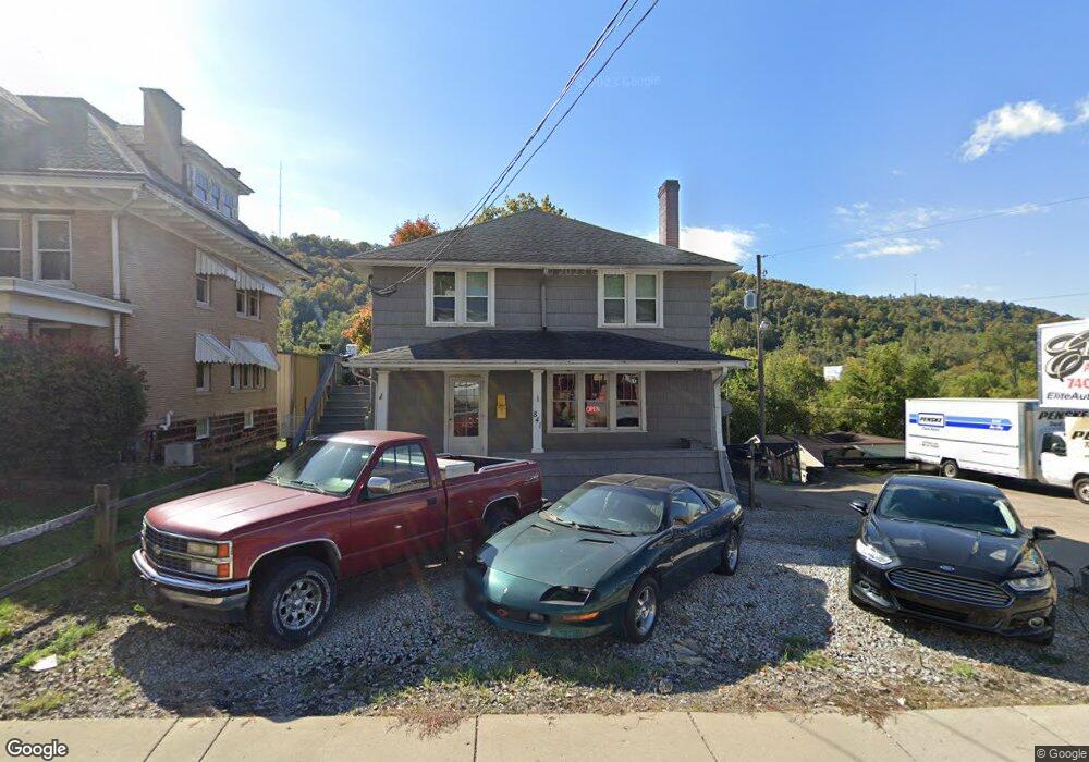
841 Main St Bridgeport, OH 43912
Estimated Value: $163,000 - $214,000
5
Beds
3
Baths
2,080
Sq Ft
$90/Sq Ft
Est. Value
About This Home
This home is located at 841 Main St, Bridgeport, OH 43912 and is currently estimated at $186,199, approximately $89 per square foot. 841 Main St is a home with nearby schools including Bridgeport Elementary School, Bridgeport Middle School, and Bridgeport High School.
Ownership History
Date
Name
Owned For
Owner Type
Purchase Details
Closed on
Jun 24, 2010
Sold by
Citizens Savings Bank
Bought by
Brig Ltd
Current Estimated Value
Home Financials for this Owner
Home Financials are based on the most recent Mortgage that was taken out on this home.
Original Mortgage
$72,000
Outstanding Balance
$23,729
Interest Rate
4.77%
Mortgage Type
Future Advance Clause Open End Mortgage
Estimated Equity
$162,470
Purchase Details
Closed on
Jan 1, 1987
Bought by
Arno Transport Company In
Create a Home Valuation Report for This Property
The Home Valuation Report is an in-depth analysis detailing your home's value as well as a comparison with similar homes in the area
Home Values in the Area
Average Home Value in this Area
Purchase History
| Date | Buyer | Sale Price | Title Company |
|---|---|---|---|
| Brig Ltd | $90,000 | Attorney | |
| Arno Transport Company In | -- | -- |
Source: Public Records
Mortgage History
| Date | Status | Borrower | Loan Amount |
|---|---|---|---|
| Open | Brig Ltd | $72,000 |
Source: Public Records
Tax History Compared to Growth
Tax History
| Year | Tax Paid | Tax Assessment Tax Assessment Total Assessment is a certain percentage of the fair market value that is determined by local assessors to be the total taxable value of land and additions on the property. | Land | Improvement |
|---|---|---|---|---|
| 2024 | $2,049 | $54,130 | $4,430 | $49,700 |
| 2023 | $1,910 | $45,590 | $3,620 | $41,970 |
| 2022 | $1,909 | $45,587 | $3,619 | $41,968 |
| 2021 | $1,937 | $45,590 | $3,622 | $41,968 |
| 2020 | $1,703 | $40,170 | $3,150 | $37,020 |
| 2019 | $1,704 | $40,170 | $3,150 | $37,020 |
| 2018 | $1,743 | $40,170 | $3,150 | $37,020 |
| 2017 | $1,538 | $32,880 | $9,410 | $23,470 |
| 2016 | $1,510 | $32,880 | $9,410 | $23,470 |
| 2015 | $1,504 | $32,880 | $9,410 | $23,470 |
| 2014 | $1,502 | $32,020 | $8,550 | $23,470 |
| 2013 | $1,437 | $32,020 | $8,550 | $23,470 |
Source: Public Records
Map
Nearby Homes
- 866 Main St
- 20 Locust Ave
- 902 National Rd
- 16 Patterson Rd
- 8 Spring St
- 56624 Boyd Ave
- 56559 Boyd Ave
- 67478 Kirkwood Heights Rd
- 61 Laipple St
- 67605 Kirkwood Heights Rd
- 67620 Kirkwood Heights Rd
- 67730 Kirkwood Heights Rd
- 0 Ohio 7
- 116 Ohio St
- 69341 Old Cadiz Rd
- 217 N Huron St
- 50 Kentucky St
- 301 N Huron St
- 219 S York St
- 25 Kentucky St
- 841 National Rd
- 839 Main St
- 0 National Rd Unit T9506731
- 0 National Rd Unit T9511128
- 0 National Rd Unit 5013129
- 845 Main St
- 854 National Rd
- 856 National Rd
- 850 Main St
- 854 Main St
- 847 Main St
- 848 Main St
- 846 Main St
- 856 Main St
- 844 Main St
- 862 Main St
- 842 Natl Rd
- 849 Main St
- 866 National Rd
- 2 Ross St