Estimated Value: $600,000 - $861,259
3
Beds
1
Bath
2,322
Sq Ft
$315/Sq Ft
Est. Value
About This Home
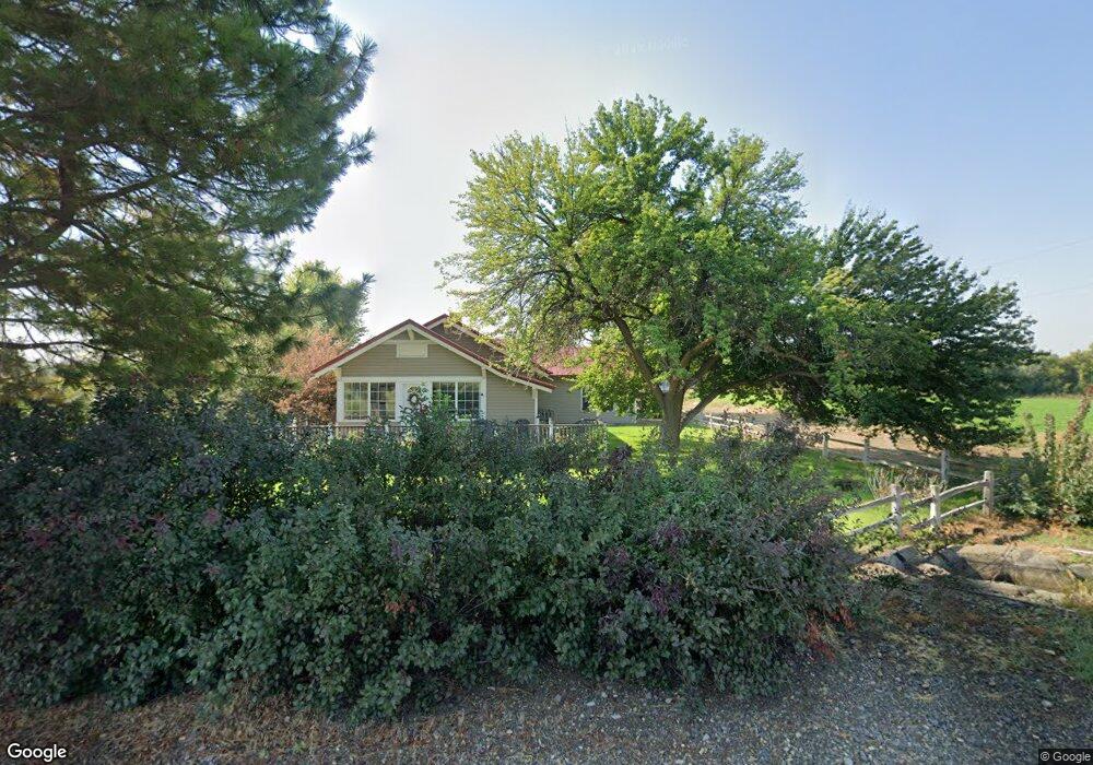
This home is located at 841 River Rd, Nyssa, OR 97913 and is currently estimated at $730,630, approximately $314 per square foot. 841 River Rd is a home located in Malheur County with nearby schools including Adrian Elementary School and Adrian High School.
Ownership History
Date
Name
Owned For
Owner Type
Purchase Details
Closed on
Aug 31, 2021
Sold by
Snipe Flats Farm Llc
Bought by
Papp Daniel and Papp Gail
Current Estimated Value
Purchase Details
Closed on
Jun 4, 2021
Sold by
Papp Daniel W and Papp Gail H
Bought by
Papp Russell
Home Financials for this Owner
Home Financials are based on the most recent Mortgage that was taken out on this home.
Original Mortgage
$160,000
Interest Rate
2.9%
Mortgage Type
New Conventional
Create a Home Valuation Report for This Property
The Home Valuation Report is an in-depth analysis detailing your home's value as well as a comparison with similar homes in the area
Purchase History
| Date | Buyer | Sale Price | Title Company |
|---|---|---|---|
| Papp Daniel | -- | None Available | |
| Snipe Flats Farm Llc | -- | None Available | |
| Papp Russell | -- | Fidelity National Title |
Source: Public Records
Mortgage History
| Date | Status | Borrower | Loan Amount |
|---|---|---|---|
| Previous Owner | Papp Russell | $160,000 |
Source: Public Records
Tax History
| Year | Tax Paid | Tax Assessment Tax Assessment Total Assessment is a certain percentage of the fair market value that is determined by local assessors to be the total taxable value of land and additions on the property. | Land | Improvement |
|---|---|---|---|---|
| 2025 | $2,886 | $205,890 | $101,625 | $104,265 |
| 2024 | $2,924 | $200,251 | $99,022 | $101,229 |
| 2023 | $2,734 | $194,611 | $96,330 | $98,281 |
| 2022 | $2,685 | $189,117 | $93,698 | $95,419 |
| 2021 | $2,770 | $183,476 | $90,836 | $92,640 |
| 2020 | $2,711 | $178,310 | $88,368 | $89,942 |
| 2019 | $2,680 | $173,216 | $85,893 | $87,323 |
| 2018 | $2,631 | $168,346 | $83,566 | $84,780 |
| 2017 | $1,640 | $111,879 | $81,309 | $30,570 |
| 2016 | $1,713 | $109,688 | $79,118 | $30,570 |
| 2015 | $1,508 | $97,609 | $76,989 | $20,620 |
| 2014 | $1,480 | $95,543 | $74,923 | $20,620 |
Source: Public Records
Map
Nearby Homes
- 933 Overstreet Rd
- 2555 Jefferson Dr
- 646 Overstreet Rd
- TBD Kygar Rd
- 26635 Pioneer Ln
- 26915 Chips Ln
- Lot 2B Clydesdale Ln
- Lot 3B Drum Ln
- Lot 5A Drum Ln
- 4.8acTBD Chips Ln
- 30327 Hexon Rd
- 830 Snively Gulch Rd
- TBD Snively Gulch Rd
- 1349 Klamath Ave
- 2580 Schweizer Rd
- 0 Leigh Ln
- 24013 Arena Valley Rd
- 0 Tbd Stephen Ln
- 29410 Pearl Rd
- TBD Monte Rd
Your Personal Tour Guide
Ask me questions while you tour the home.