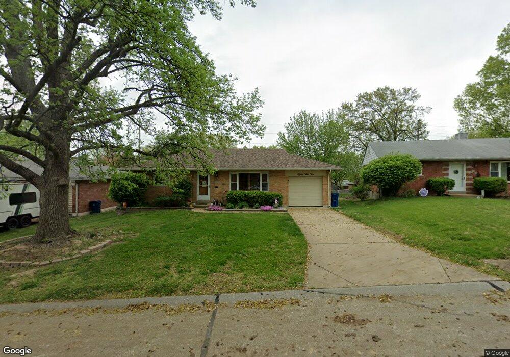
8410 Hampstead Dr Saint Louis, MO 63123
Estimated Value: $253,000 - $281,000
3
Beds
1
Bath
1,384
Sq Ft
$190/Sq Ft
Est. Value
About This Home
This home is located at 8410 Hampstead Dr, Saint Louis, MO 63123 and is currently estimated at $262,591, approximately $189 per square foot. 8410 Hampstead Dr is a home located in St. Louis County with nearby schools including Mesnier Primary School, Gotsch Intermediate School, and Rogers Middle School.
Ownership History
Date
Name
Owned For
Owner Type
Purchase Details
Closed on
Sep 28, 2006
Sold by
Ray David W and Ray Karen A
Bought by
Stanger Sandra L
Current Estimated Value
Home Financials for this Owner
Home Financials are based on the most recent Mortgage that was taken out on this home.
Original Mortgage
$136,000
Outstanding Balance
$80,780
Interest Rate
6.47%
Mortgage Type
Purchase Money Mortgage
Estimated Equity
$181,811
Purchase Details
Closed on
Oct 24, 1997
Sold by
Ray David W and Ray Karen A
Bought by
Ray David W and Ray Karen A
Purchase Details
Closed on
Aug 8, 1997
Sold by
Maxine Sailors Laura
Bought by
Ray David W
Create a Home Valuation Report for This Property
The Home Valuation Report is an in-depth analysis detailing your home's value as well as a comparison with similar homes in the area
Home Values in the Area
Average Home Value in this Area
Purchase History
| Date | Buyer | Sale Price | Title Company |
|---|---|---|---|
| Stanger Sandra L | $170,000 | None Available | |
| Ray David W | -- | -- | |
| Ray David W | -- | First American Title Ins Co |
Source: Public Records
Mortgage History
| Date | Status | Borrower | Loan Amount |
|---|---|---|---|
| Open | Stanger Sandra L | $136,000 |
Source: Public Records
Tax History Compared to Growth
Tax History
| Year | Tax Paid | Tax Assessment Tax Assessment Total Assessment is a certain percentage of the fair market value that is determined by local assessors to be the total taxable value of land and additions on the property. | Land | Improvement |
|---|---|---|---|---|
| 2025 | $2,985 | $43,450 | $15,200 | $28,250 |
| 2024 | $2,985 | $37,000 | $10,130 | $26,870 |
| 2023 | $2,885 | $37,000 | $10,130 | $26,870 |
| 2022 | $2,776 | $32,420 | $10,130 | $22,290 |
| 2021 | $2,711 | $32,420 | $10,130 | $22,290 |
| 2020 | $2,684 | $29,940 | $9,820 | $20,120 |
| 2019 | $2,678 | $29,940 | $9,820 | $20,120 |
| 2018 | $2,385 | $23,540 | $6,840 | $16,700 |
| 2017 | $2,370 | $23,540 | $6,840 | $16,700 |
| 2016 | $2,206 | $23,280 | $5,890 | $17,390 |
| 2015 | $2,196 | $23,280 | $5,890 | $17,390 |
| 2014 | $2,164 | $22,830 | $7,140 | $15,690 |
Source: Public Records
Map
Nearby Homes
- 6540 Lawnside Dr
- 8400 New Hampshire Ave
- 6325 Sheppard Dr
- 8505 Ava Dr
- 8509 Mackenzie Rd
- 6205 MacKenzie Valley Ct
- 8554 Palmetto Dr
- 6236 Bixby Ave
- 6211 Bixby Ave
- 8613 Carriage Way Dr
- 8736 New Hampshire Ave
- 8027 McGee St
- 8315 Maylor Dr
- 8740 Brenda Ave
- 7123 Craighill Dr
- 6426 Judson Ave
- 8348 Vasel Dr
- 8415 Rockhaven Ln
- 6830 Preservation Pkwy
- 6843 Preservation Pkwy
- 8406 Hampstead Dr
- 8414 Hampstead Dr
- 8418 Hampstead Dr
- 6536 Lawnside Dr
- 6532 Lawnside Dr
- 8413 Hampstead Dr
- 6528 Lawnside Dr
- 8390 New Hampshire Ave
- 8403 Hampstead Dr
- 8422 Hampstead Dr
- 6524 Lawnside Dr
- 8431 Hampstead Dr
- 8416 New Hampshire Ave
- 6520 Lawnside Dr
- 8435 Hampstead Dr
- 8430 Hampstead Dr
- 8420 New Hampshire Ave
- 6537 Lawnside Dr
- 6533 Lawnside Dr