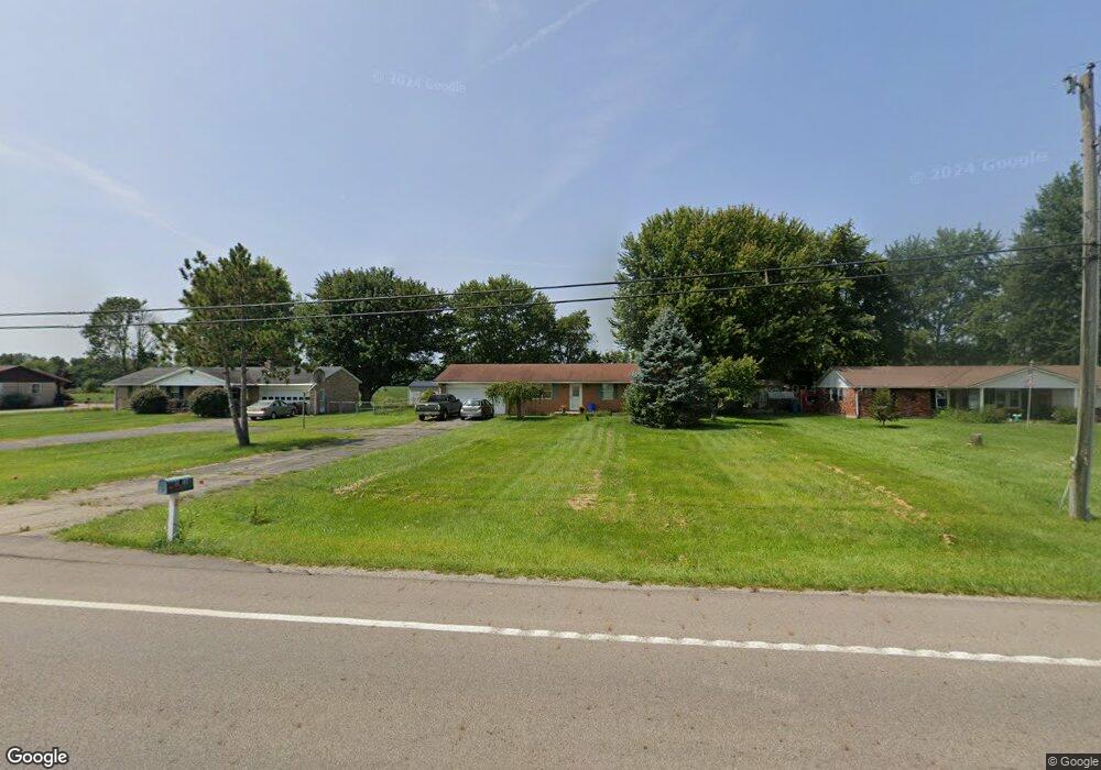
8415 Us Route 127 West Manchester, OH 45382
Estimated Value: $182,339 - $206,000
3
Beds
2
Baths
1,100
Sq Ft
$176/Sq Ft
Est. Value
About This Home
This home is located at 8415 Us Route 127, West Manchester, OH 45382 and is currently estimated at $194,085, approximately $176 per square foot. 8415 Us Route 127 is a home with nearby schools including National Trail Elementary School, National Trail Middle School, and National Trail High School.
Ownership History
Date
Name
Owned For
Owner Type
Purchase Details
Closed on
Dec 22, 2014
Sold by
Mccabe Kim L
Bought by
Mccabe Kim L and Kim L Mccabe Living Trust
Current Estimated Value
Purchase Details
Closed on
Aug 8, 2008
Sold by
Mccabe Michael P and Mccabe Kim L
Bought by
Mccabe Kim L and The Living Trust Of Michael P Mccabe
Purchase Details
Closed on
Dec 14, 2007
Sold by
Hud
Bought by
Mccabe Michael P and Mccabe Kim L
Purchase Details
Closed on
Jun 15, 2007
Sold by
Watts Beth Ann
Bought by
Hud
Purchase Details
Closed on
Feb 24, 2000
Sold by
Armacost Charles
Bought by
Wogoman Beth A
Home Financials for this Owner
Home Financials are based on the most recent Mortgage that was taken out on this home.
Original Mortgage
$75,920
Interest Rate
8.21%
Mortgage Type
FHA
Purchase Details
Closed on
May 15, 1987
Bought by
Mccabe Kim L Trustee
Create a Home Valuation Report for This Property
The Home Valuation Report is an in-depth analysis detailing your home's value as well as a comparison with similar homes in the area
Home Values in the Area
Average Home Value in this Area
Purchase History
| Date | Buyer | Sale Price | Title Company |
|---|---|---|---|
| Mccabe Kim L | -- | None Available | |
| Mccabe Kim L | -- | Attorney | |
| Mccabe Michael P | $66,500 | Lakeside Title & Escrow | |
| Hud | $50,000 | None Available | |
| Wogoman Beth A | $76,000 | -- | |
| Mccabe Kim L Trustee | $39,000 | -- |
Source: Public Records
Mortgage History
| Date | Status | Borrower | Loan Amount |
|---|---|---|---|
| Previous Owner | Wogoman Beth A | $75,920 |
Source: Public Records
Tax History Compared to Growth
Tax History
| Year | Tax Paid | Tax Assessment Tax Assessment Total Assessment is a certain percentage of the fair market value that is determined by local assessors to be the total taxable value of land and additions on the property. | Land | Improvement |
|---|---|---|---|---|
| 2024 | $1,533 | $41,690 | $7,250 | $34,440 |
| 2023 | $1,533 | $41,690 | $7,250 | $34,440 |
| 2022 | $1,364 | $32,030 | $4,760 | $27,270 |
| 2021 | $1,434 | $32,030 | $4,760 | $27,270 |
| 2020 | $1,331 | $32,030 | $4,760 | $27,270 |
| 2019 | $1,230 | $30,280 | $4,520 | $25,760 |
| 2018 | $1,213 | $30,280 | $4,520 | $25,760 |
| 2017 | $1,266 | $30,280 | $4,520 | $25,760 |
| 2016 | $1,120 | $30,490 | $4,590 | $25,900 |
| 2014 | $1,082 | $30,490 | $4,590 | $25,900 |
| 2013 | $1,159 | $30,485 | $4,585 | $25,900 |
Source: Public Records
Map
Nearby Homes
- 8486 Us Route 127
- 0 W US 40
- 230 Stephens Rd
- 383 Georgetown Verona Rd
- 0 E Scott Unit 942470
- 2294 U S 40
- 2892 Swishers Mill Rd
- 792 W Holtzmuller Rd
- 7337 E Lock Rd
- 9923 Euphemia Castine Rd
- 3608 E 40 Us
- 210 N Main St
- 501 N Maple St
- 101 Northcreek Dr
- 300 Ackton St
- 216 Ackton St
- 303 W Cumberland St
- 211 Horn St
- 5380 Shields Rd
- 5101 Pundt Rd