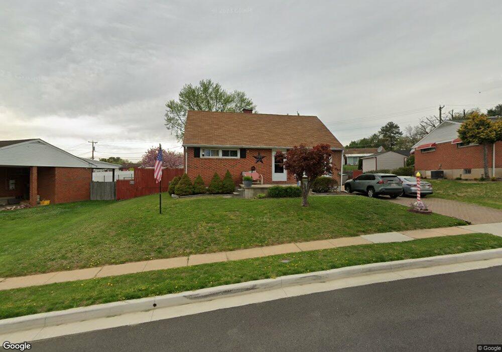
8418 Coco Rd Rosedale, MD 21237
Estimated Value: $339,156 - $394,000
Studio
2
Baths
1,566
Sq Ft
$231/Sq Ft
Est. Value
About This Home
This home is located at 8418 Coco Rd, Rosedale, MD 21237 and is currently estimated at $361,539, approximately $230 per square foot. 8418 Coco Rd is a home located in Baltimore County with nearby schools including Red House Run Elementary School, Golden Ring Middle School, and Overlea High School.
Ownership History
Date
Name
Owned For
Owner Type
Purchase Details
Closed on
Jan 4, 2005
Sold by
Ambrose Robert L
Bought by
Ambrose Robert L and Ambrose Lisa
Current Estimated Value
Purchase Details
Closed on
Nov 29, 2004
Sold by
Ambrose Robert L
Bought by
Ambrose Robert L and Ambrose Lisa
Purchase Details
Closed on
Oct 27, 1998
Sold by
Secretary Of Housing
Bought by
Ambrose Robert L
Purchase Details
Closed on
Jul 29, 1998
Sold by
Brandenburg John J
Bought by
Secretary Of Housing and Urban Development
Purchase Details
Closed on
May 3, 1994
Sold by
Hudak John J
Bought by
Brandenburg John J
Home Financials for this Owner
Home Financials are based on the most recent Mortgage that was taken out on this home.
Original Mortgage
$125,972
Interest Rate
7.7%
Create a Home Valuation Report for This Property
The Home Valuation Report is an in-depth analysis detailing your home's value as well as a comparison with similar homes in the area
Home Values in the Area
Average Home Value in this Area
Purchase History
| Date | Buyer | Sale Price | Title Company |
|---|---|---|---|
| Ambrose Robert L | -- | -- | |
| Ambrose Robert L | -- | -- | |
| Ambrose Robert L | $137,000 | -- | |
| Secretary Of Housing | $134,274 | -- | |
| Brandenburg John J | $124,900 | -- |
Source: Public Records
Mortgage History
| Date | Status | Borrower | Loan Amount |
|---|---|---|---|
| Previous Owner | Brandenburg John J | $125,972 |
Source: Public Records
Tax History
| Year | Tax Paid | Tax Assessment Tax Assessment Total Assessment is a certain percentage of the fair market value that is determined by local assessors to be the total taxable value of land and additions on the property. | Land | Improvement |
|---|---|---|---|---|
| 2025 | $3,594 | $264,300 | -- | -- |
| 2024 | $3,594 | $245,600 | $0 | $0 |
| 2023 | $2,075 | $226,900 | $80,600 | $146,300 |
| 2022 | $4,447 | $220,300 | $0 | $0 |
| 2021 | $4,170 | $213,700 | $0 | $0 |
| 2020 | $4,170 | $207,100 | $80,600 | $126,500 |
| 2019 | $3,449 | $202,267 | $0 | $0 |
| 2018 | $3,046 | $197,433 | $0 | $0 |
| 2017 | $3,387 | $192,600 | $0 | $0 |
| 2016 | $2,898 | $192,600 | $0 | $0 |
| 2015 | $2,898 | $192,600 | $0 | $0 |
| 2014 | $2,898 | $194,800 | $0 | $0 |
Source: Public Records
Map
Nearby Homes
- 1324 Chapel Hill Dr
- 6420 Kenwood Ave
- 6414 Kenwood Ave
- 8506 Coco Rd
- 1821 Weyburn Rd
- 1813 Hanford Rd
- 6516 Golden Ring Rd
- 1829 Hanford Rd
- 6303 Fieldvale Rd
- 6515 Hazelwood Ct
- 1218 Rustic Ave
- 8204 Analee Ave
- 1239 Hilldale Rd
- 8853 Delegge Rd
- 1225 Landover Rd
- 8109 Woodhaven Rd
- 8105 Woodhaven Rd
- 6108 Shady Spring Ave
- 6733 Fordcrest Rd
- 6720 Garvey Rd
Your Personal Tour Guide
Ask me questions while you tour the home.