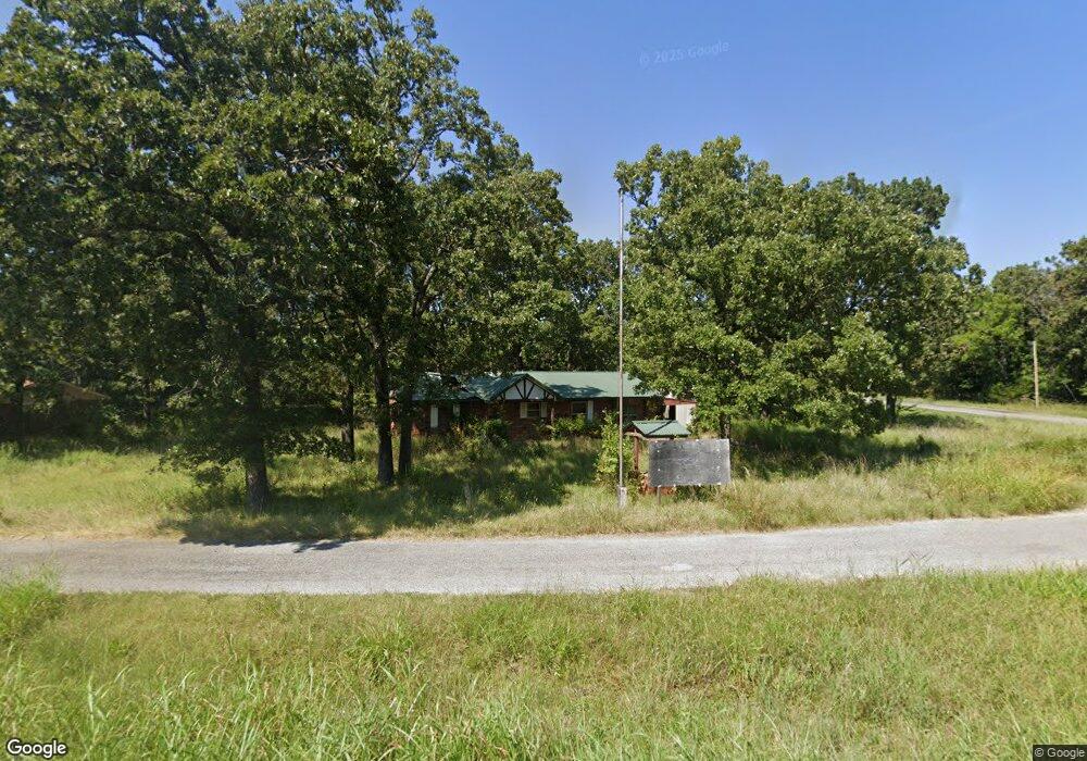
8419 E Highway 412 Locust Grove, OK 74352
Estimated Value: $138,000 - $206,000
3
Beds
1
Bath
1,352
Sq Ft
$123/Sq Ft
Est. Value
About This Home
This home is located at 8419 E Highway 412, Locust Grove, OK 74352 and is currently estimated at $166,076, approximately $122 per square foot. 8419 E Highway 412 is a home located in Mayes County with nearby schools including Locust Grove Early Lrning Center, Locust Grove Upper Elementary School, and Locust Grove Middle School.
Ownership History
Date
Name
Owned For
Owner Type
Purchase Details
Closed on
Nov 5, 2020
Sold by
Smith Robert Allen
Bought by
Smith Robert Allen and Groth Casey
Current Estimated Value
Purchase Details
Closed on
Nov 2, 2011
Sold by
Shepherd Elma L and Cooper Bernard
Bought by
Smith Robert Allen and Smith Vyneta
Home Financials for this Owner
Home Financials are based on the most recent Mortgage that was taken out on this home.
Original Mortgage
$70,900
Outstanding Balance
$47,921
Interest Rate
3.99%
Mortgage Type
New Conventional
Estimated Equity
$118,155
Create a Home Valuation Report for This Property
The Home Valuation Report is an in-depth analysis detailing your home's value as well as a comparison with similar homes in the area
Home Values in the Area
Average Home Value in this Area
Purchase History
| Date | Buyer | Sale Price | Title Company |
|---|---|---|---|
| Smith Robert Allen | -- | None Available | |
| Smith Robert Allen | $62,000 | None Available |
Source: Public Records
Mortgage History
| Date | Status | Borrower | Loan Amount |
|---|---|---|---|
| Open | Smith Robert Allen | $70,900 |
Source: Public Records
Tax History Compared to Growth
Tax History
| Year | Tax Paid | Tax Assessment Tax Assessment Total Assessment is a certain percentage of the fair market value that is determined by local assessors to be the total taxable value of land and additions on the property. | Land | Improvement |
|---|---|---|---|---|
| 2025 | $122 | $1,381 | $1,380 | $1 |
| 2023 | $122 | $1,253 | $1,236 | $17 |
| 2022 | $108 | $1,193 | $1,176 | $17 |
| 2021 | $110 | $1,193 | $1,176 | $17 |
| 2020 | $112 | $1,193 | $1,176 | $17 |
| 2019 | $472 | $1,193 | $1,176 | $17 |
| 2018 | $473 | $6,952 | $1,176 | $5,776 |
| 2017 | $473 | $6,952 | $1,176 | $5,776 |
| 2016 | $555 | $6,952 | $1,176 | $5,776 |
| 2015 | $573 | $6,953 | $1,176 | $5,777 |
| 2014 | $573 | $6,953 | $1,176 | $5,777 |
Source: Public Records
Map
Nearby Homes
- 6959 E 561 Rd
- 57 Joe Koelsch Dr
- 815 S Cherokee St
- 715 S Cherokee St
- 608 S Cherokee St
- 00 Hill St
- 8604 S County Road 4468
- 301 S Water St
- 415 N Broadway
- 212 N Mayes St
- 1 W Ross St
- 310 W Harrison
- 3704 SE 583 Dr
- 6164 E 578
- 000 Earl Smith Rd
- 10171 U S Highway 412
- TRACT 2 SE 575
- TBD SE 575
- TRACT 1 SE 575
- 9212 S 443 Rd
- 8419 U S 412
- 8387 E Highway 412
- 8363 E Highway 412
- 8363 Hwy 412 Hwy E
- 7198 S 442 Rd
- 8376 E Highway 412
- 7331 S 442 Rd
- 8354 E Highway 412
- 7340 S 442 Rd
- 8332 E Highway 412
- 8332 U S 412
- 8519 E Highway 412
- 6928 E 562 Rd
- 7150 S 442 Rd
- 8301 E Highway 412
- 8316 E Highway 412
- 6585 E 564 Rd
- 8294 U S 412
- 8279 E Highway 412
- 8294 E Highway 412