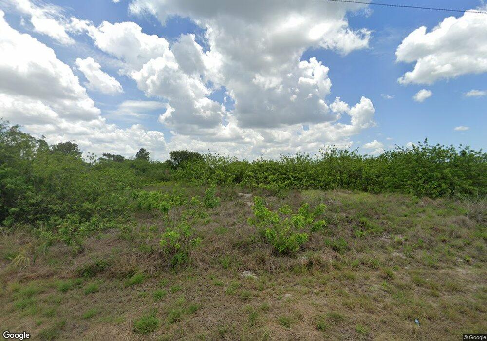
842 Chemstrand St E Lehigh Acres, FL 33974
Eisenhower NeighborhoodEstimated Value: $35,883 - $334,000
3
Beds
2
Baths
1,392
Sq Ft
$119/Sq Ft
Est. Value
About This Home
This home is located at 842 Chemstrand St E, Lehigh Acres, FL 33974 and is currently estimated at $165,221, approximately $118 per square foot. 842 Chemstrand St E is a home located in Lee County with nearby schools including Lehigh Elementary School, The Alva School, and Gateway Elementary School.
Ownership History
Date
Name
Owned For
Owner Type
Purchase Details
Closed on
Mar 21, 2017
Sold by
Not Provided
Bought by
Jalp Llc
Current Estimated Value
Purchase Details
Closed on
Jan 31, 2006
Sold by
Ross Home Builders Inc
Bought by
Irwin David A
Home Financials for this Owner
Home Financials are based on the most recent Mortgage that was taken out on this home.
Original Mortgage
$205,300
Interest Rate
7.37%
Mortgage Type
Construction
Purchase Details
Closed on
Jan 9, 2004
Sold by
Christensen La Vonne
Bought by
R F B Inc
Purchase Details
Closed on
Oct 1, 2001
Sold by
Stjohn Lisa and Piper Lisa
Bought by
Piper Myles D
Create a Home Valuation Report for This Property
The Home Valuation Report is an in-depth analysis detailing your home's value as well as a comparison with similar homes in the area
Home Values in the Area
Average Home Value in this Area
Purchase History
| Date | Buyer | Sale Price | Title Company |
|---|---|---|---|
| Jalp Llc | $2,018 | None Available | |
| Irwin David A | $55,000 | None Available | |
| R F B Inc | $4,100 | -- | |
| Piper Myles D | -- | -- |
Source: Public Records
Mortgage History
| Date | Status | Borrower | Loan Amount |
|---|---|---|---|
| Previous Owner | Irwin David A | $205,300 |
Source: Public Records
Tax History Compared to Growth
Tax History
| Year | Tax Paid | Tax Assessment Tax Assessment Total Assessment is a certain percentage of the fair market value that is determined by local assessors to be the total taxable value of land and additions on the property. | Land | Improvement |
|---|---|---|---|---|
| 2025 | $343 | $6,040 | -- | -- |
| 2024 | $343 | $5,491 | -- | -- |
| 2023 | $284 | $4,992 | $0 | $0 |
| 2022 | $284 | $4,538 | $0 | $0 |
| 2021 | $257 | $4,250 | $4,250 | $0 |
| 2020 | $254 | $3,750 | $3,750 | $0 |
| 2019 | $110 | $3,700 | $3,700 | $0 |
| 2018 | $102 | $3,700 | $3,700 | $0 |
| 2017 | $89 | $2,907 | $2,907 | $0 |
| 2016 | $94 | $4,000 | $4,000 | $0 |
| 2015 | $84 | $2,900 | $2,900 | $0 |
| 2014 | $68 | $2,585 | $2,585 | $0 |
| 2013 | -- | $2,300 | $2,300 | $0 |
Source: Public Records
Map
Nearby Homes
- 510 Lone Star Ln
- 437/439 Loretta Ave S
- 458/456 Loretta Ave S
- 462 Loretta Ave S
- 807 Theodore Vail St E
- 857 Christy St
- 507 Kilgour Ave S
- 550 Lone Star Ln
- 533 Lone Star Ln
- 531 Lone Star Ln
- 518 Kingsbury Ln
- 818 Chemstrand St E
- 850 Theodore Vail St E Unit 3
- 456 Lotus Ave S
- 452 Loretta Ave S
- 506 Morris Tyler Ave S
- 533 Morris Tyler Ave S
- 884 Chemstrand St E
- 859 Chipley St
- 508 Cable Ave S
- 842 Chemstrand St E Unit 15
- 838 Chemstrand St E
- 829 Theodore Vail St E
- 831 Theodore Vail St E
- 494 Loretta Ave S Unit 15
- 499 Linden Ave S
- 834 Chemstrand St E
- 497 Linden Ave S Unit 499
- 497 Linden Ave S
- 489-491 Loretta Ave S
- 850 Chemstrand St E
- 492 Lotus Ave S
- 832 Chemstrand St E
- 489 Linden Ave S
- 484 Loretta Ave S
- 505 Kilgour Ave S
- 830 Chemstrand St E Unit 15
- 469 Loretta Ave S
- 488 Lotus Ave S
- 488 Lotus Ave S
