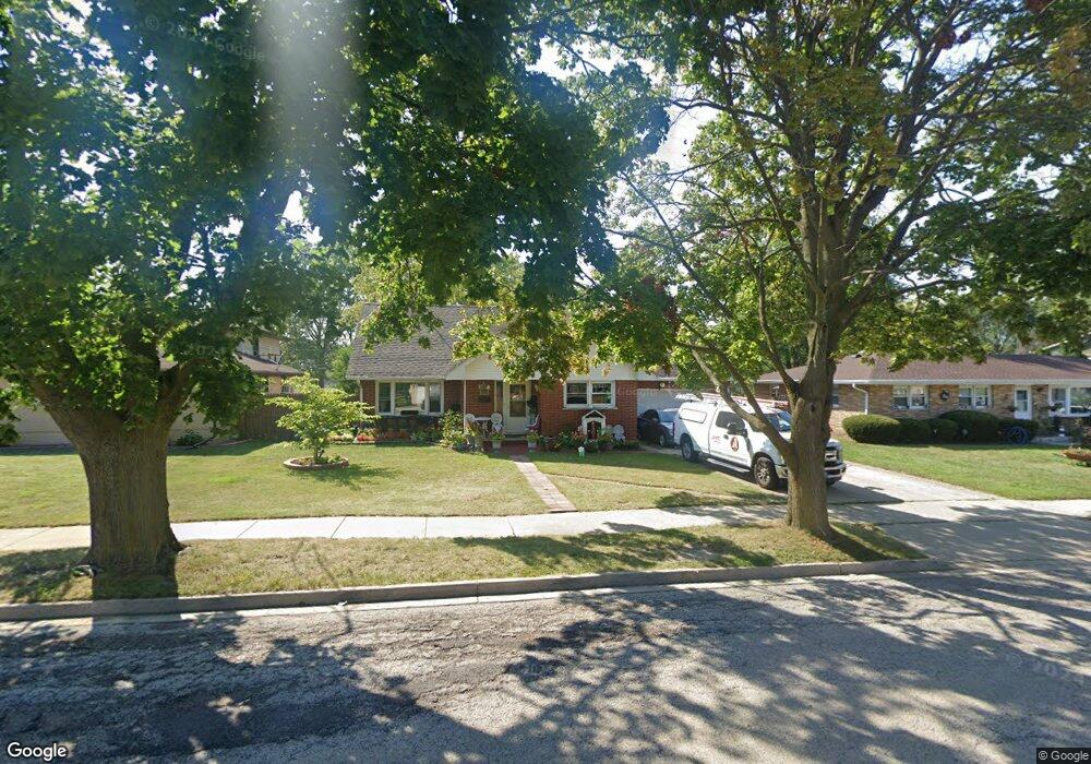
842 S Mcaree Rd Waukegan, IL 60085
Norshore Park NeighborhoodEstimated Value: $296,668 - $334,000
4
Beds
3
Baths
1,800
Sq Ft
$171/Sq Ft
Est. Value
About This Home
This home is located at 842 S Mcaree Rd, Waukegan, IL 60085 and is currently estimated at $307,167, approximately $170 per square foot. 842 S Mcaree Rd is a home located in Lake County with nearby schools including Clearview Elementary School, John R Lewis Middle School, and Waukegan High School.
Ownership History
Date
Name
Owned For
Owner Type
Purchase Details
Closed on
Apr 4, 2012
Sold by
Fannie Mae
Bought by
Ramirez Jose L Zuniga
Current Estimated Value
Purchase Details
Closed on
Dec 14, 2007
Sold by
Maldonado Arturo
Bought by
Escobar Maldonado Arturo and Escobar De Maldonado Maria Refugio
Home Financials for this Owner
Home Financials are based on the most recent Mortgage that was taken out on this home.
Original Mortgage
$194,000
Interest Rate
6.12%
Mortgage Type
New Conventional
Purchase Details
Closed on
Jun 13, 2005
Sold by
Jerina Fred J and Jerina Frances B
Bought by
Maldonado Arturo
Home Financials for this Owner
Home Financials are based on the most recent Mortgage that was taken out on this home.
Original Mortgage
$37,380
Interest Rate
5.68%
Mortgage Type
Stand Alone Second
Create a Home Valuation Report for This Property
The Home Valuation Report is an in-depth analysis detailing your home's value as well as a comparison with similar homes in the area
Home Values in the Area
Average Home Value in this Area
Purchase History
| Date | Buyer | Sale Price | Title Company |
|---|---|---|---|
| Ramirez Jose L Zuniga | $61,500 | Attorneys Title Guaranty Fun | |
| Escobar Maldonado Arturo | -- | Premier Title | |
| Maldonado Arturo | $187,000 | St |
Source: Public Records
Mortgage History
| Date | Status | Borrower | Loan Amount |
|---|---|---|---|
| Previous Owner | Escobar Maldonado Arturo | $194,000 | |
| Previous Owner | Maldonado Arturo | $37,380 |
Source: Public Records
Tax History Compared to Growth
Tax History
| Year | Tax Paid | Tax Assessment Tax Assessment Total Assessment is a certain percentage of the fair market value that is determined by local assessors to be the total taxable value of land and additions on the property. | Land | Improvement |
|---|---|---|---|---|
| 2024 | $5,986 | $80,751 | $15,090 | $65,661 |
| 2023 | $6,352 | $71,485 | $12,922 | $58,563 |
| 2022 | $6,352 | $70,980 | $12,933 | $58,047 |
| 2021 | $5,740 | $61,055 | $11,109 | $49,946 |
| 2020 | $5,768 | $56,880 | $10,349 | $46,531 |
| 2019 | $5,752 | $52,121 | $9,483 | $42,638 |
| 2018 | $5,088 | $45,731 | $12,203 | $33,528 |
| 2017 | $4,902 | $40,459 | $10,796 | $29,663 |
| 2016 | $4,506 | $35,157 | $9,381 | $25,776 |
| 2015 | $4,302 | $31,466 | $8,396 | $23,070 |
| 2014 | $2,580 | $19,528 | $8,218 | $11,310 |
| 2012 | $2,592 | $21,155 | $8,903 | $12,252 |
Source: Public Records
Map
Nearby Homes
- 3027 Belvidere Rd
- 12601 W Atlantic Ave
- 2116 & 2101 Williamsburg Dr
- 2726 W Hidden Glen Dr
- 671 Oldsmar Ln
- 1712 11th St
- 819 S Fulton Ave
- 3159 Jeanette Ave
- 3298 7th St
- 3285 Meadow Dr
- 1511 14th St
- 49 S Lewis Ave
- 0 Casimer Pulaski Dr Unit MRD12490157
- 1521 Seymour Ave
- 24 Washington Terrace
- 910 Cummings Ave
- 446 S Jackson St
- 1617 Grove Ave
- 1244 Victoria Ave
- 1521 Catalpa Ave
- 2600 9th Pkwy
- 832 S Mcaree Rd
- 835 Willow Ave
- 830 S Mcaree Rd
- 2518 9th Pkwy
- 815 S Mcaree Rd
- 2601 9th Pkwy
- 822 S Mcaree Rd
- 2512 9th Pkwy
- 821 Willow Ave
- 2513 Pearsall Pkwy
- 908 S Mcaree Rd
- 2519 9th Pkwy
- 2504 9th Pkwy
- 820 S Mcaree Rd
- 2505 Pearsall Pkwy
- 2511 9th Pkwy
- 832 Willow Ave
- 2520 Pearsall Pkwy
- 918 S Mcaree Rd