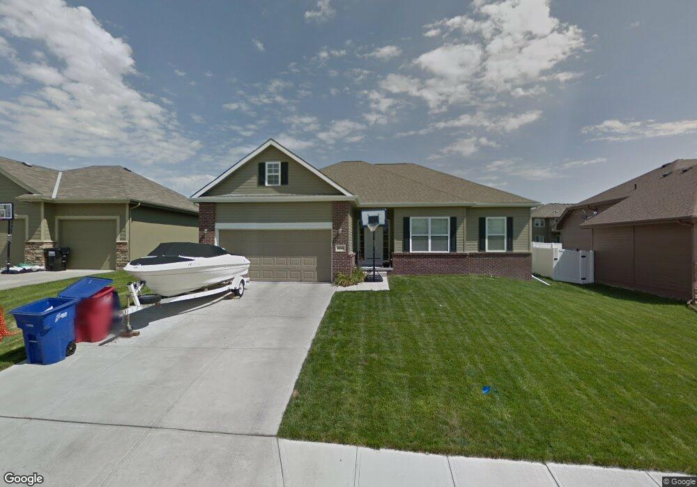
8423 S 106th St La Vista, NE 68128
Estimated Value: $368,992 - $465,000
3
Beds
3
Baths
1,767
Sq Ft
$244/Sq Ft
Est. Value
About This Home
This home is located at 8423 S 106th St, La Vista, NE 68128 and is currently estimated at $431,498, approximately $244 per square foot. 8423 S 106th St is a home located in Sarpy County with nearby schools including Prairie Queen Elementary School, Liberty Middle School, and Papillion La Vista Senior High School.
Ownership History
Date
Name
Owned For
Owner Type
Purchase Details
Closed on
Jun 25, 2010
Sold by
Charleston Homes Llc
Bought by
Price Jeffrey T and Price Cara L
Current Estimated Value
Home Financials for this Owner
Home Financials are based on the most recent Mortgage that was taken out on this home.
Original Mortgage
$171,860
Outstanding Balance
$114,045
Interest Rate
4.77%
Estimated Equity
$317,453
Purchase Details
Closed on
Mar 4, 2010
Sold by
Portal Ridge Development Llc
Bought by
Charelston Homes L L C
Create a Home Valuation Report for This Property
The Home Valuation Report is an in-depth analysis detailing your home's value as well as a comparison with similar homes in the area
Home Values in the Area
Average Home Value in this Area
Purchase History
| Date | Buyer | Sale Price | Title Company |
|---|---|---|---|
| Price Jeffrey T | $215,000 | Fat | |
| Charelston Homes L L C | $38,000 | Pre |
Source: Public Records
Mortgage History
| Date | Status | Borrower | Loan Amount |
|---|---|---|---|
| Open | Price Jeffrey T | $171,860 |
Source: Public Records
Tax History Compared to Growth
Tax History
| Year | Tax Paid | Tax Assessment Tax Assessment Total Assessment is a certain percentage of the fair market value that is determined by local assessors to be the total taxable value of land and additions on the property. | Land | Improvement |
|---|---|---|---|---|
| 2025 | $5,681 | $333,027 | $61,000 | $272,027 |
| 2024 | $6,321 | $315,770 | $58,000 | $257,770 |
| 2023 | $6,321 | $292,688 | $54,000 | $238,688 |
| 2022 | $5,757 | $250,638 | $50,000 | $200,638 |
| 2021 | $5,828 | $249,617 | $46,000 | $203,617 |
| 2020 | $5,686 | $242,835 | $46,000 | $196,835 |
| 2019 | $5,306 | $227,747 | $44,000 | $183,747 |
| 2018 | $5,347 | $225,845 | $44,000 | $181,845 |
| 2017 | $5,188 | $219,235 | $44,000 | $175,235 |
| 2016 | $5,068 | $208,516 | $42,000 | $166,516 |
| 2015 | $5,033 | $206,935 | $40,000 | $166,935 |
| 2014 | $5,584 | $206,179 | $40,000 | $166,179 |
| 2012 | -- | $203,315 | $36,000 | $167,315 |
Source: Public Records
Map
Nearby Homes
- 8507 S 106th St
- 8627 S 104th St
- 8608 S 98th St
- 7510 S 103 Ave
- 8613 S 98th St
- 7821 S 98th St
- 1210 Norton Dr
- 1011 Norton Dr
- 9710 S 103rd Ave
- 10208 Edna St
- 811 Western Hills Dr
- 9929 S 103rd Avenue Cir
- 10915 Windward Ave
- 10204 S 103rd St
- 9964 S 105th Ave
- 808 W Centennial Rd
- 9402 Margo Cir
- 10222 Polk St
- 10206 Longshore Ave
- 10011 S 105th Ave
- 8431 S 106th St
- 8417 S 106th St
- 8422 S 105th St
- 8428 S 105th St
- 8414 S 105th St
- 8502 S 105th St
- 8426 S 106th St
- 8420 S 106th St
- 8513 S 106th St
- 8412 S 106th St
- 8508 S 105th St
- 8510 S 106th St
- 8514 S 105th St
- 8514 105
- 8519 S 106th St
- 8421 S 105th St
- 8427 S 105th St
- 8415 S 105th St
- 8520 S 105th St
- 8516 S 106th St