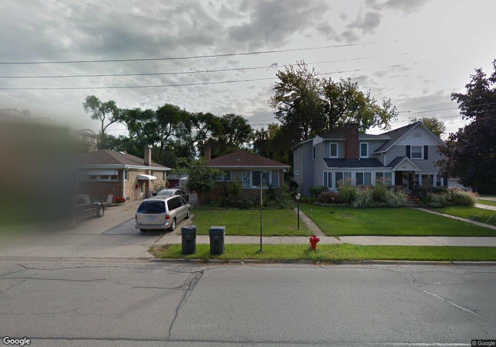
8427 Austin Ave Morton Grove, IL 60053
Estimated Value: $415,000 - $480,000
3
Beds
2
Baths
1,300
Sq Ft
$346/Sq Ft
Est. Value
About This Home
This home is located at 8427 Austin Ave, Morton Grove, IL 60053 and is currently estimated at $449,345, approximately $345 per square foot. 8427 Austin Ave is a home located in Cook County with nearby schools including Park View Elementary School, Niles West High School, and Arie Crown Hebrew Day School.
Ownership History
Date
Name
Owned For
Owner Type
Purchase Details
Closed on
Sep 23, 2009
Sold by
Gordon Lisa Sue
Bought by
Memon Ahmed
Current Estimated Value
Home Financials for this Owner
Home Financials are based on the most recent Mortgage that was taken out on this home.
Original Mortgage
$225,834
Outstanding Balance
$147,695
Interest Rate
5.19%
Mortgage Type
FHA
Estimated Equity
$301,650
Purchase Details
Closed on
Oct 2, 2006
Sold by
Kozokar Judith and Christie Judith Ann
Bought by
Christie Judith Ann and The Judith Ann Christie Trust
Create a Home Valuation Report for This Property
The Home Valuation Report is an in-depth analysis detailing your home's value as well as a comparison with similar homes in the area
Home Values in the Area
Average Home Value in this Area
Purchase History
| Date | Buyer | Sale Price | Title Company |
|---|---|---|---|
| Memon Ahmed | $230,000 | Ticor | |
| Christie Judith Ann | -- | None Available |
Source: Public Records
Mortgage History
| Date | Status | Borrower | Loan Amount |
|---|---|---|---|
| Open | Memon Ahmed | $225,834 |
Source: Public Records
Tax History Compared to Growth
Tax History
| Year | Tax Paid | Tax Assessment Tax Assessment Total Assessment is a certain percentage of the fair market value that is determined by local assessors to be the total taxable value of land and additions on the property. | Land | Improvement |
|---|---|---|---|---|
| 2024 | $8,574 | $33,000 | $6,770 | $26,230 |
| 2023 | $8,140 | $33,000 | $6,770 | $26,230 |
| 2022 | $8,140 | $33,000 | $6,770 | $26,230 |
| 2021 | $7,347 | $26,235 | $4,166 | $22,069 |
| 2020 | $7,222 | $26,235 | $4,166 | $22,069 |
| 2019 | $7,293 | $29,478 | $4,166 | $25,312 |
| 2018 | $6,068 | $22,667 | $3,775 | $18,892 |
| 2017 | $7,636 | $27,397 | $3,775 | $23,622 |
| 2016 | $7,462 | $27,397 | $3,775 | $23,622 |
| 2015 | $5,888 | $20,896 | $3,255 | $17,641 |
| 2014 | $5,900 | $20,896 | $3,255 | $17,641 |
| 2013 | $7,083 | $22,519 | $3,255 | $19,264 |
Source: Public Records
Map
Nearby Homes
- 6035 Lincoln Ave
- 6140 Elm St
- 6166 Mayfair St Unit 33714
- 6163 Mayfair St Unit 102714
- 8425 Callie Ave Unit 62
- 8300 Callie Ave Unit F314
- 8300 Callie Ave Unit F610
- 8400 Callie Ave Unit D209
- 8400 Callie Ave Unit D207
- 6330 Lincoln Ave Unit 2A
- 6411 Elm St
- 5510 Lincoln Ave Unit B301
- 5510 Lincoln Ave Unit B101
- 5506 Lincoln Ave Unit A117
- 5506 Lincoln Ave Unit A216
- 8836 Mansfield Ave
- 8380 Miami Ave
- 8849 Mcvicker Ave
- 8650 Ferris Ave Unit 203
- 8712 Ferris Ave
- 8429 Austin Ave
- 8425 Austin Ave
- 8425 Austin Ave
- 8431 Austin Ave
- 8417 Austin Ave
- 8430 Mason Ave
- 8434 Mason Ave
- 8434 Mason Ave
- 8434 Mason Ave
- 8420 Mason Ave
- 8420 Mason Ave
- 8411 Austin Ave
- 8428 Austin Ave
- 8424 Austin Ave
- 5935 Lincoln Ave Unit 205
- 5935 Lincoln Ave Unit 503
- 5935 Lincoln Ave Unit 403
- 5935 Lincoln Ave Unit 505
- 5935 Lincoln Ave Unit 302