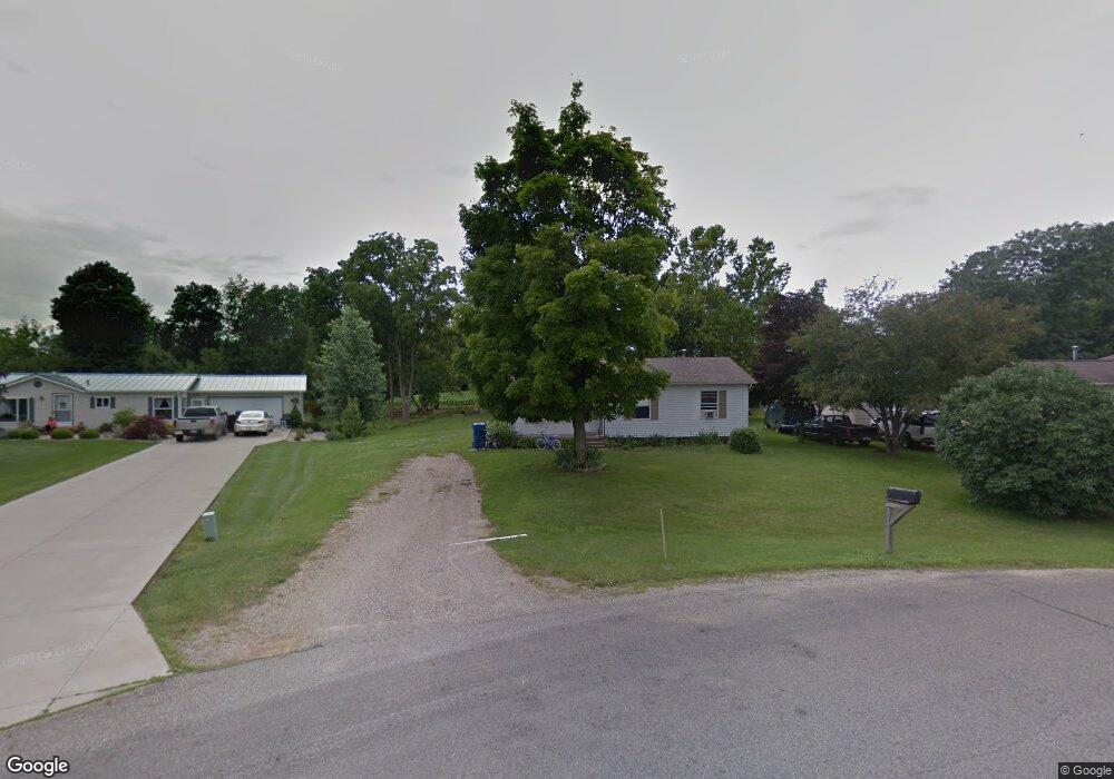
843 Lawrence St Quincy, MI 49082
Estimated Value: $147,020 - $158,000
3
Beds
1
Bath
1,100
Sq Ft
$139/Sq Ft
Est. Value
About This Home
This home is located at 843 Lawrence St, Quincy, MI 49082 and is currently estimated at $153,005, approximately $139 per square foot. 843 Lawrence St is a home located in Branch County with nearby schools including Jennings Elementary School, Quincy Middle School, and Quincy High School.
Ownership History
Date
Name
Owned For
Owner Type
Purchase Details
Closed on
Jun 20, 2007
Sold by
Kibiloski Lynn A and Kibiloski Victoria R
Bought by
Leosh Kyle W and Leosh Leah A
Current Estimated Value
Home Financials for this Owner
Home Financials are based on the most recent Mortgage that was taken out on this home.
Original Mortgage
$87,500
Outstanding Balance
$53,570
Interest Rate
6.2%
Mortgage Type
Purchase Money Mortgage
Estimated Equity
$99,435
Purchase Details
Closed on
Nov 11, 2005
Sold by
Household Mtg Funding Corp Iii
Bought by
Household Finance Corp Iii
Purchase Details
Closed on
Jun 10, 2004
Sold by
Smotherman Anthony
Bought by
Household Mtg Funding Corp Iii
Purchase Details
Closed on
Sep 30, 2002
Sold by
Aker Richard D and Aker Nancy J
Bought by
Smotherman Anthony
Create a Home Valuation Report for This Property
The Home Valuation Report is an in-depth analysis detailing your home's value as well as a comparison with similar homes in the area
Home Values in the Area
Average Home Value in this Area
Purchase History
| Date | Buyer | Sale Price | Title Company |
|---|---|---|---|
| Leosh Kyle W | $87,500 | Branch County Abstract & Tit | |
| Household Finance Corp Iii | -- | Metropolitan Title Co | |
| Household Mtg Funding Corp Iii | $71,745 | -- | |
| Smotherman Anthony | $73,000 | -- |
Source: Public Records
Mortgage History
| Date | Status | Borrower | Loan Amount |
|---|---|---|---|
| Open | Leosh Kyle W | $87,500 |
Source: Public Records
Tax History Compared to Growth
Tax History
| Year | Tax Paid | Tax Assessment Tax Assessment Total Assessment is a certain percentage of the fair market value that is determined by local assessors to be the total taxable value of land and additions on the property. | Land | Improvement |
|---|---|---|---|---|
| 2025 | $898 | $61,761 | $0 | $0 |
| 2024 | $327 | $56,679 | $0 | $0 |
| 2023 | $297 | $53,801 | $0 | $0 |
| 2022 | $297 | $38,482 | $0 | $0 |
| 2021 | -- | $37,979 | $0 | $0 |
| 2020 | -- | $36,352 | $0 | $0 |
| 2019 | -- | $32,590 | $0 | $0 |
| 2018 | -- | $30,334 | $0 | $0 |
| 2017 | -- | $26,477 | $0 | $0 |
| 2016 | -- | $26,377 | $0 | $0 |
| 2015 | -- | $27,111 | $0 | $0 |
| 2014 | -- | $25,493 | $0 | $0 |
| 2013 | -- | $23,597 | $0 | $0 |
Source: Public Records
Map
Nearby Homes
- 78 Taylor St
- 44 Berry St
- 19 Arnold St
- 46 W Chicago St
- 42 W Chicago St
- 34 W Liberty St
- 912 Beckwith Shore
- 34 Park St
- 21 Cole St
- 14 Cole St
- 9 Cole St
- 1014 Aguadero Pkwy
- 732 Cambridge Dr
- 988 Williams Dr
- 216 Sandalwood Dr
- 1085 E Chicago Rd
- 1085 E Chicago Rd Unit B
- 1085 E Chicago Rd Unit A
- 808 Rolling Meadows Dr
- 0 Lott Rd