Estimated Value: $193,000 - $312,000
3
Beds
2
Baths
1,650
Sq Ft
$156/Sq Ft
Est. Value
About This Home
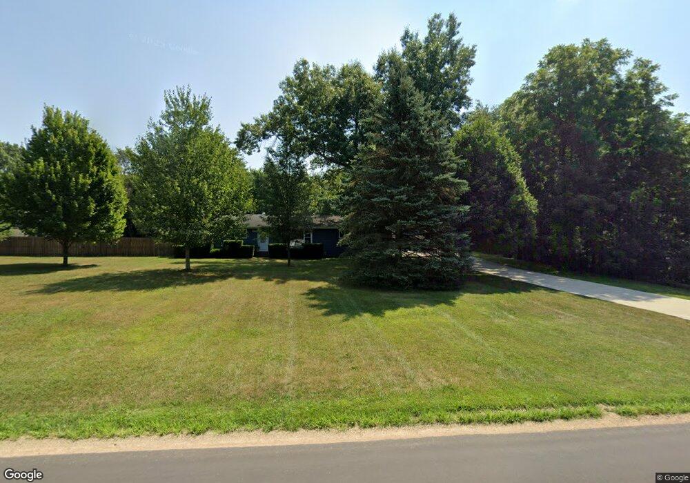
This home is located at 843 Leet Rd, Niles, MI 49120 and is currently estimated at $257,666, approximately $156 per square foot. 843 Leet Rd is a home located in Cass County with nearby schools including Edwardsburg Primary School, Eagle Lake Elementary School, and Edwardsburg Intermediate School.
Ownership History
Date
Name
Owned For
Owner Type
Purchase Details
Closed on
Nov 23, 2015
Sold by
Ann Ralph Iii Donald R and Ann Ralph Kayla
Bought by
Ann Ralph Iii Donald R and Ann Ralph Kayla
Current Estimated Value
Home Financials for this Owner
Home Financials are based on the most recent Mortgage that was taken out on this home.
Original Mortgage
$83,000
Outstanding Balance
$1,657
Interest Rate
3.8%
Estimated Equity
$256,009
Purchase Details
Closed on
Nov 25, 2009
Sold by
Hess Henry C and Hess Anne L
Bought by
Ralph Donald R
Home Financials for this Owner
Home Financials are based on the most recent Mortgage that was taken out on this home.
Original Mortgage
$107,855
Interest Rate
4.95%
Create a Home Valuation Report for This Property
The Home Valuation Report is an in-depth analysis detailing your home's value as well as a comparison with similar homes in the area
Home Values in the Area
Average Home Value in this Area
Purchase History
| Date | Buyer | Sale Price | Title Company |
|---|---|---|---|
| Ann Ralph Iii Donald R | -- | Meridian Title Corp | |
| Ralph Donald R | $112,000 | Meridian Title Corp |
Source: Public Records
Mortgage History
| Date | Status | Borrower | Loan Amount |
|---|---|---|---|
| Open | Ann Ralph Iii Donald R | $83,000 | |
| Previous Owner | Ralph Donald R | $107,855 |
Source: Public Records
Tax History Compared to Growth
Tax History
| Year | Tax Paid | Tax Assessment Tax Assessment Total Assessment is a certain percentage of the fair market value that is determined by local assessors to be the total taxable value of land and additions on the property. | Land | Improvement |
|---|---|---|---|---|
| 2025 | $1,291 | $115,000 | $115,000 | $0 |
| 2024 | $552 | $70,700 | $70,700 | $0 |
| 2023 | $527 | $57,800 | $0 | $0 |
| 2022 | $502 | $64,200 | $0 | $0 |
| 2021 | $1,092 | $67,200 | $0 | $0 |
| 2020 | $1,085 | $63,500 | $0 | $0 |
| 2019 | $1,022 | $61,600 | $0 | $0 |
| 2018 | $462 | $52,300 | $0 | $0 |
| 2017 | $452 | $48,800 | $0 | $0 |
| 2016 | $448 | $45,062 | $0 | $0 |
| 2015 | -- | $45,700 | $0 | $0 |
| 2011 | -- | $34,900 | $0 | $0 |
Source: Public Records
Map
Nearby Homes
- 1002 Leet Rd
- 2760 Detroit Rd
- 2561 Lake Shore Dr
- 2671 Mulberry St
- 2419 Blanchard Dr
- 2726 Horton Ct
- 69260 Anderson Rd
- 30417 U S 12
- 2511 Heath Dr
- 69594 Anderson Rd
- 2354 Yankee St
- 1403 Barron Lake Rd
- 892 Sullivan Rd
- 2298 Yankee St
- 69535 Turkey Trail Dr
- 66017 Conrad Rd
- 66741 Conrad Rd
- 33546 Frantz Dr
- 33273 U S 12
- 29750 Edwards Way