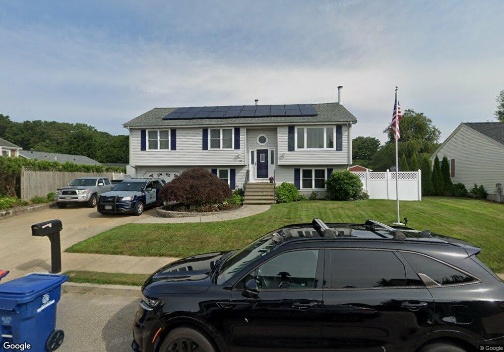
843 Phillips Rd New Bedford, MA 02745
Acushnet-Pine Hill NeighborhoodEstimated Value: $567,000 - $607,000
4
Beds
3
Baths
2,684
Sq Ft
$219/Sq Ft
Est. Value
About This Home
This home is located at 843 Phillips Rd, New Bedford, MA 02745 and is currently estimated at $587,517, approximately $218 per square foot. 843 Phillips Rd is a home located in Bristol County with nearby schools including Casimir Pulaski Elementary School, Normandin Middle School, and New Bedford High School.
Ownership History
Date
Name
Owned For
Owner Type
Purchase Details
Closed on
Aug 30, 1996
Sold by
Maroney Bldg & Contr
Bought by
Duarte Jose A and Duarte Gilberta R
Current Estimated Value
Home Financials for this Owner
Home Financials are based on the most recent Mortgage that was taken out on this home.
Original Mortgage
$80,000
Outstanding Balance
$6,857
Interest Rate
8.18%
Mortgage Type
Purchase Money Mortgage
Estimated Equity
$580,660
Purchase Details
Closed on
Oct 25, 1993
Sold by
Collette Ernest Est
Bought by
Estrada Edwin G and Vitorino Maria J
Home Financials for this Owner
Home Financials are based on the most recent Mortgage that was taken out on this home.
Original Mortgage
$95,687
Interest Rate
6.73%
Mortgage Type
Purchase Money Mortgage
Create a Home Valuation Report for This Property
The Home Valuation Report is an in-depth analysis detailing your home's value as well as a comparison with similar homes in the area
Home Values in the Area
Average Home Value in this Area
Purchase History
| Date | Buyer | Sale Price | Title Company |
|---|---|---|---|
| Duarte Jose A | $135,910 | -- | |
| Duarte Jose A | $135,910 | -- | |
| Estrada Edwin G | $95,000 | -- | |
| Estrada Edwin G | $95,000 | -- |
Source: Public Records
Mortgage History
| Date | Status | Borrower | Loan Amount |
|---|---|---|---|
| Open | Estrada Edwin G | $80,000 | |
| Closed | Estrada Edwin G | $80,000 | |
| Previous Owner | Estrada Edwin G | $95,687 |
Source: Public Records
Tax History Compared to Growth
Tax History
| Year | Tax Paid | Tax Assessment Tax Assessment Total Assessment is a certain percentage of the fair market value that is determined by local assessors to be the total taxable value of land and additions on the property. | Land | Improvement |
|---|---|---|---|---|
| 2025 | $6,045 | $534,500 | $148,600 | $385,900 |
| 2024 | $5,740 | $478,300 | $139,300 | $339,000 |
| 2023 | $5,323 | $372,500 | $118,400 | $254,100 |
| 2022 | $5,127 | $329,900 | $118,400 | $211,500 |
| 2021 | $4,863 | $311,900 | $116,100 | $195,800 |
| 2020 | $4,801 | $297,100 | $116,100 | $181,000 |
| 2019 | $4,740 | $287,800 | $116,100 | $171,700 |
| 2018 | $4,595 | $276,300 | $116,100 | $160,200 |
| 2017 | $4,364 | $261,500 | $113,800 | $147,700 |
| 2016 | $4,045 | $245,300 | $104,500 | $140,800 |
| 2015 | $3,733 | $237,300 | $102,200 | $135,100 |
| 2014 | $3,610 | $238,100 | $104,500 | $133,600 |
Source: Public Records
Map
Nearby Homes
- 26 Rounseville St
- ES Acushnet Ave
- 2981 Acushnet Ave
- 847 Terry Ln
- 957 Glen St
- 850 Terry Ln
- 1023 Bowles St
- 1044 Phillips Rd Unit 20
- 1044 Phillips Rd Unit 24
- 1045 Forbes St
- 1044 Victoria St Unit B-29
- 0 Church Dutton & Chaffee Unit 73371719
- 1214 Church St
- 1158 Joyce St
- 1164 Victoria St
- 1251 Church St Unit 10
- 9 Middlefield Place
- 1261 Church St Unit 70
- 1261 Church St Unit 46
- 1261 Church St Unit 53
- 837 Phillips Rd
- 872 Bartlett St
- 880 Bartlett St
- 829 Phillips Rd
- 846 Phillips Rd
- 836 Phillips Rd
- 854 Phillips Rd
- 821 Phillips Rd
- 862 Phillips Rd
- 832 Phillips Rd
- 871 Bartlett St
- 877 Bartlett St
- 883 Bartlett St
- 29 Garrett St
- 824 Phillips Rd
- 37 Garrett St
- 21 Garrett St
- 815 Phillips Rd
- 459 Phillips Rd
- 464 Phillips Rd