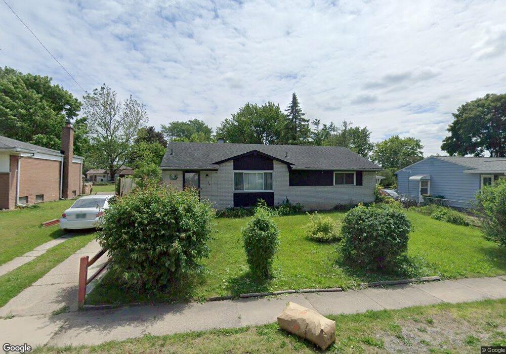
844 Auburndale Ave Ypsilanti, MI 48198
Estimated Value: $182,134 - $239,000
3
Beds
1
Bath
1,056
Sq Ft
$202/Sq Ft
Est. Value
About This Home
This home is located at 844 Auburndale Ave, Ypsilanti, MI 48198 and is currently estimated at $213,534, approximately $202 per square foot. 844 Auburndale Ave is a home located in Washtenaw County with nearby schools including Erickson Elementary School, Holmes Elementary School, and Estabrook Elementary School.
Ownership History
Date
Name
Owned For
Owner Type
Purchase Details
Closed on
Mar 6, 2003
Sold by
Korte Raymond Gerard and Korte Theresa Alice
Bought by
Slay Clarence L
Current Estimated Value
Home Financials for this Owner
Home Financials are based on the most recent Mortgage that was taken out on this home.
Original Mortgage
$118,000
Outstanding Balance
$51,172
Interest Rate
6%
Mortgage Type
VA
Estimated Equity
$162,362
Create a Home Valuation Report for This Property
The Home Valuation Report is an in-depth analysis detailing your home's value as well as a comparison with similar homes in the area
Home Values in the Area
Average Home Value in this Area
Purchase History
| Date | Buyer | Sale Price | Title Company |
|---|---|---|---|
| Slay Clarence L | $118,000 | Liberty Title Agency |
Source: Public Records
Mortgage History
| Date | Status | Borrower | Loan Amount |
|---|---|---|---|
| Open | Slay Clarence L | $118,000 |
Source: Public Records
Tax History Compared to Growth
Tax History
| Year | Tax Paid | Tax Assessment Tax Assessment Total Assessment is a certain percentage of the fair market value that is determined by local assessors to be the total taxable value of land and additions on the property. | Land | Improvement |
|---|---|---|---|---|
| 2025 | -- | $76,900 | $0 | $0 |
| 2024 | $901 | $70,600 | $0 | $0 |
| 2023 | $826 | $65,100 | $0 | $0 |
| 2022 | $855 | $57,700 | $0 | $0 |
| 2021 | $1,398 | $48,000 | $0 | $0 |
| 2020 | $1,380 | $45,600 | $0 | $0 |
| 2019 | $546 | $40,600 | $40,600 | $0 |
| 2018 | $0 | $36,000 | $0 | $0 |
| 2017 | $1,213 | $36,000 | $0 | $0 |
| 2016 | $738 | $24,864 | $0 | $0 |
| 2015 | $1,126 | $24,790 | $0 | $0 |
| 2014 | $1,126 | $27,600 | $0 | $0 |
| 2013 | -- | $27,600 | $0 | $0 |
Source: Public Records
Map
Nearby Homes
- 851 Auburndale Ave
- 950 Auburndale Ave
- 909 Maplewood Ave
- 823 Hawthorne Ave
- 204 Ecorse Rd
- 1027 Parkwood Ave
- 142 Glenwood Ave
- 310 South St
- 1320 Parkwood Ave
- 1001 Juneau Rd
- 366 S Harris Rd
- 490 Greenlawn St
- 1205 Evelyn Ave
- 238 N Prospect Rd
- 800 Cliffs Dr Unit 208F
- 102 Spring St
- 730 Cliffs Dr Unit 304 A
- 1428 Foley Ave
- 215 N Lincoln St
- 620 Kansas Ave
- 836 Auburndale Ave
- 864 Auburndale Ave
- 874 Auburndale Ave
- 830 Auburndale Ave
- 855 Debby Ct
- 845 Debby Ct
- 867 Debby Ct
- 886 Auburndale Ave
- 831 Debby Ct
- 843 Auburndale Ave
- 521 Emerick St
- 855 Auburndale Ave
- 819 Debby Ct
- 525 Emerick St
- 835 Auburndale Ave Unit Bldg-Unit
- 835 Auburndale Ave
- 519 Emerick St
- 527 Emerick St
- 871 Auburndale Ave
- 829 Auburndale Ave