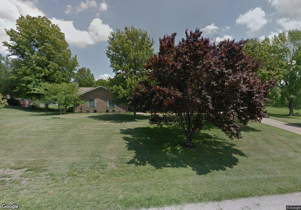
844 Lemay Dr Evansville, IN 47712
Estimated Value: $347,000 - $409,000
3
Beds
3
Baths
2,387
Sq Ft
$158/Sq Ft
Est. Value
About This Home
This home is located at 844 Lemay Dr, Evansville, IN 47712 and is currently estimated at $376,934, approximately $157 per square foot. 844 Lemay Dr is a home located in Vanderburgh County with nearby schools including West Terrace Elementary School, Perry Heights Middle School, and Francis Joseph Reitz High School.
Ownership History
Date
Name
Owned For
Owner Type
Purchase Details
Closed on
Jul 15, 2020
Sold by
Woodruff Martin L
Bought by
Woodruff Martin L and Woodruff Catherine E
Current Estimated Value
Purchase Details
Closed on
Jul 21, 2014
Sold by
Winternheimer Blake and Winternheimer Amanda
Bought by
Woodruff Martin L
Home Financials for this Owner
Home Financials are based on the most recent Mortgage that was taken out on this home.
Original Mortgage
$245,700
Outstanding Balance
$187,360
Interest Rate
4.19%
Mortgage Type
New Conventional
Estimated Equity
$189,574
Purchase Details
Closed on
Jun 9, 2011
Sold by
Smock Randall E and Smock Janet A
Bought by
Winternheimer Blake and Winterheimer Amanda
Home Financials for this Owner
Home Financials are based on the most recent Mortgage that was taken out on this home.
Original Mortgage
$208,905
Interest Rate
4.67%
Mortgage Type
New Conventional
Create a Home Valuation Report for This Property
The Home Valuation Report is an in-depth analysis detailing your home's value as well as a comparison with similar homes in the area
Home Values in the Area
Average Home Value in this Area
Purchase History
| Date | Buyer | Sale Price | Title Company |
|---|---|---|---|
| Woodruff Martin L | -- | None Available | |
| Woodruff Martin L | -- | -- | |
| Winternheimer Blake | -- | None Available |
Source: Public Records
Mortgage History
| Date | Status | Borrower | Loan Amount |
|---|---|---|---|
| Open | Woodruff Martin L | $245,700 | |
| Previous Owner | Winternheimer Blake | $208,905 |
Source: Public Records
Tax History Compared to Growth
Tax History
| Year | Tax Paid | Tax Assessment Tax Assessment Total Assessment is a certain percentage of the fair market value that is determined by local assessors to be the total taxable value of land and additions on the property. | Land | Improvement |
|---|---|---|---|---|
| 2024 | $3,002 | $287,200 | $30,100 | $257,100 |
| 2023 | $2,855 | $277,600 | $30,100 | $247,500 |
| 2022 | $3,135 | $285,500 | $30,100 | $255,400 |
| 2021 | $2,777 | $248,900 | $29,500 | $219,400 |
| 2020 | $2,712 | $249,800 | $29,500 | $220,300 |
| 2019 | $1,962 | $191,100 | $29,500 | $161,600 |
| 2018 | $1,930 | $191,100 | $29,500 | $161,600 |
| 2017 | $1,943 | $193,100 | $29,500 | $163,600 |
| 2016 | $1,986 | $198,100 | $29,500 | $168,600 |
| 2014 | $1,902 | $193,100 | $29,500 | $163,600 |
| 2013 | -- | $196,000 | $29,500 | $166,500 |
Source: Public Records
Map
Nearby Homes
- 6401 Middle Mount Vernon Rd
- 1400 Mcdowell Rd
- 9101 Allison Dr
- 9001 Jillian Ct
- 9011 Jillian Ct
- 2741 Marycrest Dr
- 9100 Marfield Ct
- 2646 Marycrest Dr
- 2704 Marycrest Dr
- 4031 Saint Phillips Rd S
- 7601 Eichele Dr
- 8307 Buck Ridge Trail
- 832 Tawny Dr
- 11314 Vixen Dr
- 0 Fox Ridge Rd
- 5712 Hausman Rd
- 2701 Woodstone Ln
- 3627 Saint Philip Rd S
- 6001 Felstead Rd
- 6016 Sarabeth Ln