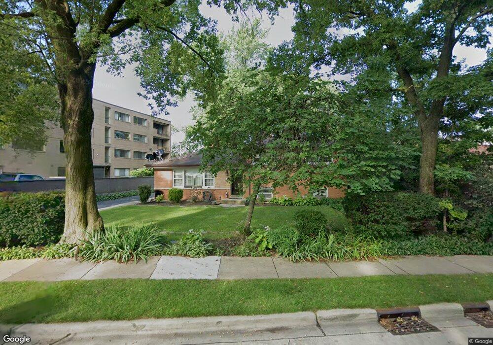
8446 Harms Rd Skokie, IL 60077
Southwest Skokie NeighborhoodEstimated Value: $440,000 - $538,062
4
Beds
2
Baths
1,296
Sq Ft
$371/Sq Ft
Est. Value
About This Home
This home is located at 8446 Harms Rd, Skokie, IL 60077 and is currently estimated at $480,266, approximately $370 per square foot. 8446 Harms Rd is a home located in Cook County with nearby schools including Madison Elementary School, Thomas Edison Elementary School, and Lincoln Junior High School.
Ownership History
Date
Name
Owned For
Owner Type
Purchase Details
Closed on
Sep 8, 2000
Sold by
Handzel John William
Bought by
Esteban Jose I and Taron Elaine R
Current Estimated Value
Home Financials for this Owner
Home Financials are based on the most recent Mortgage that was taken out on this home.
Original Mortgage
$310,000
Outstanding Balance
$113,304
Interest Rate
8.14%
Estimated Equity
$366,962
Create a Home Valuation Report for This Property
The Home Valuation Report is an in-depth analysis detailing your home's value as well as a comparison with similar homes in the area
Home Values in the Area
Average Home Value in this Area
Purchase History
| Date | Buyer | Sale Price | Title Company |
|---|---|---|---|
| Esteban Jose I | $370,000 | Centennial Title Incorporate |
Source: Public Records
Mortgage History
| Date | Status | Borrower | Loan Amount |
|---|---|---|---|
| Open | Esteban Jose I | $310,000 |
Source: Public Records
Tax History Compared to Growth
Tax History
| Year | Tax Paid | Tax Assessment Tax Assessment Total Assessment is a certain percentage of the fair market value that is determined by local assessors to be the total taxable value of land and additions on the property. | Land | Improvement |
|---|---|---|---|---|
| 2024 | $11,441 | $40,000 | $18,200 | $21,800 |
| 2023 | $11,403 | $40,000 | $18,200 | $21,800 |
| 2022 | $11,403 | $40,000 | $18,200 | $21,800 |
| 2021 | $9,791 | $30,365 | $11,200 | $19,165 |
| 2020 | $9,804 | $30,365 | $11,200 | $19,165 |
| 2019 | $9,865 | $34,119 | $11,200 | $22,919 |
| 2018 | $10,508 | $32,786 | $10,150 | $22,636 |
| 2017 | $10,576 | $32,786 | $10,150 | $22,636 |
| 2016 | $10,263 | $32,786 | $10,150 | $22,636 |
| 2015 | $9,380 | $28,891 | $8,750 | $20,141 |
| 2014 | $9,188 | $28,891 | $8,750 | $20,141 |
| 2013 | $9,290 | $28,891 | $8,750 | $20,141 |
Source: Public Records
Map
Nearby Homes
- 5500 Lincoln Ave Unit 407W
- 5500 Lincoln Ave Unit 116E
- 5500 Lincoln Ave Unit 109W
- 5501 Lincoln Ave Unit 203
- 8464 Gross Point Rd
- 8541 Lotus Ave Unit 914
- 5510 Lincoln Ave Unit B301
- 5510 Lincoln Ave Unit B101
- 5506 Lincoln Ave Unit A117
- 5506 Lincoln Ave Unit A211
- 5506 Lincoln Ave Unit A216
- 8461 Gross Point Rd
- 8655 Harms Rd
- 5309 Crain St
- 8708 Central Ave
- 8605 Laramie Ave
- 5253 Cleveland St
- 5109 Greenleaf St
- 8717 Gross Point Rd
- 5148 Cleveland St
- 8456 Harms Rd
- 5406 Lincoln Ave Unit 4D
- 5406 Lincoln Ave Unit 3D
- 5406 Lincoln Ave Unit 4A
- 5406 Lincoln Ave Unit 4F
- 5406 Lincoln Ave Unit 2B
- 5406 Lincoln Ave Unit 2C
- 5406 Lincoln Ave Unit 2A
- 5406 Lincoln Ave Unit 4E
- 5406 Lincoln Ave Unit 1C
- 5406 Lincoln Ave Unit 1E
- 5406 Lincoln Ave Unit 3C
- 5406 Lincoln Ave Unit 2D
- 5406 Lincoln Ave Unit 3B
- 5406 Lincoln Ave Unit 3E
- 5406 Lincoln Ave Unit 1D
- 5406 Lincoln Ave Unit 3A
- 5406 Lincoln Ave Unit 1A
- 5406 Lincoln Ave Unit 2F
- 5406 Lincoln Ave Unit 2E