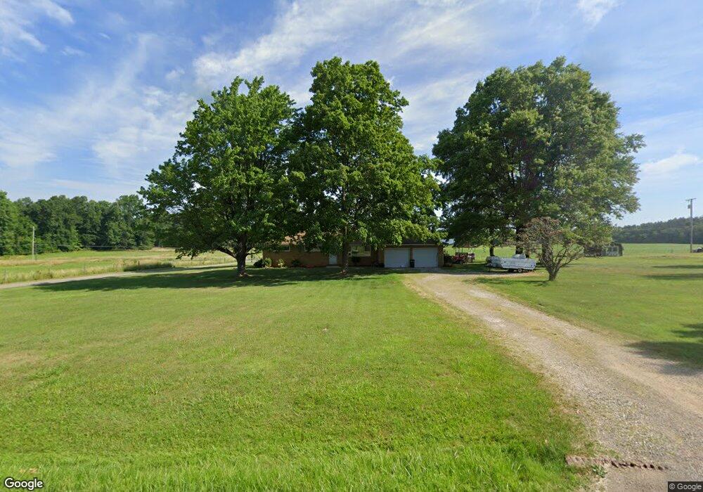
845 Crall Rd Mansfield, OH 44903
Estimated Value: $203,000 - $245,000
3
Beds
2
Baths
1,760
Sq Ft
$131/Sq Ft
Est. Value
About This Home
This home is located at 845 Crall Rd, Mansfield, OH 44903 and is currently estimated at $230,955, approximately $131 per square foot. 845 Crall Rd is a home located in Richland County with nearby schools including Crestview Elementary School, Crestview Middle School, and Crestview High School.
Ownership History
Date
Name
Owned For
Owner Type
Purchase Details
Closed on
Aug 31, 2020
Sold by
King James D and King Jocelyn L
Bought by
Hill Jason Anthony and Hill Elizabeth E
Current Estimated Value
Home Financials for this Owner
Home Financials are based on the most recent Mortgage that was taken out on this home.
Original Mortgage
$114,576
Outstanding Balance
$101,865
Interest Rate
3%
Mortgage Type
New Conventional
Estimated Equity
$129,090
Purchase Details
Closed on
Mar 30, 2006
Sold by
Marz Edward E and Ethel Marz A
Bought by
King James D and King Jocelyn L
Home Financials for this Owner
Home Financials are based on the most recent Mortgage that was taken out on this home.
Original Mortgage
$99,920
Interest Rate
7.55%
Mortgage Type
Fannie Mae Freddie Mac
Create a Home Valuation Report for This Property
The Home Valuation Report is an in-depth analysis detailing your home's value as well as a comparison with similar homes in the area
Home Values in the Area
Average Home Value in this Area
Purchase History
| Date | Buyer | Sale Price | Title Company |
|---|---|---|---|
| Hill Jason Anthony | $114,575 | Barrister Title Group | |
| King James D | $124,900 | None Available |
Source: Public Records
Mortgage History
| Date | Status | Borrower | Loan Amount |
|---|---|---|---|
| Open | Hill Jason Anthony | $114,576 | |
| Previous Owner | King James D | $99,920 |
Source: Public Records
Tax History Compared to Growth
Tax History
| Year | Tax Paid | Tax Assessment Tax Assessment Total Assessment is a certain percentage of the fair market value that is determined by local assessors to be the total taxable value of land and additions on the property. | Land | Improvement |
|---|---|---|---|---|
| 2024 | $2,093 | $57,580 | $7,140 | $50,440 |
| 2023 | $2,093 | $57,580 | $7,140 | $50,440 |
| 2022 | $2,068 | $50,230 | $7,430 | $42,800 |
| 2021 | $2,070 | $50,230 | $7,430 | $42,800 |
| 2020 | $2,022 | $50,230 | $7,430 | $42,800 |
| 2019 | $1,809 | $42,590 | $6,300 | $36,290 |
| 2018 | $1,827 | $42,590 | $6,300 | $36,290 |
| 2017 | $1,736 | $42,590 | $6,300 | $36,290 |
| 2016 | $1,676 | $41,460 | $5,710 | $35,750 |
| 2015 | $1,676 | $41,460 | $5,710 | $35,750 |
| 2014 | $1,747 | $41,460 | $5,710 | $35,750 |
| 2012 | $848 | $42,730 | $5,880 | $36,850 |
Source: Public Records
Map
Nearby Homes
- 0 Hoover Rd
- 1171 Hoover Rd
- 1791 Beal Rd
- 920 Piper Rd
- 1585 Beal Rd
- 1292 Wolford Rd
- 1245 N Stewart Rd
- 1158 Delwood Rd
- 1150 Delwood Dr
- 1140 5th Ave
- 1151 Beal Rd
- 0 Wesley
- 1106 Keller Dr Unit 1108
- 0 Miller Pkwy
- 741 Yale Ave
- 1806 Richard Dr
- 735 Pennsylvania Ave
- 1951 Woodmont Rd
- 903 Mayflower Ave
- 441 Amoy Rd E