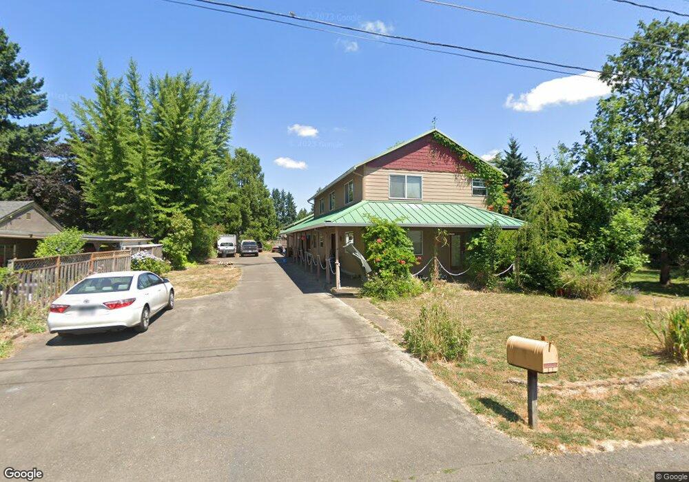
845 SW Edmunston St McMinnville, OR 97128
Estimated Value: $568,000 - $639,000
4
Beds
4
Baths
2,400
Sq Ft
$254/Sq Ft
Est. Value
About This Home
This home is located at 845 SW Edmunston St, McMinnville, OR 97128 and is currently estimated at $610,558, approximately $254 per square foot. 845 SW Edmunston St is a home located in Yamhill County with nearby schools including Willamette Elementary School, Duniway Middle School, and McMinnville High School.
Ownership History
Date
Name
Owned For
Owner Type
Purchase Details
Closed on
Feb 24, 2020
Sold by
Huff Darrell Patrick
Bought by
Huff Darrell
Current Estimated Value
Home Financials for this Owner
Home Financials are based on the most recent Mortgage that was taken out on this home.
Original Mortgage
$125,000
Outstanding Balance
$110,914
Interest Rate
3.6%
Mortgage Type
New Conventional
Estimated Equity
$499,644
Purchase Details
Closed on
Oct 5, 2015
Sold by
Rose Lonnie J and Rose Mary E
Bought by
Huff Darrell Patrick
Create a Home Valuation Report for This Property
The Home Valuation Report is an in-depth analysis detailing your home's value as well as a comparison with similar homes in the area
Home Values in the Area
Average Home Value in this Area
Purchase History
| Date | Buyer | Sale Price | Title Company |
|---|---|---|---|
| Huff Darrell | -- | First American | |
| Huff Darrell Patrick | $220,260 | None Available |
Source: Public Records
Mortgage History
| Date | Status | Borrower | Loan Amount |
|---|---|---|---|
| Open | Huff Darrell | $125,000 |
Source: Public Records
Tax History Compared to Growth
Tax History
| Year | Tax Paid | Tax Assessment Tax Assessment Total Assessment is a certain percentage of the fair market value that is determined by local assessors to be the total taxable value of land and additions on the property. | Land | Improvement |
|---|---|---|---|---|
| 2024 | $5,558 | $319,774 | -- | -- |
| 2023 | $5,248 | $310,460 | $0 | $0 |
| 2022 | $4,971 | $301,417 | $0 | $0 |
| 2021 | $4,854 | $292,638 | $0 | $0 |
| 2020 | $4,815 | $284,115 | $0 | $0 |
| 2019 | $4,684 | $275,840 | $0 | $0 |
| 2018 | $4,592 | $267,806 | $0 | $0 |
| 2017 | $4,432 | $260,006 | $0 | $0 |
| 2016 | $4,273 | $252,433 | $0 | $0 |
| 2015 | $4,169 | $245,082 | $0 | $0 |
| 2014 | $3,944 | $237,945 | $0 | $0 |
Source: Public Records
Map
Nearby Homes
- 724 SW Edmunston St
- 718 SW Cedarwood Ave
- 1116 SW Russ Ln
- 2894 NW Shadden Dr
- 170 SW Eckman St
- 1036 SW 2nd St
- 1220 SW Melrose Ave
- 1501 SW Baker St Unit 11
- 1501 SW Baker St Unit 50
- 1501 SW Baker St Unit 38
- 1501 SW Baker St Unit 13
- 1110 SW 2nd St
- 126 SW Fleishauer Ln
- 1501 SW Baker (#50) St Unit 50
- 218 NW Ash St
- 708 SW Taft St
- 651 SW Westview Dr
- 3032 NW Elizabeth
- 323 SE Cowls St
- 235 NW Fenton St
- 847 SW Edmunston St
- 637 SW Brockwood Ave
- 639 SW Brockwood Ave
- 747 SW Brockwood Ave
- 635 SW Brockwood Ave
- 838 SW Edmunston St
- 820 SW Edmunston St
- 846 SW Edmunston St
- 828 SW Edmunston St
- 627 SW Brockwood Ave
- 629 SW Brockwood Ave
- 801 SW Brockwood Ave
- 625 SW Brockwood Ave
- 820 SW Ashwood Ave
- 805 SW Brockwood Ave
- 815 SW Ashwood Ave
- 535 SW Brockwood Ave
- 821 SW Fellows St
- 730 SW Brockwood Ave
- 827 SW Brockwood Ave