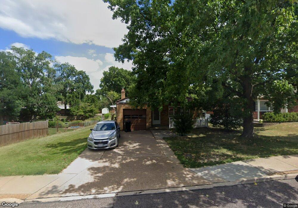
8450 S Laclede Station Rd Saint Louis, MO 63123
Estimated Value: $200,000 - $238,000
2
Beds
2
Baths
945
Sq Ft
$228/Sq Ft
Est. Value
About This Home
This home is located at 8450 S Laclede Station Rd, Saint Louis, MO 63123 and is currently estimated at $215,576, approximately $228 per square foot. 8450 S Laclede Station Rd is a home located in St. Louis County with nearby schools including Mesnier Primary School, Gotsch Intermediate School, and Rogers Middle School.
Ownership History
Date
Name
Owned For
Owner Type
Purchase Details
Closed on
Jan 30, 1998
Sold by
Conrad Phillip A and Conrad Geraldine V
Bought by
Boettinger Robert M and Boettinger Betty Sue
Current Estimated Value
Home Financials for this Owner
Home Financials are based on the most recent Mortgage that was taken out on this home.
Original Mortgage
$35,000
Interest Rate
6.98%
Create a Home Valuation Report for This Property
The Home Valuation Report is an in-depth analysis detailing your home's value as well as a comparison with similar homes in the area
Home Values in the Area
Average Home Value in this Area
Purchase History
| Date | Buyer | Sale Price | Title Company |
|---|---|---|---|
| Boettinger Robert M | -- | -- |
Source: Public Records
Mortgage History
| Date | Status | Borrower | Loan Amount |
|---|---|---|---|
| Previous Owner | Boettinger Robert M | $35,000 |
Source: Public Records
Tax History Compared to Growth
Tax History
| Year | Tax Paid | Tax Assessment Tax Assessment Total Assessment is a certain percentage of the fair market value that is determined by local assessors to be the total taxable value of land and additions on the property. | Land | Improvement |
|---|---|---|---|---|
| 2025 | $2,261 | $28,010 | $15,070 | $12,940 |
| 2024 | $2,261 | $27,770 | $9,040 | $18,730 |
| 2023 | $2,261 | $29,980 | $9,040 | $20,940 |
| 2022 | $2,166 | $25,070 | $11,310 | $13,760 |
| 2021 | $2,117 | $25,070 | $11,310 | $13,760 |
| 2020 | $1,960 | $21,640 | $8,910 | $12,730 |
| 2019 | $1,944 | $21,640 | $8,910 | $12,730 |
| 2018 | $1,854 | $18,240 | $7,540 | $10,700 |
| 2017 | $1,843 | $18,240 | $7,540 | $10,700 |
| 2016 | $1,721 | $18,100 | $8,280 | $9,820 |
| 2015 | $1,726 | $18,100 | $8,280 | $9,820 |
| 2014 | $2,255 | $23,630 | $5,070 | $18,560 |
Source: Public Records
Map
Nearby Homes
- 8415 Rockhaven Ln
- 8405 Rockhaven Ln
- 7123 Craighill Dr
- 7243 General Sherman Ln
- 8215 General Sheridan Ln
- 8853 Raleigh Dr
- 7424 Granbury Cir
- 8613 Carriage Way Dr
- 7625 General Meade Ln
- 7452 Rockwood Dr
- 7101 Fernbrook Dr
- 7369 Whitehaven Dr
- 8875 Rock Forest Dr
- 9008 Fernald Dr
- 1405 Culverhill Dr
- 8261 Watson Rd
- 8400 New Hampshire Ave
- 7636 Fort Henry Dr
- 8736 New Hampshire Ave
- 6540 Lawnside Dr
- 8454 S Laclede Station Rd
- 7240 Rockspring Dr
- 7219 Stafford Ct
- 7244 Rockspring Dr
- 7236 Rockspring Dr
- 7215 Stafford Ct
- 7215 Stafford Ct Unit A
- 7232 Rockspring Dr
- 7226 Stafford Ct
- 7211 Stafford Ct
- 7228 Rockspring Dr
- 8445 S Laclede Station Rd
- 8443 S Laclede Station Rd
- 8510 S Laclede Station Rd
- 8441 S Laclede Station Rd
- 7224 Rockspring Dr
- 7222 Stafford Ct
- 7301 Forest Haven Estate
- 7239 Rockspring Dr
- 7243 Rockspring Dr