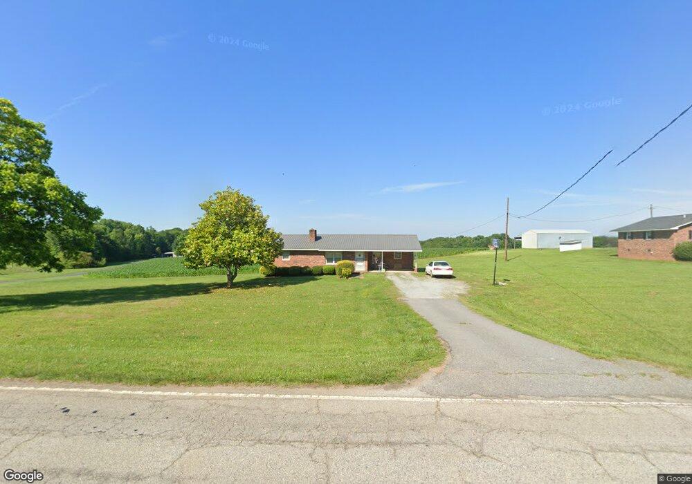
8461 Parris Bridge Rd Chesnee, SC 29323
Estimated Value: $141,000 - $258,000
3
Beds
1
Bath
1,121
Sq Ft
$170/Sq Ft
Est. Value
About This Home
This home is located at 8461 Parris Bridge Rd, Chesnee, SC 29323 and is currently estimated at $190,121, approximately $169 per square foot. 8461 Parris Bridge Rd is a home located in Spartanburg County with nearby schools including Chesnee Middle School and Chesnee High School.
Ownership History
Date
Name
Owned For
Owner Type
Purchase Details
Closed on
Oct 20, 2025
Sold by
Thompson Guynell
Bought by
Hollifield Connie M and Hollifield Kevin N
Current Estimated Value
Purchase Details
Closed on
Apr 11, 2024
Sold by
Thompson Bobby T
Bought by
Thompson Guynell
Purchase Details
Closed on
Feb 22, 2024
Sold by
Thompson Bobby T
Bought by
Thompson Guynell C
Purchase Details
Closed on
Sep 27, 2007
Sold by
Thompson Bobby T and Thompson Guynell
Bought by
Hollifield Kevin N and Hollifield Connie M
Purchase Details
Closed on
Oct 28, 2003
Sold by
Thompson Billy Joe
Bought by
Hollifield Kevin N and Hollifield Connie M
Create a Home Valuation Report for This Property
The Home Valuation Report is an in-depth analysis detailing your home's value as well as a comparison with similar homes in the area
Home Values in the Area
Average Home Value in this Area
Purchase History
| Date | Buyer | Sale Price | Title Company |
|---|---|---|---|
| Hollifield Connie M | -- | None Listed On Document | |
| Thompson Guynell | -- | None Listed On Document | |
| Thompson Guynell C | -- | None Listed On Document | |
| Hollifield Kevin N | -- | None Available | |
| Hollifield Kevin N | $50,000 | -- |
Source: Public Records
Tax History Compared to Growth
Tax History
| Year | Tax Paid | Tax Assessment Tax Assessment Total Assessment is a certain percentage of the fair market value that is determined by local assessors to be the total taxable value of land and additions on the property. | Land | Improvement |
|---|---|---|---|---|
| 2025 | $2,447 | $6,882 | $528 | $6,354 |
| 2024 | $2,447 | $6,882 | $528 | $6,354 |
| 2023 | $2,447 | $5,864 | $450 | $5,414 |
| 2022 | $1,916 | $5,100 | $356 | $4,744 |
| 2021 | $1,916 | $5,100 | $356 | $4,744 |
| 2020 | $1,899 | $5,100 | $356 | $4,744 |
| 2019 | $1,899 | $5,100 | $356 | $4,744 |
| 2018 | $1,848 | $5,100 | $356 | $4,744 |
| 2017 | $1,577 | $4,295 | $343 | $3,952 |
| 2016 | $1,577 | $4,295 | $343 | $3,952 |
| 2015 | $1,572 | $4,295 | $343 | $3,952 |
| 2014 | $1,567 | $4,295 | $343 | $3,952 |
Source: Public Records
Map
Nearby Homes
- 202 Arrowood Branch Rd
- 291 Robbins Rd
- 0 State Road S-42-1879
- 537 State Road S-42-1879
- 0 Cantrell Dr
- 545 State Road S-42-1879
- 553 State Road S-42-1879
- 557 State Road S-42-1879
- 561 State Road S-42-1879
- 565 State Road S-42-1879
- 569 State Road S-42-1879
- 73 Pond View Ln Unit 66
- 73 Pond View Ln
- 333 Mcswain Rd
- 140 Manor House Ln
- 1543 Highway 11 W
- 107 Brooklyn Church Rd
- 00 Petite Ct
- 0 Big Island Rd Unit 23524113
- 4086 Big Island Rd
- 8454 Parris Bridge Rd
- 8469 Parris Bridge Rd
- 8499 Parris Bridge Rd
- 8507 Parris Bridge Rd
- 8408 Parris Bridge Rd
- 8385 Parris Bridge Rd
- 8455 Parris Bridge Rd
- 8531 Parris Bridge Rd
- 8410 Parris Bridge Rd
- 8520 Parris Bridge Rd
- 8569 Parris Bridge Rd
- 8510 Parris Bridge Rd
- 8536 Parris Bridge Rd
- 149 Harris Rd
- 197 Harris Rd
- 333 Jeremiah Rd
- 193 Harris Rd
- 8589 Parris Bridge Rd
- 510 Arrowood Branch Rd
- 8227 Parris Bridge Rd