Estimated Value: $888,000 - $1,034,000
5
Beds
4
Baths
4,111
Sq Ft
$228/Sq Ft
Est. Value
About This Home
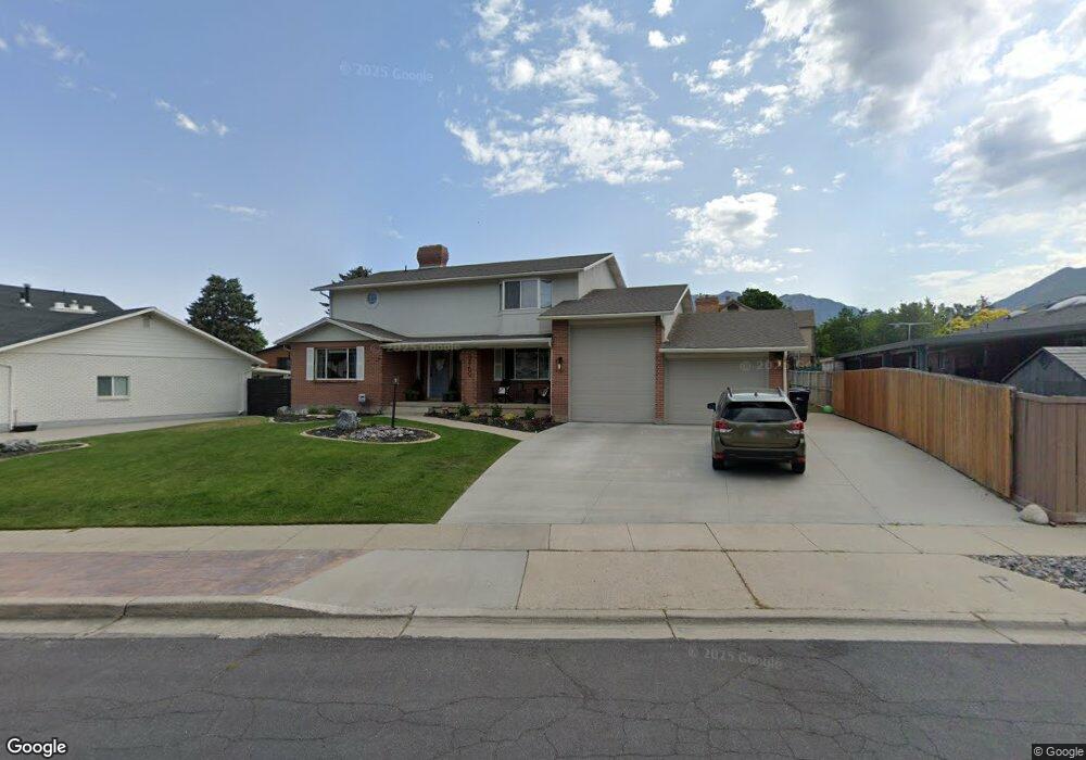
This home is located at 8469 S Jardim Way, Sandy, UT 84093 and is currently estimated at $939,125, approximately $228 per square foot. 8469 S Jardim Way is a home located in Salt Lake County with nearby schools including Oakdale School, Albion Middle School, and Hillcrest High School.
Ownership History
Date
Name
Owned For
Owner Type
Purchase Details
Closed on
Jun 9, 2022
Sold by
Johnson Michael E and Johnson Staci D
Bought by
Randall Bradley S
Current Estimated Value
Home Financials for this Owner
Home Financials are based on the most recent Mortgage that was taken out on this home.
Original Mortgage
$704,000
Outstanding Balance
$664,072
Interest Rate
4.5%
Mortgage Type
New Conventional
Estimated Equity
$275,053
Purchase Details
Closed on
Nov 8, 1996
Sold by
Dhoon Quresh G and Dhoon Lubena Q
Bought by
Johnson Michael E and Johnson Staci D
Home Financials for this Owner
Home Financials are based on the most recent Mortgage that was taken out on this home.
Original Mortgage
$176,500
Interest Rate
8.14%
Mortgage Type
Seller Take Back
Create a Home Valuation Report for This Property
The Home Valuation Report is an in-depth analysis detailing your home's value as well as a comparison with similar homes in the area
Home Values in the Area
Average Home Value in this Area
Purchase History
| Date | Buyer | Sale Price | Title Company |
|---|---|---|---|
| Randall Bradley S | -- | Old Republic Title | |
| Randall Bradley S | -- | Old Republic Title | |
| Johnson Michael E | -- | Superior Title Company | |
| Johnson Michael E | -- | Superior Title Company |
Source: Public Records
Mortgage History
| Date | Status | Borrower | Loan Amount |
|---|---|---|---|
| Open | Randall Bradley S | $704,000 | |
| Previous Owner | Johnson Michael E | $176,500 |
Source: Public Records
Tax History
| Year | Tax Paid | Tax Assessment Tax Assessment Total Assessment is a certain percentage of the fair market value that is determined by local assessors to be the total taxable value of land and additions on the property. | Land | Improvement |
|---|---|---|---|---|
| 2025 | $4,540 | $878,300 | $304,500 | $573,800 |
| 2024 | $4,540 | $850,900 | $293,200 | $557,700 |
| 2023 | $4,295 | $803,600 | $281,900 | $521,700 |
| 2022 | $3,818 | $702,800 | $276,400 | $426,400 |
| 2021 | $3,523 | $530,100 | $215,200 | $314,900 |
| 2020 | $3,239 | $470,100 | $215,200 | $254,900 |
| 2019 | $2,725 | $393,200 | $203,000 | $190,200 |
| 2016 | $2,142 | $298,900 | $182,900 | $116,000 |
Source: Public Records
Map
Nearby Homes
- 1990 E Terra Vista Way
- 1924 E Viscounti Cove
- 8483 S Terrace Dr
- 1780 Julho St
- 8638 Piper Ln
- 2152 E Creek Rd
- 1627 E Mulberry Way
- 8266 S Creek Hollow Cove
- 8921 S Shady Meadow Dr
- 8360 El Manicero Way
- 2161 E Lorita Way
- 1430 E 8685 S
- 8122 S Willow Creek Cove
- 2238 Cottonwood Cove Ln
- 8857 S Capella Way
- 8546 S 1330 E
- 9078 S Daybreak Dr
- 8142 S Newbury Grove Ln
- 2156 E Falcon Way
- 1482 Waters Ln
- 8469 Jardim Way
- 1941 Jardim Cir
- 1941 E Jardim Cir
- 8455 Jardim Way
- 8455 S Jardim Way
- 1947 Jardim Cir
- 8474 S Jardim Way
- 8474 Jardim Way
- 1924 Rua Branco Dr
- 1934 Rua Branco Dr
- 8484 Jardim Way
- 8484 S Jardim Way
- 8466 S Jardim Way
- 8466 Jardim Way
- 8435 Jardim Way
- 1944 Rua Branco Dr
- 1944 E Rua Branco Dr
- 1942 Jardim Cir
- 8458 Jardim Way
- 1951 Jardim Cir
Your Personal Tour Guide
Ask me questions while you tour the home.