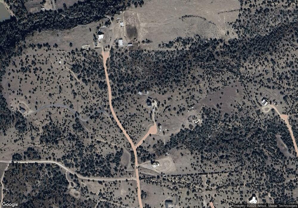
8469 Savage Rd Beulah, CO 81023
Estimated Value: $427,000 - $460,000
3
Beds
3
Baths
2,360
Sq Ft
$189/Sq Ft
Est. Value
About This Home
This home is located at 8469 Savage Rd, Beulah, CO 81023 and is currently estimated at $446,895, approximately $189 per square foot. 8469 Savage Rd is a home located in Pueblo County with nearby schools including Beulah Elementary School, Beulah Middle School, and Rye High School.
Ownership History
Date
Name
Owned For
Owner Type
Purchase Details
Closed on
Oct 30, 2024
Sold by
Rebernik Ray F
Bought by
Landis Rick Dale and Landis Leeanna Jean
Current Estimated Value
Home Financials for this Owner
Home Financials are based on the most recent Mortgage that was taken out on this home.
Original Mortgage
$2,387
Outstanding Balance
$2,038
Interest Rate
6.09%
Mortgage Type
New Conventional
Estimated Equity
$444,857
Purchase Details
Closed on
Sep 19, 2024
Sold by
Pueblo County Treasurer
Bought by
Housman Bob
Home Financials for this Owner
Home Financials are based on the most recent Mortgage that was taken out on this home.
Original Mortgage
$2,387
Outstanding Balance
$2,038
Interest Rate
6.09%
Mortgage Type
New Conventional
Estimated Equity
$444,857
Purchase Details
Closed on
Aug 30, 2010
Sold by
Maldonado Karl
Bought by
Rebernik Ray F and Rebernik Elke
Create a Home Valuation Report for This Property
The Home Valuation Report is an in-depth analysis detailing your home's value as well as a comparison with similar homes in the area
Home Values in the Area
Average Home Value in this Area
Purchase History
| Date | Buyer | Sale Price | Title Company |
|---|---|---|---|
| Landis Rick Dale | $348,000 | Fntc | |
| Landis Rick Dale | $348,000 | Fntc | |
| Housman Bob | -- | None Listed On Document | |
| Housman Bob | -- | None Listed On Document | |
| Rebernik Ray F | $185,000 | Heritage Title |
Source: Public Records
Mortgage History
| Date | Status | Borrower | Loan Amount |
|---|---|---|---|
| Open | Landis Rick Dale | $2,387 | |
| Closed | Landis Rick Dale | $2,387 |
Source: Public Records
Tax History Compared to Growth
Tax History
| Year | Tax Paid | Tax Assessment Tax Assessment Total Assessment is a certain percentage of the fair market value that is determined by local assessors to be the total taxable value of land and additions on the property. | Land | Improvement |
|---|---|---|---|---|
| 2024 | $1,712 | $21,570 | -- | -- |
| 2023 | $1,735 | $25,260 | $5,000 | $20,260 |
| 2022 | $1,663 | $20,996 | $3,390 | $17,606 |
| 2021 | $1,704 | $21,600 | $3,490 | $18,110 |
| 2020 | $1,637 | $20,710 | $3,220 | $17,490 |
| 2019 | $1,632 | $20,708 | $3,218 | $17,490 |
| 2018 | $1,504 | $19,090 | $3,240 | $15,850 |
| 2017 | $1,507 | $19,090 | $3,240 | $15,850 |
| 2016 | $1,445 | $18,344 | $3,582 | $14,762 |
| 2015 | $718 | $18,344 | $3,582 | $14,762 |
| 2014 | $697 | $17,859 | $3,582 | $14,277 |
Source: Public Records
Map
Nearby Homes
- 8719 Ponderosa Pine Dr
- Tbd Savage Rd
- 0 Old Homestead Ln Unit REC3441764
- TBD Old Homestead Ln
- 0 Old Homestead Ln Unit 3818209
- 8716 National Forest Dr
- 8718 Ponderosa Pine Dr
- 8782 Vaughn View Dr
- 2915 Siloam Rd
- TBD Hart Ranch Rd
- TBD Waterbarrel Rd
- 2200 Pope Valley Ranch Rd
- 5207 Northcreek Rd
- 8201 State Highway 78 W
- 3990 Northcreek Rd
- 2190 Pope Valley Ranch Rd
- 7787 State Hwy 78
- 8689 Douglas Ln
- Lot 24 Pope Valley Ranch Rd
- 1745 Pope Valley Ranch Rd
- 8463 Savage Rd
- 8463 Savage Rd Unit 12
- 8459 Savage Rd
- 8473 Savage Rd
- 8435 Savage Rd
- 8443 Savage Rd
- 8433 Savage Rd
- 8470 Savage Rd
- None Savage Rd
- 6 Owl Canyon Rd Unit 6
- 8429 Savage Rd
- 7887 Savage Rd
- 3 Owl Canyon Rd Unit 3
- 8411 Savage Rd
- 8484 Ponderosa Pine Dr
- Lot 17 Savage Rd
- TBD Owl Canyon Rd Unit 6
- Lot 17 Savage Rd
- 8395 Savage Rd
- 17 Ponderosa Pine Dr Unit 17
