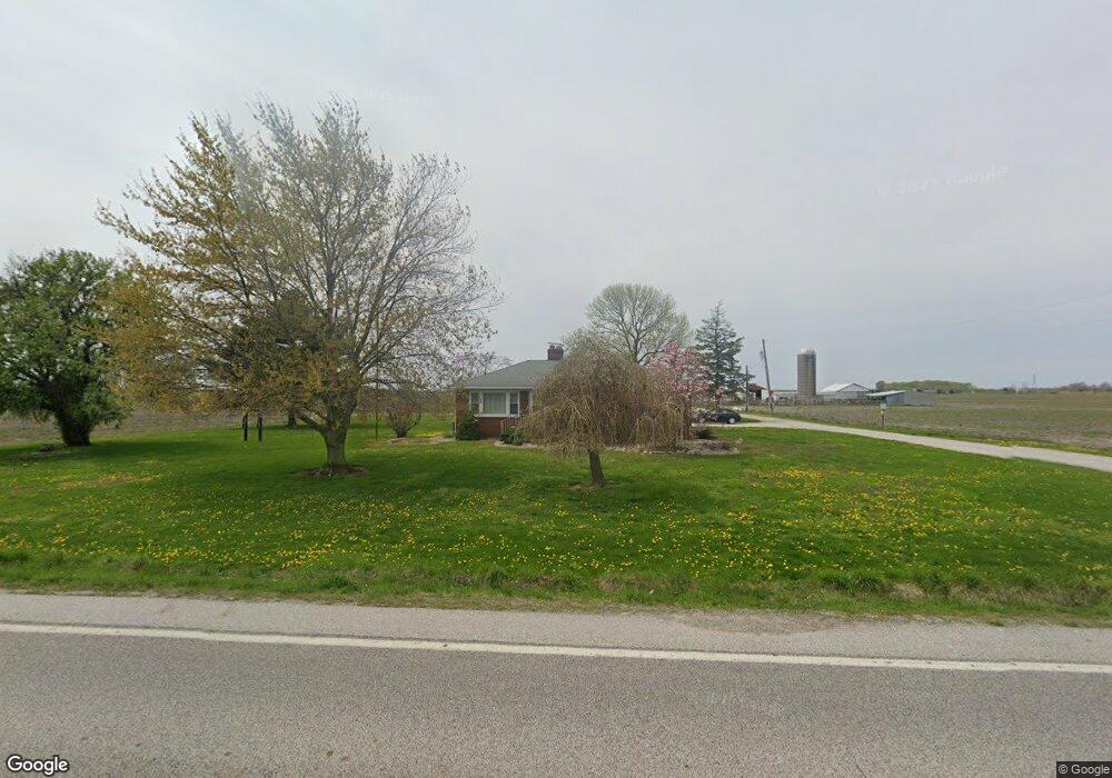
8473 State Route 4 Staunton, IL 62088
Estimated Value: $139,693 - $461,000
4
Beds
1
Bath
1,224
Sq Ft
$218/Sq Ft
Est. Value
About This Home
This home is located at 8473 State Route 4, Staunton, IL 62088 and is currently estimated at $267,423, approximately $218 per square foot. 8473 State Route 4 is a home located in Madison County with nearby schools including Staunton Elementary School, Staunton Junior High School, and Staunton High School.
Ownership History
Date
Name
Owned For
Owner Type
Purchase Details
Closed on
Feb 25, 2021
Sold by
Wall Alice A and Henke Donna Lee
Bought by
Sievers Family Lp
Current Estimated Value
Home Financials for this Owner
Home Financials are based on the most recent Mortgage that was taken out on this home.
Original Mortgage
$1,592,000
Interest Rate
3%
Mortgage Type
Commercial
Purchase Details
Closed on
Nov 22, 2019
Sold by
Brown Karen S
Bought by
Brown Trust
Create a Home Valuation Report for This Property
The Home Valuation Report is an in-depth analysis detailing your home's value as well as a comparison with similar homes in the area
Home Values in the Area
Average Home Value in this Area
Purchase History
| Date | Buyer | Sale Price | Title Company |
|---|---|---|---|
| Sievers Family Lp | $1,114,500 | Community Title & Escrow | |
| Brown Trust | -- | None Available |
Source: Public Records
Mortgage History
| Date | Status | Borrower | Loan Amount |
|---|---|---|---|
| Previous Owner | Sievers Family Lp | $1,592,000 |
Source: Public Records
Tax History Compared to Growth
Tax History
| Year | Tax Paid | Tax Assessment Tax Assessment Total Assessment is a certain percentage of the fair market value that is determined by local assessors to be the total taxable value of land and additions on the property. | Land | Improvement |
|---|---|---|---|---|
| 2024 | $2,621 | $43,580 | $6,770 | $36,810 |
| 2023 | $2,621 | $40,230 | $6,250 | $33,980 |
| 2022 | $2,257 | $39,750 | $6,180 | $33,570 |
| 2021 | $2,074 | $36,620 | $5,900 | $30,720 |
| 2020 | $2,070 | $35,380 | $5,700 | $29,680 |
| 2019 | $1,967 | $33,280 | $5,360 | $27,920 |
| 2018 | $1,932 | $29,800 | $4,800 | $25,000 |
| 2017 | $1,897 | $30,120 | $4,850 | $25,270 |
| 2016 | $1,909 | $30,120 | $4,850 | $25,270 |
| 2015 | $1,159 | $29,190 | $4,700 | $24,490 |
| 2014 | $1,159 | $29,190 | $4,700 | $24,490 |
| 2013 | $1,159 | $29,520 | $4,750 | $24,770 |
Source: Public Records
Map
Nearby Homes
- 8221 State Route 4
- 7882 State Route 4
- 200 Spangle Rd W
- 650 Sarah St
- 0 Possum Hill Rd Unit MIS25066264
- 9007 Wieseman Rd
- 9455 Renken Rd
- 479 School St
- 481 Park St
- 9479 Schaefer Rd
- 427 E Donnewald St
- 18415 Oxford Rd
- Outer Lot Oxford Rd
- 995 Alicia Way
- 1105 Jefferson Ave
- 402 Mckinley St
- 524 N Shirley St
- 1545 Kathleen Dr
- 307 Sandbach St
- 329 Rutledge St