
Seller's Agent in 2026
Cindy Randall
Koerner Realty
(937) 408-1064
61 Total Sales
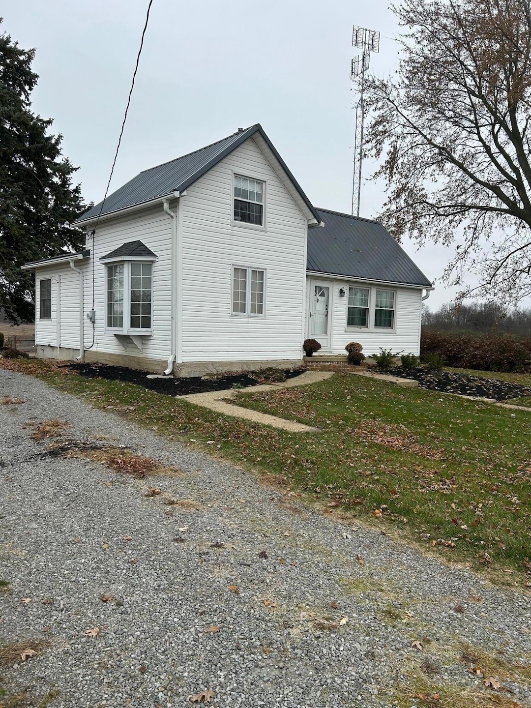
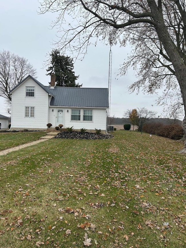
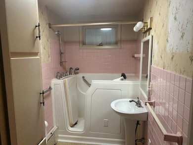
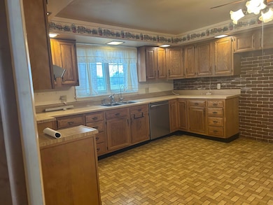
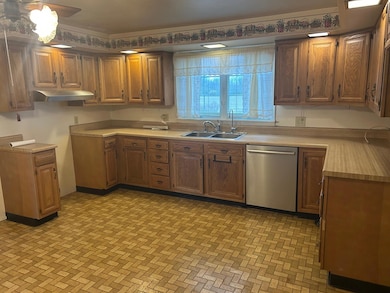
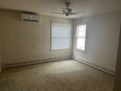
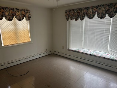
This 3 Bedroom Farmhouse has much potential with some personal taste of the new owners. There is a newer Split heating and air system in most rooms. Replacement windows. Newer Metal Roof. 2 Bedrooms downstairs, 1 Full bath downstairs as well. Large kitchen. Back room has a woodburning fireplace that can be used for a Den or study and overlooks the brick courtyard in back. Tankless hot water heater. Updated electric to house and also electric in 30x24 garage. Mature trees. Turn around drive. Some wood floors. No showings until November 28th.
Last Agent to Sell the Property
Koerner Realty License #000261917 Listed on: 11/25/2025
| Date | Type | Sale Price | Title Company |
|---|---|---|---|
| Deed | $247,000 | Team Title | |
| Warranty Deed | -- | None Listed On Document | |
| Warranty Deed | -- | None Listed On Document |
| Date | Status | Loan Amount | Loan Type |
|---|---|---|---|
| Open | $167,000 | New Conventional |
| Date | Event | Price | List to Sale | Price per Sq Ft | Prior Sale |
|---|---|---|---|---|---|
| 01/16/2026 01/16/26 | Sold | $247,000 | -5.0% | $230 / Sq Ft | |
| 11/25/2025 11/25/25 | For Sale | $260,000 | -90.4% | $242 / Sq Ft | |
| 06/30/2024 06/30/24 | Price Changed | $2,700,000 | -5.3% | $2,509 / Sq Ft | |
| 06/28/2024 06/28/24 | Sold | $2,850,000 | +90.0% | $2,649 / Sq Ft | View Prior Sale |
| 05/28/2024 05/28/24 | Pending | -- | -- | -- | |
| 03/21/2024 03/21/24 | For Sale | $1,500,000 | -- | $1,394 / Sq Ft |
| Year | Tax Paid | Tax Assessment Tax Assessment Total Assessment is a certain percentage of the fair market value that is determined by local assessors to be the total taxable value of land and additions on the property. | Land | Improvement |
|---|---|---|---|---|
| 2025 | $2,592 | $62,100 | $21,230 | $40,870 |
| 2024 | $2,592 | $38,150 | $11,510 | $26,640 |
| 2023 | $1,330 | $38,150 | $11,510 | $26,640 |
| 2022 | $2,676 | $239,030 | $212,390 | $26,640 |
| 2021 | $2,377 | $192,110 | $169,910 | $22,200 |
| 2020 | $2,303 | $192,110 | $169,910 | $22,200 |
| 2019 | $2,350 | $192,110 | $169,910 | $22,200 |
| 2018 | $2,990 | $134,100 | $119,980 | $14,120 |
| 2017 | $2,598 | $134,100 | $119,980 | $14,120 |
| 2016 | $2,579 | $134,100 | $119,980 | $14,120 |
| 2015 | $2,386 | $123,160 | $109,590 | $13,570 |
| 2014 | $2,410 | $123,160 | $109,590 | $13,570 |
| 2013 | $2,451 | $123,160 | $109,590 | $13,570 |
Seller's Agent in 2026
Cindy Randall
Koerner Realty
(937) 408-1064
61 Total Sales
Buyer's Agent in 2026
Kyle Springs
Zimmerman Realty Ltd.
(937) 935-9797
145 Total Sales
Seller's Agent in 2024
Bart Sheridan
Sheridans LLC
(937) 902-8066
108 Total Sales
Source: Western Regional Information Systems & Technology (WRIST)
MLS Number: 1042701
APN: A01-01-12-06-00-009-00
Disclaimer: Certain information contained herein is derived from information provided by parties other than Homes.com. All information provided is deemed reliable, but is not guaranteed to be accurate and should be independently verified.
![]() IDX information is provided exclusively for personal, non-commercial use, and may not be used for any purpose other than to identify prospective properties consumers may be interested in purchasing.
IDX information is provided exclusively for personal, non-commercial use, and may not be used for any purpose other than to identify prospective properties consumers may be interested in purchasing.
Ask me questions while you tour the home.