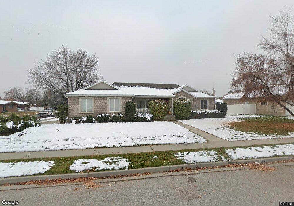
848 E 575 N American Fork, UT 84003
Estimated Value: $613,000 - $667,000
3
Beds
2
Baths
3,624
Sq Ft
$175/Sq Ft
Est. Value
About This Home
This home is located at 848 E 575 N, American Fork, UT 84003 and is currently estimated at $633,115, approximately $174 per square foot. 848 E 575 N is a home located in Utah County with nearby schools including Barratt Elementary School, American Fork Junior High School, and American Fork High School.
Ownership History
Date
Name
Owned For
Owner Type
Purchase Details
Closed on
May 7, 1997
Sold by
Heagy Scott A and Heagy Jacqueline B
Bought by
Miller Bruce W and Miller Janiel
Current Estimated Value
Home Financials for this Owner
Home Financials are based on the most recent Mortgage that was taken out on this home.
Original Mortgage
$156,000
Outstanding Balance
$21,644
Interest Rate
8.15%
Estimated Equity
$611,471
Create a Home Valuation Report for This Property
The Home Valuation Report is an in-depth analysis detailing your home's value as well as a comparison with similar homes in the area
Home Values in the Area
Average Home Value in this Area
Purchase History
| Date | Buyer | Sale Price | Title Company |
|---|---|---|---|
| Miller Bruce W | -- | -- |
Source: Public Records
Mortgage History
| Date | Status | Borrower | Loan Amount |
|---|---|---|---|
| Open | Miller Bruce W | $156,000 |
Source: Public Records
Tax History
| Year | Tax Paid | Tax Assessment Tax Assessment Total Assessment is a certain percentage of the fair market value that is determined by local assessors to be the total taxable value of land and additions on the property. | Land | Improvement |
|---|---|---|---|---|
| 2025 | $2,850 | $333,465 | -- | -- |
| 2024 | $2,850 | $316,635 | $0 | $0 |
| 2023 | $2,680 | $315,755 | $0 | $0 |
| 2022 | $2,727 | $316,965 | $0 | $0 |
| 2021 | $2,399 | $435,600 | $183,700 | $251,900 |
| 2020 | $2,328 | $410,000 | $170,100 | $239,900 |
| 2019 | $2,120 | $386,100 | $162,800 | $223,300 |
| 2018 | $1,865 | $324,800 | $126,700 | $198,100 |
| 2017 | $1,839 | $172,810 | $0 | $0 |
| 2016 | $1,931 | $168,630 | $0 | $0 |
| 2015 | $1,929 | $159,885 | $0 | $0 |
| 2014 | $1,761 | $143,935 | $0 | $0 |
Source: Public Records
Map
Nearby Homes
- 474 N 850 E
- 478 N 900 E Unit 15
- 912 E Ellens St Unit 1
- 462 N 950 E Unit 5
- 322 N 900 E
- 1121 E 580 N
- 410 N 600 E
- 649 N 1280 E
- 2421 Renaissance Ct
- 474 E 580 N
- 1045 N 930 E Unit 58
- 198 N 600 E
- 1058 N 930 E Unit 64
- 266 N 500 E
- 1089 N 950 E
- 610 N 300 E
- 16 N 700 E Unit 21
- 1977 N 1300 W
- 22 S 700 East St Unit 2
- 67 S 930 E
Your Personal Tour Guide
Ask me questions while you tour the home.