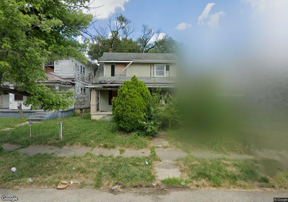
848 N Euclid Ave Dayton, OH 45402
Southern Dayton View NeighborhoodEstimated Value: $272,000
3
Beds
1
Bath
1,452
Sq Ft
$187/Sq Ft
Est. Value
About This Home
This home is located at 848 N Euclid Ave, Dayton, OH 45402 and is currently estimated at $272,000, approximately $187 per square foot. 848 N Euclid Ave is a home located in Montgomery County with nearby schools including International School at Residence Park, Westwood Elementary, and Louise Troy Elementary.
Ownership History
Date
Name
Owned For
Owner Type
Purchase Details
Closed on
Dec 29, 2000
Sold by
Davenport Arthur B
Bought by
Davenport Arthur B and Davenport Sherry
Current Estimated Value
Home Financials for this Owner
Home Financials are based on the most recent Mortgage that was taken out on this home.
Original Mortgage
$49,600
Outstanding Balance
$18,500
Interest Rate
7.69%
Mortgage Type
Purchase Money Mortgage
Estimated Equity
$253,500
Purchase Details
Closed on
Nov 4, 1993
Sold by
Jewitt Bennie
Bought by
Davenport Arthur B
Create a Home Valuation Report for This Property
The Home Valuation Report is an in-depth analysis detailing your home's value as well as a comparison with similar homes in the area
Home Values in the Area
Average Home Value in this Area
Purchase History
| Date | Buyer | Sale Price | Title Company |
|---|---|---|---|
| Davenport Arthur B | -- | -- | |
| Davenport Arthur B | -- | -- |
Source: Public Records
Mortgage History
| Date | Status | Borrower | Loan Amount |
|---|---|---|---|
| Open | Davenport Arthur B | $49,600 |
Source: Public Records
Tax History Compared to Growth
Tax History
| Year | Tax Paid | Tax Assessment Tax Assessment Total Assessment is a certain percentage of the fair market value that is determined by local assessors to be the total taxable value of land and additions on the property. | Land | Improvement |
|---|---|---|---|---|
| 2024 | $666 | $2,310 | $2,310 | -- |
| 2023 | $666 | $11,590 | $2,310 | $9,280 |
| 2022 | $1,799 | $11,590 | $2,310 | $9,280 |
| 2021 | $1,086 | $11,590 | $2,310 | $9,280 |
| 2020 | $825 | $11,590 | $2,310 | $9,280 |
| 2019 | $638 | $4,920 | $2,940 | $1,980 |
| 2018 | $423 | $4,920 | $2,940 | $1,980 |
| 2017 | $657 | $4,920 | $2,940 | $1,980 |
| 2016 | $505 | $5,720 | $3,290 | $2,430 |
| 2015 | $786 | $5,720 | $3,290 | $2,430 |
| 2014 | $786 | $5,720 | $3,290 | $2,430 |
| 2012 | -- | $12,910 | $3,300 | $9,610 |
Source: Public Records
Map
Nearby Homes
- 1215 Superior Ave Unit 1213
- 809 Faulkner Ave
- 721 Kumler Ave
- 817 Faulkner Ave
- 1401 Superior Ave
- 924 Catalpa Dr
- 1606 W Grand Ave
- 928 Dustin St
- 1407 W Grand Ave
- 1524 Superior Ave
- 403 Lexington Ave
- 518 Oxford Ave
- 230 Oxford Ave Unit 228
- 408 N Conover St
- 945 N Broadway St
- 1231 N Euclid Ave
- 1234 Kumler Ave
- 1044 W Grand Ave
- 601 Cambridge Ave
- 1112 Windsor Ave Unit 1110
- 852 N Euclid Ave
- 844 N Euclid Ave
- 856 N Euclid Ave
- 860 N Euclid Ave
- 836 N Euclid Ave
- 864 N Euclid Ave
- 832 N Euclid Ave
- 847 Saint Agnes Ave
- 861 Saint Agnes Ave
- 841 N Euclid Ave
- 843 Saint Agnes Ave
- 849 N Euclid Ave
- 839 N Euclid Ave
- 865 Saint Agnes Ave
- 868 N Euclid Ave
- 826 N Euclid Ave
- 851 N Euclid Ave
- 835 N Euclid Ave
- 837 Saint Agnes Ave
- 855 N Euclid Ave