J
Seller's Agent in 2012
Jerry Payne
Sanders & Company
(217) 549-4058
7 in this area
27 Total Sales
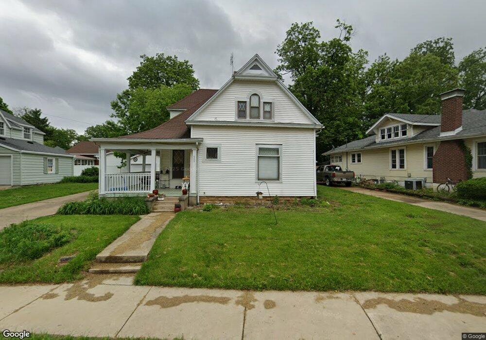

Estimated Value: $164,000 - $187,000
Motivated sellers relocating, 4 bedroom 2 bath house in a great neighborhood, walking distance to 4 of the 5 Charleston schools. This home was built in 1901, but has been kept in amazing condition. New roof 2011, flooring, countertops and appliances between 2008 and 2010. Heating and cooling system just a few years old. Has a hot tub which stays. New carpet and paint. You will enjoy the huge screened in front porch. Great for reading, playing games, or relaxing in the warm days of spring and summer. The porch also has ceiling fans and outlets for convenience. This and more makes this home amazing
Last Agent to Sell the Property
Sanders & Company License #475129109 Listed on: 02/24/2012
| Date | Buyer | Sale Price | Title Company |
|---|---|---|---|
| Skinner Preston | $86,000 | None Listed On Document | |
| Gioia Michael | $105,000 | Coles County Title L L C |
| Date | Status | Borrower | Loan Amount |
|---|---|---|---|
| Open | Skinner Preston | $122,550 | |
| Previous Owner | Gioia Michael | $108,465 |
| Date | Event | Price | List to Sale | Price per Sq Ft |
|---|---|---|---|---|
| 07/27/2012 07/27/12 | Sold | $105,000 | 0.0% | $51 / Sq Ft |
| 06/14/2012 06/14/12 | Pending | -- | -- | -- |
| 02/24/2012 02/24/12 | For Sale | $105,000 | -- | $51 / Sq Ft |
| Year | Tax Paid | Tax Assessment Tax Assessment Total Assessment is a certain percentage of the fair market value that is determined by local assessors to be the total taxable value of land and additions on the property. | Land | Improvement |
|---|---|---|---|---|
| 2024 | $3,370 | $49,432 | $3,142 | $46,290 |
| 2023 | $3,274 | $45,143 | $2,869 | $42,274 |
| 2022 | $3,274 | $44,398 | $2,822 | $41,576 |
| 2021 | $2,970 | $38,188 | $2,708 | $35,480 |
| 2020 | $3,017 | $39,566 | $4,688 | $34,878 |
| 2019 | $2,949 | $38,188 | $4,525 | $33,663 |
| 2018 | $2,917 | $38,188 | $4,525 | $33,663 |
| 2017 | $2,879 | $38,188 | $4,525 | $33,663 |
| 2016 | $2,854 | $38,188 | $4,525 | $33,663 |
| 2015 | $2,947 | $38,188 | $4,525 | $33,663 |
| 2014 | $2,947 | $38,188 | $4,525 | $33,663 |
| 2013 | $2,947 | $38,188 | $4,525 | $33,663 |
J
Seller's Agent in 2012
Jerry Payne
Sanders & Company
(217) 549-4058
7 in this area
27 Total Sales
Source: Central Illinois Board of REALTORS®
MLS Number: 4214976
APN: 02-1-06220-000
Ask me questions while you tour the home.
