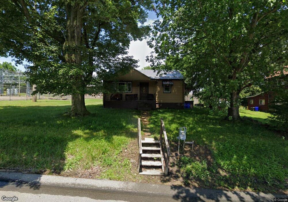
849 Frank Ave New Castle, PA 16101
Estimated Value: $67,000 - $85,000
2
Beds
1
Bath
768
Sq Ft
$102/Sq Ft
Est. Value
About This Home
This home is located at 849 Frank Ave, New Castle, PA 16101 and is currently estimated at $77,959, approximately $101 per square foot. 849 Frank Ave is a home located in Lawrence County with nearby schools including New Castle Junior/Senior High School, St. Vitus School, and Wesleyan Methodist Academy.
Ownership History
Date
Name
Owned For
Owner Type
Purchase Details
Closed on
Jun 27, 2011
Sold by
Gibson Roger J
Bought by
Corcoran John P
Current Estimated Value
Home Financials for this Owner
Home Financials are based on the most recent Mortgage that was taken out on this home.
Original Mortgage
$34,794
Outstanding Balance
$24,340
Interest Rate
4.87%
Mortgage Type
FHA
Estimated Equity
$53,619
Create a Home Valuation Report for This Property
The Home Valuation Report is an in-depth analysis detailing your home's value as well as a comparison with similar homes in the area
Home Values in the Area
Average Home Value in this Area
Purchase History
| Date | Buyer | Sale Price | Title Company |
|---|---|---|---|
| Corcoran John P | $18,250 | None Available |
Source: Public Records
Mortgage History
| Date | Status | Borrower | Loan Amount |
|---|---|---|---|
| Open | Corcoran John P | $34,794 |
Source: Public Records
Tax History Compared to Growth
Tax History
| Year | Tax Paid | Tax Assessment Tax Assessment Total Assessment is a certain percentage of the fair market value that is determined by local assessors to be the total taxable value of land and additions on the property. | Land | Improvement |
|---|---|---|---|---|
| 2025 | $1,424 | $33,700 | $7,200 | $26,500 |
| 2024 | $1,404 | $33,700 | $7,200 | $26,500 |
| 2023 | $1,404 | $33,700 | $7,200 | $26,500 |
| 2022 | $1,404 | $33,700 | $7,200 | $26,500 |
| 2021 | $1,360 | $33,700 | $7,200 | $26,500 |
| 2020 | $1,360 | $33,700 | $7,200 | $26,500 |
| 2019 | $1,326 | $33,700 | $7,200 | $26,500 |
| 2018 | $1,326 | $33,700 | $7,200 | $26,500 |
| 2017 | $1,298 | $33,700 | $7,200 | $26,500 |
| 2016 | $619 | $33,700 | $7,200 | $26,500 |
| 2015 | $619 | $33,700 | $7,200 | $26,500 |
| 2014 | $619 | $33,700 | $7,200 | $26,500 |
Source: Public Records
Map
Nearby Homes
- 1815 E Washington St
- 911 Hazel St
- 1605 E Washington St
- 0 Ellwood Rd Unit LotWP001 22906327
- 0 Ellwood Rd
- 919 Warren Ave
- 1505 Thorpe St
- 1415 E Washington St
- 819 Addis St
- 0 Gretchen Ave
- 848 Arlington Ave
- 925 Rose Ave
- 938 Adams St
- 1510 Jackson Ave
- 1229 Huron Ave
- 2001 Tony St
- 1810 Tony St
- 1049 Adams St
- 1062 Adams St
- 726 Arlington Ave
- 851 Frank Ave
- 853 Frank Ave
- 1806 E Washington St
- 1804 E Washington St
- 1808 E Washington St
- 854 Vogan St
- 856 Vogan St
- 1812 E Washington St
- 845 Frank Ave
- 842 Vogan St
- 841 Frank Ave
- 840 Vogan St
- 1805 E Washington St
- 1801 E Washington St
- 1809 E Washington St
- 1811 E Washington St
- 1731 E Washington St
- 1733 E Washington St
- 1813 E Washington St
- 1724 E Washington St