Estimated Value: $360,012 - $397,000
--
Bed
--
Bath
1,714
Sq Ft
$226/Sq Ft
Est. Value
About This Home
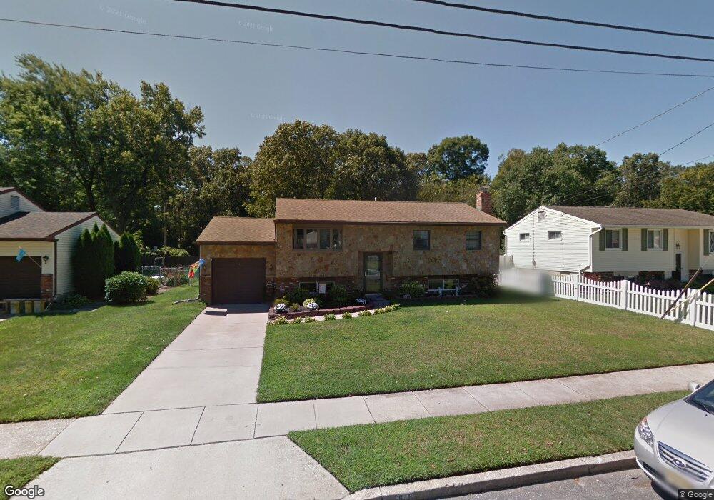
This home is located at 849 Lois Dr, Williamstown, NJ 08094 and is currently estimated at $386,753, approximately $225 per square foot. 849 Lois Dr is a home located in Gloucester County with nearby schools including Williamstown High School, St. Mary School, and Finest of the Wheat Christian.
Ownership History
Date
Name
Owned For
Owner Type
Purchase Details
Closed on
Jul 30, 2004
Sold by
Alexander William J and Alexander Marie A
Bought by
Tucker Scott F and Tucker Janet P
Current Estimated Value
Home Financials for this Owner
Home Financials are based on the most recent Mortgage that was taken out on this home.
Original Mortgage
$150,400
Outstanding Balance
$76,210
Interest Rate
6.33%
Mortgage Type
Purchase Money Mortgage
Estimated Equity
$310,543
Create a Home Valuation Report for This Property
The Home Valuation Report is an in-depth analysis detailing your home's value as well as a comparison with similar homes in the area
Home Values in the Area
Average Home Value in this Area
Purchase History
| Date | Buyer | Sale Price | Title Company |
|---|---|---|---|
| Tucker Scott F | $192,000 | Landis Title |
Source: Public Records
Mortgage History
| Date | Status | Borrower | Loan Amount |
|---|---|---|---|
| Open | Tucker Scott F | $150,400 |
Source: Public Records
Tax History Compared to Growth
Tax History
| Year | Tax Paid | Tax Assessment Tax Assessment Total Assessment is a certain percentage of the fair market value that is determined by local assessors to be the total taxable value of land and additions on the property. | Land | Improvement |
|---|---|---|---|---|
| 2025 | $6,149 | $167,900 | $56,500 | $111,400 |
| 2024 | $6,103 | $167,900 | $56,500 | $111,400 |
| 2023 | $6,103 | $167,900 | $56,500 | $111,400 |
| 2022 | $6,075 | $167,900 | $56,500 | $111,400 |
| 2021 | $6,113 | $167,900 | $56,500 | $111,400 |
| 2020 | $6,107 | $167,900 | $56,500 | $111,400 |
| 2019 | $6,070 | $167,900 | $56,500 | $111,400 |
| 2018 | $5,971 | $167,900 | $56,500 | $111,400 |
| 2017 | $6,018 | $169,900 | $57,200 | $112,700 |
| 2016 | $5,941 | $169,900 | $57,200 | $112,700 |
| 2015 | $5,772 | $169,900 | $57,200 | $112,700 |
| 2014 | $5,603 | $169,900 | $57,200 | $112,700 |
Source: Public Records
Map
Nearby Homes
- 24 W Lois Dr
- 1240 Glassboro Rd
- 109 Lindale Ave
- 1186 Glen Haven Ct
- 61 William Ave
- 128 Kerry Lynn Ct
- 758 N Tuckahoe Rd
- 136 Cora Ave
- 117 Cora Ave
- 208 Brandywine Dr
- 412 Aberdeen Rd
- 741 N Tuckahoe Rd
- 101 N Black Horse Pike
- 45 Sicklerville Rd
- 20 Maple Ave
- L. 5 N Black Horse Pike
- 1311 N Main St
- 17 Matthews St
- 505 Kirkwall Dr
- 1003 Baywood Dr