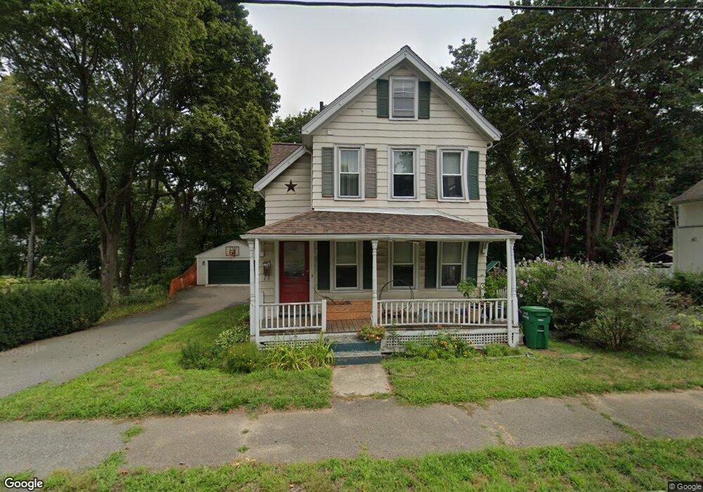
849 Main St Reading, MA 01867
Estimated Value: $790,034 - $898,000
3
Beds
2
Baths
1,539
Sq Ft
$550/Sq Ft
Est. Value
About This Home
This home is located at 849 Main St, Reading, MA 01867 and is currently estimated at $846,259, approximately $549 per square foot. 849 Main St is a home located in Middlesex County with nearby schools including Birch Meadow Elementary School, Arthur W. Coolidge Middle School, and Reading Memorial High School.
Ownership History
Date
Name
Owned For
Owner Type
Purchase Details
Closed on
May 2, 2007
Sold by
Burns Jessica M and Burns Thomas S
Bought by
Debenedictis Paul and Marcucci Stephanie
Current Estimated Value
Home Financials for this Owner
Home Financials are based on the most recent Mortgage that was taken out on this home.
Original Mortgage
$308,000
Interest Rate
6.23%
Mortgage Type
Purchase Money Mortgage
Purchase Details
Closed on
Jul 31, 1997
Sold by
Orourke Michael T and Orourke Gail M
Bought by
Atkinson Neil A and Bernard Tania L
Purchase Details
Closed on
Oct 2, 1995
Sold by
Lee Ft and Lee
Bought by
Orourke Michael T and Rourke Gail M
Create a Home Valuation Report for This Property
The Home Valuation Report is an in-depth analysis detailing your home's value as well as a comparison with similar homes in the area
Home Values in the Area
Average Home Value in this Area
Purchase History
| Date | Buyer | Sale Price | Title Company |
|---|---|---|---|
| Debenedictis Paul | $385,000 | -- | |
| Atkinson Neil A | $165,000 | -- | |
| Orourke Michael T | $163,500 | -- |
Source: Public Records
Mortgage History
| Date | Status | Borrower | Loan Amount |
|---|---|---|---|
| Open | Orourke Michael T | $378,310 | |
| Closed | Orourke Michael T | $381,562 | |
| Closed | Debenedictis Paul | $308,000 | |
| Previous Owner | Orourke Michael T | $100,000 |
Source: Public Records
Tax History
| Year | Tax Paid | Tax Assessment Tax Assessment Total Assessment is a certain percentage of the fair market value that is determined by local assessors to be the total taxable value of land and additions on the property. | Land | Improvement |
|---|---|---|---|---|
| 2025 | $7,689 | $675,100 | $366,300 | $308,800 |
| 2024 | $7,370 | $628,800 | $359,100 | $269,700 |
| 2023 | $7,072 | $561,700 | $320,300 | $241,400 |
| 2022 | $6,728 | $504,700 | $287,300 | $217,400 |
| 2021 | $6,311 | $457,000 | $249,500 | $207,500 |
| 2020 | $6,110 | $438,000 | $239,000 | $199,000 |
| 2019 | $7,642 | $417,200 | $227,500 | $189,700 |
| 2018 | $7,033 | $409,600 | $223,300 | $186,300 |
| 2017 | $5,402 | $385,000 | $209,700 | $175,300 |
| 2016 | $5,172 | $356,700 | $207,500 | $149,200 |
| 2015 | $4,998 | $340,000 | $197,600 | $142,400 |
| 2014 | $4,777 | $324,100 | $188,200 | $135,900 |
Source: Public Records
Map
Nearby Homes
- 863 Main St
- 35 Longfellow Rd
- 64 Longfellow Rd
- 52 Sanborn St Unit 7
- 89 Grand St
- 103 Orange St
- 41 Winter St
- 69 Ash St
- 48 Village St Unit 1001
- 24 Smith Ave
- 5 Washington St Unit D4
- 115 Forest St
- 3 Carnation Cir Unit C
- 237 Salem St Unit 2
- 43 Wakefield St
- 25 Wakefield St
- 43 Ashley Place
- 61 Beaver Rd
- 100 Prescott St
- 37 Fairchild Dr
Your Personal Tour Guide
Ask me questions while you tour the home.