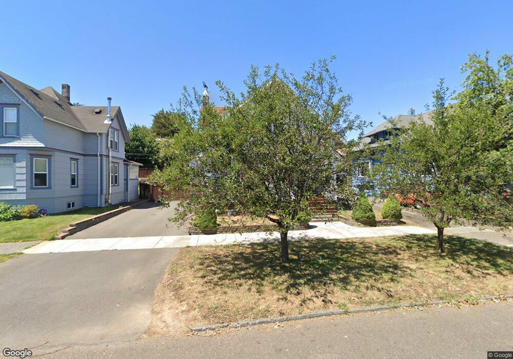
849 S 5th St Coos Bay, OR 97420
Estimated Value: $347,548 - $378,000
3
Beds
3
Baths
2,280
Sq Ft
$159/Sq Ft
Est. Value
About This Home
This home is located at 849 S 5th St, Coos Bay, OR 97420 and is currently estimated at $362,774, approximately $159 per square foot. 849 S 5th St is a home located in Coos County with nearby schools including Eastside School, Millicoma School, and Marshfield Senior High School.
Ownership History
Date
Name
Owned For
Owner Type
Purchase Details
Closed on
Oct 19, 2015
Sold by
Barber Jared Nathan and Barber Margaret Ellen
Bought by
Barber Margaret E
Current Estimated Value
Purchase Details
Closed on
May 26, 2015
Sold by
Barber Jared Nathan and Barber Margaret Ellen
Bought by
Barber Jared Nathan and Barber Margaret Ellen
Home Financials for this Owner
Home Financials are based on the most recent Mortgage that was taken out on this home.
Original Mortgage
$171,000
Outstanding Balance
$131,922
Interest Rate
3.64%
Mortgage Type
New Conventional
Estimated Equity
$230,852
Purchase Details
Closed on
Apr 10, 2015
Sold by
Barber Jared Nathan and Barber Margaret Ellen
Bought by
Barber Margaret E
Home Financials for this Owner
Home Financials are based on the most recent Mortgage that was taken out on this home.
Original Mortgage
$171,000
Outstanding Balance
$131,922
Interest Rate
3.64%
Mortgage Type
New Conventional
Estimated Equity
$230,852
Purchase Details
Closed on
Mar 10, 2014
Sold by
Barber Jared N and Barber Margaret E
Bought by
Nathan Jared and Barber Ellen Barber
Purchase Details
Closed on
Apr 8, 2010
Sold by
Barber Charles P and Barber Kathleen
Bought by
Barber Jared N and Barber Margaret E
Home Financials for this Owner
Home Financials are based on the most recent Mortgage that was taken out on this home.
Original Mortgage
$100,191
Interest Rate
4.95%
Mortgage Type
New Conventional
Purchase Details
Closed on
Oct 27, 2009
Sold by
Kay Andrea C and Kay Andrea Christina
Bought by
Barber Charles P and Barber Kathleen
Purchase Details
Closed on
Feb 29, 2008
Sold by
Kay Ronald Orr
Bought by
Kay Andrea Christina
Purchase Details
Closed on
Sep 10, 2004
Sold by
James Geneieve G
Bought by
Kay Ronald O and Kay Andrea C
Home Financials for this Owner
Home Financials are based on the most recent Mortgage that was taken out on this home.
Original Mortgage
$161,415
Interest Rate
5.25%
Mortgage Type
Purchase Money Mortgage
Create a Home Valuation Report for This Property
The Home Valuation Report is an in-depth analysis detailing your home's value as well as a comparison with similar homes in the area
Home Values in the Area
Average Home Value in this Area
Purchase History
| Date | Buyer | Sale Price | Title Company |
|---|---|---|---|
| Barber Margaret E | -- | Ticor Title Company | |
| Barber Jared Nathan | -- | None Available | |
| Barber Jared Nathan | -- | First American Title | |
| Barber Margaret E | -- | Accommodation | |
| Nathan Jared | -- | None Available | |
| Barber Jared Nathan | -- | None Available | |
| Barber Jared N | $125,239 | Ticor Title Insurance | |
| Barber Charles P | $125,239 | Ticor Title Insurance | |
| Kay Andrea Christina | -- | None Available | |
| Kay Ronald O | $189,900 | Ticor Title Insurance |
Source: Public Records
Mortgage History
| Date | Status | Borrower | Loan Amount |
|---|---|---|---|
| Open | Barber Jared Nathan | $171,000 | |
| Closed | Barber Jared N | $100,191 | |
| Previous Owner | Kay Ronald O | $161,415 | |
| Closed | Kay Ronald O | $28,485 |
Source: Public Records
Tax History Compared to Growth
Tax History
| Year | Tax Paid | Tax Assessment Tax Assessment Total Assessment is a certain percentage of the fair market value that is determined by local assessors to be the total taxable value of land and additions on the property. | Land | Improvement |
|---|---|---|---|---|
| 2024 | $3,176 | $182,700 | -- | -- |
| 2023 | $3,080 | $177,380 | $0 | $0 |
| 2022 | $3,029 | $172,220 | $0 | $0 |
| 2021 | $2,951 | $167,210 | $0 | $0 |
| 2020 | $2,867 | $167,210 | $0 | $0 |
| 2019 | $2,753 | $157,620 | $0 | $0 |
| 2018 | $2,658 | $153,030 | $0 | $0 |
| 2017 | $2,356 | $148,580 | $0 | $0 |
| 2016 | $2,249 | $144,260 | $0 | $0 |
| 2015 | $2,096 | $140,060 | $0 | $0 |
| 2014 | $2,096 | $135,990 | $0 | $0 |
Source: Public Records
Map
Nearby Homes
- 0 S 5th St
- 955 S 5th St
- 0 Ingersoll Ave
- 905 Ingersoll St
- 0 Johnson Ave
- 1032 S 4th St
- 1050 S 8th St
- 834 S 11th St
- 731 Elrod Ave
- 625 S 9th St
- 0 Elrod Ave
- 831 S 11th St
- 643 S 12th Ct
- 1048 Elrod Ave
- 766 Southwest Blvd
- 539 S 12th St
- 1320 Ingersoll St
- 1300 Ingersoll St
- 1395 Ingersoll St
- 790 Commercial Ave