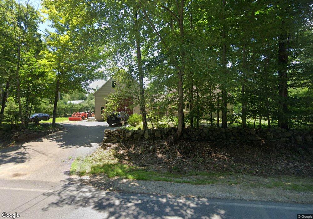
849 Second Crown Point Rd Strafford, NH 03884
Estimated Value: $570,893 - $694,000
3
Beds
2
Baths
1,900
Sq Ft
$334/Sq Ft
Est. Value
About This Home
This home is located at 849 Second Crown Point Rd, Strafford, NH 03884 and is currently estimated at $634,973, approximately $334 per square foot. 849 Second Crown Point Rd is a home located in Strafford County with nearby schools including Strafford School and Coe-Brown Northwood Academy.
Ownership History
Date
Name
Owned For
Owner Type
Purchase Details
Closed on
Nov 30, 2018
Sold by
Riley Joanne D
Bought by
Thornton Jeffry W and Thornton Emily J
Current Estimated Value
Home Financials for this Owner
Home Financials are based on the most recent Mortgage that was taken out on this home.
Original Mortgage
$379,998
Outstanding Balance
$334,786
Interest Rate
4.8%
Mortgage Type
FHA
Estimated Equity
$300,187
Purchase Details
Closed on
Sep 12, 2018
Sold by
Riley T
Bought by
Riley Joanne D
Create a Home Valuation Report for This Property
The Home Valuation Report is an in-depth analysis detailing your home's value as well as a comparison with similar homes in the area
Home Values in the Area
Average Home Value in this Area
Purchase History
| Date | Buyer | Sale Price | Title Company |
|---|---|---|---|
| Thornton Jeffry W | $390,000 | -- | |
| Riley Joanne D | -- | -- |
Source: Public Records
Mortgage History
| Date | Status | Borrower | Loan Amount |
|---|---|---|---|
| Open | Thornton Jeffry W | $379,998 |
Source: Public Records
Tax History
| Year | Tax Paid | Tax Assessment Tax Assessment Total Assessment is a certain percentage of the fair market value that is determined by local assessors to be the total taxable value of land and additions on the property. | Land | Improvement |
|---|---|---|---|---|
| 2024 | $7,736 | $391,500 | $65,900 | $325,600 |
| 2023 | $7,298 | $391,500 | $65,900 | $325,600 |
| 2022 | $6,696 | $390,900 | $65,900 | $325,000 |
| 2021 | $7,356 | $398,500 | $65,900 | $332,600 |
| 2020 | $7,613 | $296,800 | $59,500 | $237,300 |
| 2019 | $6,870 | $292,700 | $59,500 | $233,200 |
| 2018 | $6,749 | $285,600 | $59,500 | $226,100 |
| 2016 | $6,069 | $285,600 | $59,500 | $226,100 |
| 2015 | $6,242 | $286,200 | $73,400 | $212,800 |
| 2014 | $6,628 | $286,200 | $73,400 | $212,800 |
| 2013 | $6,505 | $286,800 | $73,400 | $213,400 |
| 2012 | $6,419 | $286,800 | $73,400 | $213,400 |
Source: Public Records
Map
Nearby Homes
- 435 Second Crown Point Rd
- 0 Sloper Rd Unit 6
- 64 Crown Point Rd
- 16 King Arthur Dr
- 19 King Arthur Dr
- 322 Long Shores Dr
- 185 Berry River Rd
- 516 Berry River Rd
- 11 Avalon Rd
- 22 Viviana Dr
- 184 Pocahontas Ln Unit 184
- 1207 1st Crown Point Rd
- 739 Berry River Rd
- 21 Julia Ave
- M37 L40 Beaver Rd
- 118 Secretariat Way Unit 204
- 23 Porcupine Way
- 0 Daniel Cater Rd Unit 10 5030094
- 50 Knotty Knoll Cir
- 147 Boulder Dr
- 849 2nd Crown Point Rd
- 837 2nd Crown Point Rd
- 861 2nd Crown Point Rd
- 844 Second Crown Point Rd
- 844 2nd Crown Point Rd
- 111 Cross Rd
- 48-2 Second Crown Point Rd
- 103 Cross Rd
- 48-1 Second Crown Point Rd
- 104 Cross Rd
- 825 2nd Crown Point Rd
- 119 Cross Rd
- 818 2nd Crown Point Rd
- 77 Cross Rd
- 159 Cross Rd
- 801 2nd Crown Point Rd
- 67 Cross Rd
- 796 2nd Crown Point Rd
- 0 Cross Rd
- 905 2nd Crown Point Rd
Your Personal Tour Guide
Ask me questions while you tour the home.