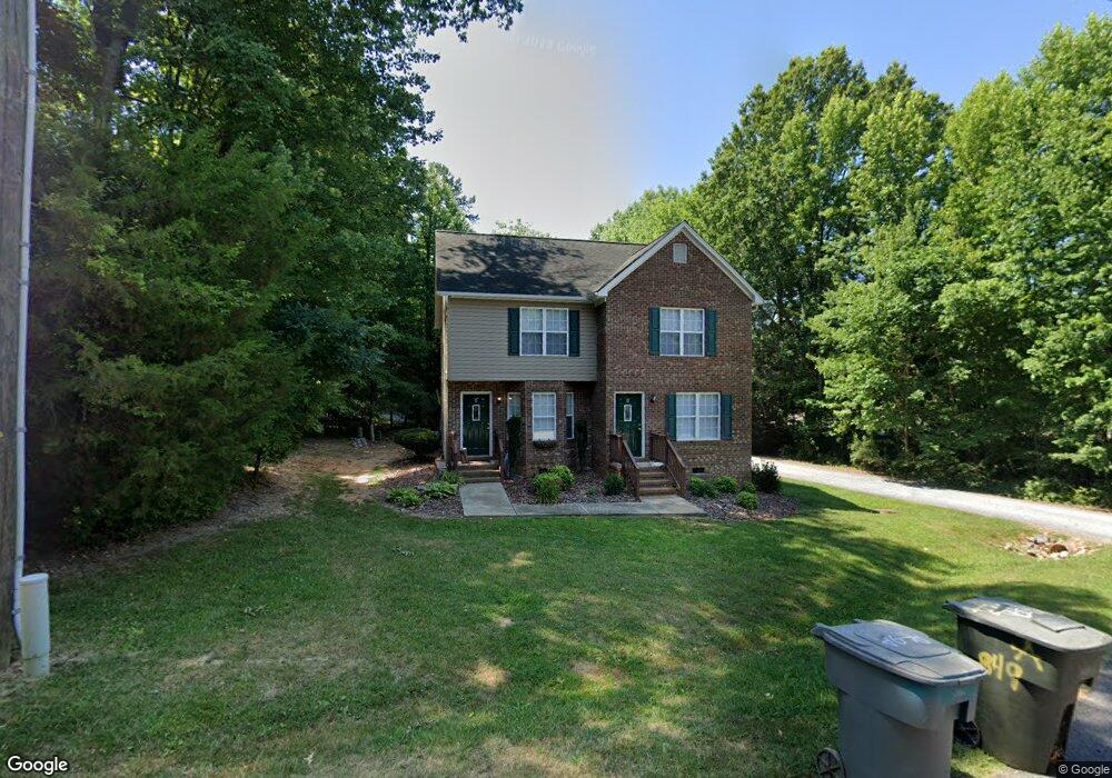
849 Sherwood Rd Asheboro, NC 27205
Estimated Value: $251,000 - $291,000
--
Bed
4
Baths
2,016
Sq Ft
$136/Sq Ft
Est. Value
About This Home
This home is located at 849 Sherwood Rd, Asheboro, NC 27205 and is currently estimated at $274,142, approximately $135 per square foot. 849 Sherwood Rd is a home located in Randolph County with nearby schools including Guy B. Teachey Elementary School, South Asheboro Middle School, and Asheboro High School.
Ownership History
Date
Name
Owned For
Owner Type
Purchase Details
Closed on
Aug 21, 2024
Sold by
Brown Daniel Martin
Bought by
Nardali Ali
Current Estimated Value
Purchase Details
Closed on
Jul 9, 2018
Sold by
Bsr Llc
Bought by
Brown Daniel M
Home Financials for this Owner
Home Financials are based on the most recent Mortgage that was taken out on this home.
Original Mortgage
$94,563
Interest Rate
4.6%
Mortgage Type
New Conventional
Create a Home Valuation Report for This Property
The Home Valuation Report is an in-depth analysis detailing your home's value as well as a comparison with similar homes in the area
Home Values in the Area
Average Home Value in this Area
Purchase History
| Date | Buyer | Sale Price | Title Company |
|---|---|---|---|
| Nardali Ali | $275,000 | None Listed On Document | |
| Brown Daniel M | $111,500 | None Available |
Source: Public Records
Mortgage History
| Date | Status | Borrower | Loan Amount |
|---|---|---|---|
| Previous Owner | Brown Daniel M | $94,563 |
Source: Public Records
Tax History Compared to Growth
Tax History
| Year | Tax Paid | Tax Assessment Tax Assessment Total Assessment is a certain percentage of the fair market value that is determined by local assessors to be the total taxable value of land and additions on the property. | Land | Improvement |
|---|---|---|---|---|
| 2025 | $2,478 | $166,940 | $30,250 | $136,690 |
| 2024 | $2,478 | $166,940 | $30,250 | $136,690 |
| 2023 | $2,478 | $166,940 | $30,250 | $136,690 |
| 2022 | $1,514 | $105,050 | $13,200 | $91,850 |
| 2021 | $1,514 | $105,050 | $13,200 | $91,850 |
| 2020 | $1,514 | $105,050 | $13,200 | $91,850 |
| 2019 | $1,514 | $105,050 | $13,200 | $91,850 |
| 2018 | $1,357 | $92,480 | $12,000 | $80,480 |
| 2016 | $1,357 | $92,484 | $12,000 | $80,484 |
| 2015 | $1,360 | $92,484 | $12,000 | $80,484 |
| 2014 | -- | $116,569 | $13,090 | $103,479 |
Source: Public Records
Map
Nearby Homes
- 1922 Oak Dr
- 724 Sherwood Rd
- 811 Sherwood Ave
- 481 McLarkling Ln
- 2006 Lambert Dr
- 406 Ashmont Ct
- 386 Sherwood Oaks Dr
- 7808 State Highway 49
- 01 Mack Rd
- 1037 Robbins St
- 841 Hollings Rd
- 1427 S Fayetteville St
- 228 Anchor Dr
- 960 Lee St
- 287 Eldorado Rd
- 737 Britt Ave
- 261 Charles Ave
- 481 Nc Highway 49 S
- 353 Auman Ave
- 855 Lee St
- 849 Sherwood Rd Unit B
- 849 Sherwood Rd Unit A
- 1804 Dennis St
- 853 Sherwood Rd
- 1818 Dennis St
- 834 Sherwood Rd
- 1828 Dennis St
- 1805 Dennis St
- 1813 Dennis St
- 1819 Dennis St
- 1834 Dennis St
- 527 Sherwood Ave
- 527 Sherwood Ave
- 828 Sherwood Rd
- 819 Sherwood Rd
- 1829 Dennis St
- 516 Sherwood Ave
- 1840 Dennis St
- 818 Sherwood Rd
- 803 Sherwood Rd