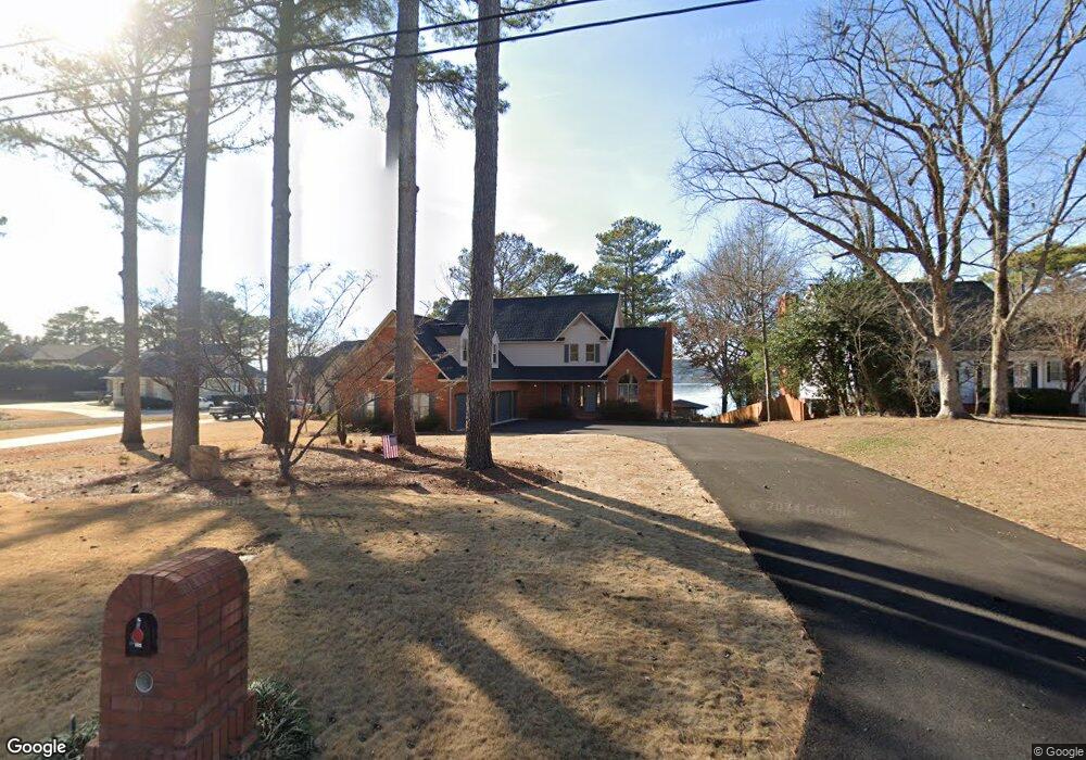
849 Signal Point Rd Guntersville, AL 35976
Estimated Value: $890,000 - $1,467,000
--
Bed
3
Baths
4,672
Sq Ft
$275/Sq Ft
Est. Value
About This Home
This home is located at 849 Signal Point Rd, Guntersville, AL 35976 and is currently estimated at $1,282,671, approximately $274 per square foot. 849 Signal Point Rd is a home located in Marshall County with nearby schools including Guntersville Elementary School, Cherokee Elementary School, and Guntersville Middle School.
Ownership History
Date
Name
Owned For
Owner Type
Purchase Details
Closed on
Oct 8, 2021
Sold by
Batchelor Janet and Jane E Conway Living Trust
Bought by
Brown Thomas and Brown Emily T
Current Estimated Value
Home Financials for this Owner
Home Financials are based on the most recent Mortgage that was taken out on this home.
Original Mortgage
$800,000
Outstanding Balance
$729,525
Interest Rate
2.8%
Mortgage Type
New Conventional
Estimated Equity
$553,146
Purchase Details
Closed on
Mar 17, 2016
Sold by
Conway Jack D and Conway Jane E
Bought by
Conway Jane E and Conway Jack D
Purchase Details
Closed on
Nov 10, 2006
Sold by
Allen Thomas E and Allen Janell
Bought by
Conway Jack D and Conway Jane E
Create a Home Valuation Report for This Property
The Home Valuation Report is an in-depth analysis detailing your home's value as well as a comparison with similar homes in the area
Home Values in the Area
Average Home Value in this Area
Purchase History
| Date | Buyer | Sale Price | Title Company |
|---|---|---|---|
| Brown Thomas | $1,000,000 | None Available | |
| Conway Jane E | -- | None Available | |
| Conway Jack D | $965,000 | None Available |
Source: Public Records
Mortgage History
| Date | Status | Borrower | Loan Amount |
|---|---|---|---|
| Open | Brown Thomas | $800,000 |
Source: Public Records
Tax History Compared to Growth
Tax History
| Year | Tax Paid | Tax Assessment Tax Assessment Total Assessment is a certain percentage of the fair market value that is determined by local assessors to be the total taxable value of land and additions on the property. | Land | Improvement |
|---|---|---|---|---|
| 2024 | $5,098 | $111,960 | $0 | $0 |
| 2023 | $4,761 | $111,960 | $0 | $0 |
| 2022 | $9,061 | $210,720 | $0 | $0 |
| 2021 | $4,112 | $95,620 | $0 | $0 |
| 2020 | $3,527 | $82,020 | $0 | $0 |
| 2017 | $3,871 | $90,020 | $0 | $0 |
| 2015 | -- | $78,260 | $0 | $0 |
| 2014 | -- | $78,260 | $0 | $0 |
Source: Public Records
Map
Nearby Homes
- 1551 Signal Point Rd
- Lot 33 Signal Point Rd
- Lot 32 Signal Point Rd
- 6.48 Acres Signal Point Rd
- 2699 - 103 Paddle Wheel Dr Unit 103
- 2699 Paddle Wheel Dr Unit 403
- 2699 Paddle Wheel Dr Unit 101
- 2699 Paddle Wheel Dr Unit 202
- 3708 Perry St
- 0.30 Mccoy St
- 1504 Mccoy St
- 320 Blount Ave
- 1984 Signal Point Rd
- 4125 Hide Away Dr
- 245 Hill Ave
- 247 Hill Ave
- Lot 4 Smith St
- 4157 Hide Away Dr
- Lot 42 Spy Glass Cove
- Lot 41 Spy Glass Cove
- 871 Signal Point Rd
- 889 Signal Point Rd
- 833 Signal Point Rd
- 850 Signal Point Rd
- 894 Signal Point Rd
- 804 Signal Point Rd
- 791 Signal Point Rd
- 914 Signal Point Rd
- 800 Signal Point Rd
- 775 Signal Point Rd
- 824 Signal Point Rd
- 755 Signal Point Rd
- 00000 Signal Point Rd
- 729 Signal Point Rd
- 926 Signal Point Rd
- 725 Signal Point Rd
- 1004 Signal Point Rd
- 695 Signal Point Rd
- 100 Marina Ln Unit D410
- 1006 Signal Point Rd