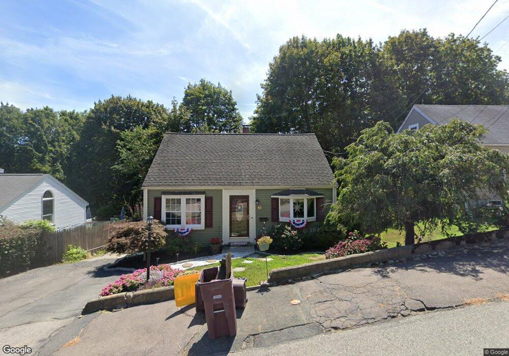
85 Brae Rd North Weymouth, MA 02191
North Weymouth NeighborhoodEstimated Value: $437,000 - $532,000
2
Beds
1
Bath
720
Sq Ft
$660/Sq Ft
Est. Value
About This Home
This home is located at 85 Brae Rd, North Weymouth, MA 02191 and is currently estimated at $475,144, approximately $659 per square foot. 85 Brae Rd is a home located in Norfolk County with nearby schools including Wessagusset Elementary School, Abigail Adams Middle School, and Weymouth Middle School Chapman.
Ownership History
Date
Name
Owned For
Owner Type
Purchase Details
Closed on
Oct 31, 1997
Sold by
Bastis Joseph T and Bastis Carmen L
Bought by
Snow Robert P and Snow Lisa J
Current Estimated Value
Home Financials for this Owner
Home Financials are based on the most recent Mortgage that was taken out on this home.
Original Mortgage
$115,450
Interest Rate
7.31%
Mortgage Type
Purchase Money Mortgage
Purchase Details
Closed on
May 20, 1991
Sold by
Rockwood Tr Craig T
Bought by
Heal Carmen L
Home Financials for this Owner
Home Financials are based on the most recent Mortgage that was taken out on this home.
Original Mortgage
$104,786
Interest Rate
9.4%
Mortgage Type
Purchase Money Mortgage
Create a Home Valuation Report for This Property
The Home Valuation Report is an in-depth analysis detailing your home's value as well as a comparison with similar homes in the area
Home Values in the Area
Average Home Value in this Area
Purchase History
| Date | Buyer | Sale Price | Title Company |
|---|---|---|---|
| Snow Robert P | $117,000 | -- | |
| Heal Carmen L | $103,500 | -- |
Source: Public Records
Mortgage History
| Date | Status | Borrower | Loan Amount |
|---|---|---|---|
| Open | Heal Carmen L | $157,500 | |
| Closed | Heal Carmen L | $115,450 | |
| Previous Owner | Heal Carmen L | $104,786 |
Source: Public Records
Tax History
| Year | Tax Paid | Tax Assessment Tax Assessment Total Assessment is a certain percentage of the fair market value that is determined by local assessors to be the total taxable value of land and additions on the property. | Land | Improvement |
|---|---|---|---|---|
| 2025 | $4,059 | $401,900 | $210,100 | $191,800 |
| 2024 | $3,932 | $382,900 | $200,100 | $182,800 |
| 2023 | $3,707 | $354,700 | $185,300 | $169,400 |
| 2022 | $3,643 | $317,900 | $171,600 | $146,300 |
| 2021 | $3,408 | $290,300 | $171,600 | $118,700 |
| 2020 | $3,251 | $272,700 | $171,600 | $101,100 |
| 2019 | $3,173 | $261,800 | $165,000 | $96,800 |
| 2018 | $3,086 | $246,900 | $157,100 | $89,800 |
| 2017 | $2,927 | $228,500 | $142,900 | $85,600 |
| 2016 | $2,813 | $219,800 | $137,400 | $82,400 |
| 2015 | $2,673 | $207,200 | $130,800 | $76,400 |
| 2014 | $2,542 | $191,100 | $121,800 | $69,300 |
Source: Public Records
Map
Nearby Homes
- 70 Holmes Ave
- 109 Merryknoll Rd
- 92 Doris Dr
- 237 North St Unit A
- 9 Davids Island Rd
- 10 Marion Rd
- 90 Sea St Unit 204
- 1206 Tuckers Ln Unit 1206
- 70 Colonial Rd
- 87 Fort Point Rd
- 16 Caldwell St
- 30 Puritan Rd
- 85 Kings Cove Beach Rd
- 73 Broad Reach Unit M21C
- 104 Kings Cove Beach Rd
- 51 Broad Reach Unit T23A
- 5 Endicott St
- 300 River St Unit 12
- 54 Broad Reach Unit 104
- 64 Broad Reach Unit 107
Your Personal Tour Guide
Ask me questions while you tour the home.