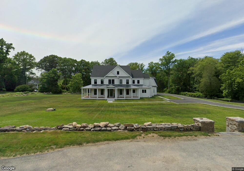
85 Carter St New Canaan, CT 06840
Estimated Value: $4,158,824 - $5,092,000
5
Beds
6
Baths
7,162
Sq Ft
$663/Sq Ft
Est. Value
About This Home
This home is located at 85 Carter St, New Canaan, CT 06840 and is currently estimated at $4,748,956, approximately $663 per square foot. 85 Carter St is a home located in Fairfield County with nearby schools including East Elementary School, Saxe Middle School, and New Canaan High School.
Ownership History
Date
Name
Owned For
Owner Type
Purchase Details
Closed on
Jun 7, 2021
Sold by
Greenleaf Properties Llc
Bought by
Jackson Scott and Quintin Marie
Current Estimated Value
Home Financials for this Owner
Home Financials are based on the most recent Mortgage that was taken out on this home.
Original Mortgage
$900,000
Outstanding Balance
$814,838
Interest Rate
2.9%
Mortgage Type
Purchase Money Mortgage
Estimated Equity
$3,934,118
Purchase Details
Closed on
Jan 6, 1984
Bought by
Karl Mary K
Create a Home Valuation Report for This Property
The Home Valuation Report is an in-depth analysis detailing your home's value as well as a comparison with similar homes in the area
Home Values in the Area
Average Home Value in this Area
Purchase History
| Date | Buyer | Sale Price | Title Company |
|---|---|---|---|
| Jackson Scott | $1,200,000 | None Available | |
| Karl Mary K | -- | -- |
Source: Public Records
Mortgage History
| Date | Status | Borrower | Loan Amount |
|---|---|---|---|
| Open | Jackson Scott | $900,000 |
Source: Public Records
Tax History Compared to Growth
Tax History
| Year | Tax Paid | Tax Assessment Tax Assessment Total Assessment is a certain percentage of the fair market value that is determined by local assessors to be the total taxable value of land and additions on the property. | Land | Improvement |
|---|---|---|---|---|
| 2025 | $42,248 | $2,531,340 | $772,800 | $1,758,540 |
| 2024 | $40,856 | $2,531,340 | $772,800 | $1,758,540 |
| 2023 | $36,881 | $1,947,260 | $743,050 | $1,204,210 |
| 2022 | $13,650 | $743,050 | $743,050 | $0 |
| 2021 | $13,494 | $743,050 | $743,050 | $0 |
| 2020 | $13,494 | $743,050 | $743,050 | $0 |
| 2019 | $13,553 | $743,050 | $743,050 | $0 |
| 2018 | $10,330 | $609,070 | $609,070 | $0 |
| 2017 | $10,153 | $609,070 | $609,070 | $0 |
| 2016 | $13,034 | $799,120 | $609,070 | $190,050 |
| 2015 | $13,233 | $799,120 | $609,070 | $190,050 |
| 2014 | $12,418 | $799,120 | $609,070 | $190,050 |
Source: Public Records
Map
Nearby Homes
- 67 Carter St
- 136L Carter St
- 140L Carter St
- 152L Carter St
- 158L Carter St
- 250 Carter St
- 38 Fitch Ln
- 262 Brushy Ridge Rd
- 289 New Norwalk Rd Unit 22
- 152 Long Lots Rd
- 49 Ludlowe Rd
- 96 East Ave Unit C
- 515 Carter St
- 180 Summer St
- 79 Locust Ave Unit 212
- 240 Rosebrook Rd
- 145 River St
- 64 East Ave
- 60 East Ave
- 63 Middle Ridge Rd