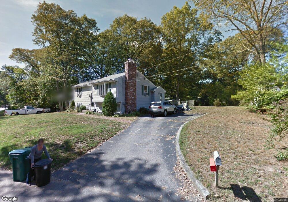
85 Cypress Rd Attleboro, MA 02703
Estimated Value: $497,000 - $563,192
2
Beds
2
Baths
1,612
Sq Ft
$334/Sq Ft
Est. Value
About This Home
This home is located at 85 Cypress Rd, Attleboro, MA 02703 and is currently estimated at $537,798, approximately $333 per square foot. 85 Cypress Rd is a home located in Bristol County with nearby schools including Peter Thacher Elementary School, Cyril K. Brennan Middle School, and Attleboro High School.
Ownership History
Date
Name
Owned For
Owner Type
Purchase Details
Closed on
Sep 23, 2013
Sold by
Nilsson Michael C and Nilsson Linda M
Bought by
Nilsson Michael C and Nilsson Linda M
Current Estimated Value
Home Financials for this Owner
Home Financials are based on the most recent Mortgage that was taken out on this home.
Original Mortgage
$227,200
Outstanding Balance
$71,464
Interest Rate
4.42%
Mortgage Type
New Conventional
Estimated Equity
$466,334
Purchase Details
Closed on
Jan 1, 1985
Bought by
Nilsson Michael C and Nilsson Linda M
Create a Home Valuation Report for This Property
The Home Valuation Report is an in-depth analysis detailing your home's value as well as a comparison with similar homes in the area
Home Values in the Area
Average Home Value in this Area
Purchase History
| Date | Buyer | Sale Price | Title Company |
|---|---|---|---|
| Nilsson Michael C | -- | -- | |
| Nilsson Michael C | -- | -- |
Source: Public Records
Mortgage History
| Date | Status | Borrower | Loan Amount |
|---|---|---|---|
| Open | Nilsson Michael C | $227,200 | |
| Previous Owner | Nilsson Michael C | $50,000 | |
| Previous Owner | Nilsson Michael C | $88,500 | |
| Previous Owner | Nilsson Michael C | $80,000 | |
| Previous Owner | Nilsson Michael C | $70,000 |
Source: Public Records
Tax History Compared to Growth
Tax History
| Year | Tax Paid | Tax Assessment Tax Assessment Total Assessment is a certain percentage of the fair market value that is determined by local assessors to be the total taxable value of land and additions on the property. | Land | Improvement |
|---|---|---|---|---|
| 2025 | $6,107 | $486,600 | $140,100 | $346,500 |
| 2024 | $6,073 | $477,100 | $140,100 | $337,000 |
| 2023 | $5,694 | $415,900 | $127,200 | $288,700 |
| 2022 | $5,371 | $371,700 | $121,300 | $250,400 |
| 2021 | $4,971 | $335,900 | $116,700 | $219,200 |
| 2020 | $4,690 | $322,100 | $113,400 | $208,700 |
| 2019 | $4,424 | $312,400 | $111,200 | $201,200 |
| 2018 | $4,218 | $284,600 | $108,100 | $176,500 |
| 2017 | $4,147 | $285,000 | $108,100 | $176,900 |
| 2016 | $3,912 | $264,000 | $105,900 | $158,100 |
| 2015 | $3,886 | $264,200 | $105,900 | $158,300 |
| 2014 | $3,016 | $203,100 | $100,800 | $102,300 |
Source: Public Records
Map
Nearby Homes
- 75 Grant St
- 429 S Main St Unit 1
- 3 Grant St
- 0 Tulip Unit 73410552
- 0 Tulip Unit 73407296
- 309 Thacher St
- 115 Ellis St
- 26 Lamb St
- 804 County St
- 24 Oakland Ave Unit 1
- 22 Oakland Ave Unit 1
- 248 S Main St
- 172 Downing Dr
- 139 Downing Dr
- 17 Jewel Ave
- 97 Dexter St
- 62 Garden St Unit 3
- 49 Bushee St
- 52 Hawthorne St
- 31 Verndale Ave