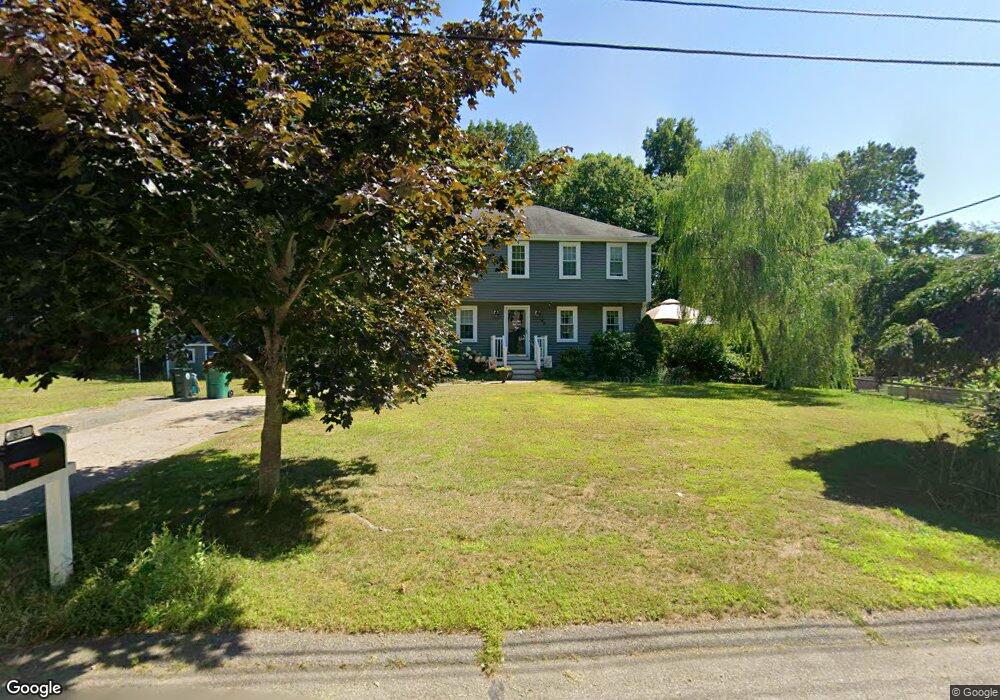
85 Donald Tennant Cir North Attleboro, MA 02760
North Attleboro NeighborhoodEstimated Value: $630,667 - $705,000
4
Beds
2
Baths
1,800
Sq Ft
$366/Sq Ft
Est. Value
About This Home
This home is located at 85 Donald Tennant Cir, North Attleboro, MA 02760 and is currently estimated at $658,667, approximately $365 per square foot. 85 Donald Tennant Cir is a home located in Bristol County with nearby schools including North Attleboro High School, Cadence Academy Preschool - North Attleborough, and Bishop Feehan High School.
Ownership History
Date
Name
Owned For
Owner Type
Purchase Details
Closed on
Oct 2, 1995
Sold by
Vital Michael W and Vital Lucinda L
Bought by
Patjane Anthony W and Patjane Hilde I
Current Estimated Value
Create a Home Valuation Report for This Property
The Home Valuation Report is an in-depth analysis detailing your home's value as well as a comparison with similar homes in the area
Home Values in the Area
Average Home Value in this Area
Purchase History
| Date | Buyer | Sale Price | Title Company |
|---|---|---|---|
| Patjane Anthony W | $161,600 | -- |
Source: Public Records
Mortgage History
| Date | Status | Borrower | Loan Amount |
|---|---|---|---|
| Open | Patjane Anthony W | $139,900 | |
| Closed | Patjane Anthony W | $42,900 | |
| Closed | Patjane Anthony W | $143,000 |
Source: Public Records
Tax History Compared to Growth
Tax History
| Year | Tax Paid | Tax Assessment Tax Assessment Total Assessment is a certain percentage of the fair market value that is determined by local assessors to be the total taxable value of land and additions on the property. | Land | Improvement |
|---|---|---|---|---|
| 2025 | $5,950 | $504,700 | $145,400 | $359,300 |
| 2024 | $5,921 | $513,100 | $145,400 | $367,700 |
| 2023 | $5,780 | $451,900 | $145,400 | $306,500 |
| 2022 | $5,515 | $395,900 | $145,400 | $250,500 |
| 2021 | $5,278 | $369,900 | $145,400 | $224,500 |
| 2020 | $5,218 | $363,600 | $145,400 | $218,200 |
| 2019 | $5,010 | $351,800 | $132,300 | $219,500 |
| 2018 | $2,764 | $339,000 | $132,300 | $206,700 |
| 2017 | $2,490 | $339,000 | $132,300 | $206,700 |
| 2016 | $4,393 | $332,300 | $146,900 | $185,400 |
| 2015 | $4,225 | $321,500 | $146,900 | $174,600 |
| 2014 | $4,018 | $303,500 | $128,900 | $174,600 |
Source: Public Records
Map
Nearby Homes
- 196 Donald Tennant Cir
- 11 Landry Ave
- 115 Westfield Dr
- 57 Vine St
- 11 Buckthorn Ln
- Lot 2 Jeffrey Dr
- Lot 5 Jeffrey Dr
- 255 Mckeon Dr
- 5 Old Wood Rd
- 116 George St
- 150 Gilbert St
- 12 Houde St
- 40 Natalie Dr
- 24 Maverick Dr
- 20 Sperry Ln
- 21 Shady Ln
- 835 Mt Hope St Unit 39
- 28 Messenger St
- 9 Sunnyside Dr Unit 9
- 29 Lyman St
- 91 Donald Tennant Cir
- 73 Donald Tennant Cir
- 84 Donald Tennant Cir
- 90 Donald Tennant Cir
- 103 Donald Tennant Cir
- 70 Donald Tennant Cir
- 53 Donald Tennant Cir
- 98 Donald Tennant Cir
- 66 Donald Tennant Cir
- 56 Donald Tennant Cir
- 32 Indian Trail
- 109 Donald Tennant Cir
- 47 Donald Tennant Cir
- 104 Donald Tennant Cir
- 48 Donald Tennant Cir
- 119 Donald Tennant Cir
- 39 Donald Tennant Cir
- 42 Donald Tennant Cir
- 125 Donald Tennant Cir
- 190 Donald Tennant Cir