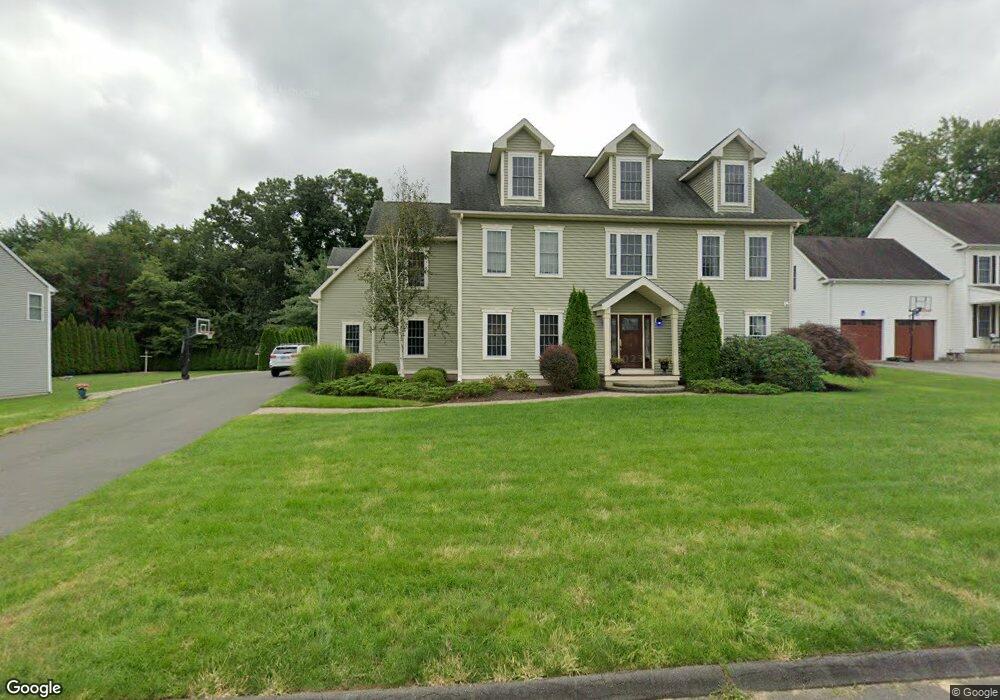
85 Fireside Ln Bristol, CT 06010
Forestville NeighborhoodEstimated Value: $608,000 - $640,000
4
Beds
3
Baths
3,156
Sq Ft
$199/Sq Ft
Est. Value
About This Home
This home is located at 85 Fireside Ln, Bristol, CT 06010 and is currently estimated at $628,142, approximately $199 per square foot. 85 Fireside Ln is a home located in Hartford County with nearby schools including Bristol Central High School, St Matthew School, and Great Beginnings.
Ownership History
Date
Name
Owned For
Owner Type
Purchase Details
Closed on
Jul 2, 2007
Sold by
Lorenzetti Thomas and Lorenzetti Stacy
Bought by
Torreso Jeffrey M and Torreso Ginny M
Current Estimated Value
Home Financials for this Owner
Home Financials are based on the most recent Mortgage that was taken out on this home.
Original Mortgage
$75,000
Interest Rate
6.72%
Purchase Details
Closed on
Dec 16, 2004
Sold by
Villa Constr Inc
Bought by
Lorenzetti Thomas and Lorenzetti Stacy
Create a Home Valuation Report for This Property
The Home Valuation Report is an in-depth analysis detailing your home's value as well as a comparison with similar homes in the area
Home Values in the Area
Average Home Value in this Area
Purchase History
| Date | Buyer | Sale Price | Title Company |
|---|---|---|---|
| Torreso Jeffrey M | $470,000 | -- | |
| Lorenzetti Thomas | $115,000 | -- |
Source: Public Records
Mortgage History
| Date | Status | Borrower | Loan Amount |
|---|---|---|---|
| Open | Lorenzetti Thomas | $200,000 | |
| Open | Lorenzetti Thomas | $352,000 | |
| Closed | Lorenzetti Thomas | $377,000 | |
| Closed | Lorenzetti Thomas | $75,000 |
Source: Public Records
Tax History
| Year | Tax Paid | Tax Assessment Tax Assessment Total Assessment is a certain percentage of the fair market value that is determined by local assessors to be the total taxable value of land and additions on the property. | Land | Improvement |
|---|---|---|---|---|
| 2025 | $12,037 | $356,650 | $54,320 | $302,330 |
| 2024 | $11,359 | $356,650 | $54,320 | $302,330 |
| 2023 | $10,824 | $356,650 | $54,320 | $302,330 |
| 2022 | $10,325 | $269,220 | $41,930 | $227,290 |
| 2021 | $10,325 | $269,220 | $41,930 | $227,290 |
| 2020 | $10,325 | $269,220 | $41,930 | $227,290 |
| 2019 | $10,244 | $269,220 | $41,930 | $227,290 |
| 2018 | $9,929 | $269,220 | $41,930 | $227,290 |
| 2017 | $9,470 | $262,850 | $59,850 | $203,000 |
| 2016 | $9,470 | $262,850 | $59,850 | $203,000 |
| 2015 | $9,097 | $262,850 | $59,850 | $203,000 |
| 2014 | $9,097 | $262,850 | $59,850 | $203,000 |
Source: Public Records
Map
Nearby Homes
- 85 Forest St
- 25 Zack Ln
- 132 Hollyberry Ln
- 683 Pine St
- 26 Skyline Dr
- 536 Redstone Hill Rd Unit 24
- 121 Village St
- 158 E Main St
- 9 Hemingway St
- 135 E Main St
- 33 Kenney St
- 50 Forestville Ave
- 279 Redstone Hill Rd Unit 58
- 295 Redstone Hill Rd Unit 3
- 19 Bingham St
- 29 Bingham St
- 513 Emmett St Unit 13
- 25 Julia Rd
- 581 Village St
- 595 Village St
Your Personal Tour Guide
Ask me questions while you tour the home.