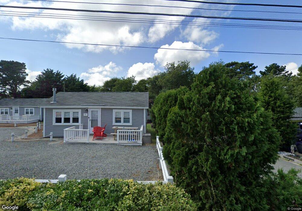
85 Glendon Rd Dennis Port, MA 02639
Dennis Port NeighborhoodEstimated Value: $660,000 - $880,000
4
Beds
2
Baths
1,512
Sq Ft
$520/Sq Ft
Est. Value
About This Home
This home is located at 85 Glendon Rd, Dennis Port, MA 02639 and is currently estimated at $786,836, approximately $520 per square foot. 85 Glendon Rd is a home located in Barnstable County with nearby schools including Dennis-Yarmouth Regional High School and St. Pius X. School.
Ownership History
Date
Name
Owned For
Owner Type
Purchase Details
Closed on
Feb 10, 2015
Sold by
Burns Gregory A
Bought by
Burns Jean M
Current Estimated Value
Purchase Details
Closed on
Dec 2, 2014
Sold by
Burns Marie D Est
Bought by
Burns Gregory A
Purchase Details
Closed on
Mar 8, 2013
Sold by
Marie Doris Burns Ret
Bought by
Burns Marie F
Purchase Details
Closed on
Jun 17, 2010
Sold by
Marie Doris Burns Ret
Bought by
Burns Doris Marie
Create a Home Valuation Report for This Property
The Home Valuation Report is an in-depth analysis detailing your home's value as well as a comparison with similar homes in the area
Home Values in the Area
Average Home Value in this Area
Purchase History
| Date | Buyer | Sale Price | Title Company |
|---|---|---|---|
| Burns Jean M | -- | -- | |
| Burns Gregory A | -- | -- | |
| Burns Marie F | -- | -- | |
| Marie Doris Burns Ret | -- | -- | |
| Burns Doris Marie | -- | -- |
Source: Public Records
Tax History Compared to Growth
Tax History
| Year | Tax Paid | Tax Assessment Tax Assessment Total Assessment is a certain percentage of the fair market value that is determined by local assessors to be the total taxable value of land and additions on the property. | Land | Improvement |
|---|---|---|---|---|
| 2025 | $3,064 | $707,600 | $322,900 | $384,700 |
| 2024 | $2,981 | $679,100 | $310,500 | $368,600 |
| 2023 | $2,904 | $621,900 | $282,300 | $339,600 |
| 2022 | $2,906 | $518,900 | $266,100 | $252,800 |
| 2021 | $2,797 | $463,800 | $260,900 | $202,900 |
| 2020 | $2,935 | $481,200 | $289,900 | $191,300 |
| 2019 | $2,819 | $456,900 | $284,200 | $172,700 |
| 2018 | $2,500 | $394,400 | $227,300 | $167,100 |
| 2017 | $2,426 | $394,400 | $227,300 | $167,100 |
| 2016 | $2,381 | $364,600 | $221,900 | $142,700 |
| 2015 | $2,333 | $364,600 | $221,900 | $142,700 |
| 2014 | $2,252 | $354,600 | $216,500 | $138,100 |
Source: Public Records
Map
Nearby Homes
- 154 Old Wharf Rd Unit 26
- 154 Old Wharf Rd Unit 14
- 120 Old Wharf Rd Unit 11
- 64 Beaten Rd
- 112 Old Wharf Rd Unit E4
- 112 Old Wharf Rd Unit E1
- 217 Old Wharf Rd Unit 64
- 37 Ocean Dr Unit 2
- 241 Old Wharf Rd Unit 82
- 241 Old Wharf Rd Unit 127
- 241 Old Wharf Rd Unit 90
- 262 Old Wharf Rd Unit 67
- 262 Old Wharf Rd Unit 5
- 262 Old Wharf Rd Unit 5
- 262 Old Wharf Rd Unit 20
- 262 Old Wharf Rd Unit 87
- 37 Beach Hills Rd
- 37-A Beach Hills Rd
- 31 Easy St
- 80 Michaels Ave
- 95 Glendon Rd Unit 95
- 95 Glendon Rd Unit 99
- 95 Glendon Rd
- 93 Glendon Rd
- 99 Glendon Rd
- 97 Glendon Rd
- 91 Glendon Rd Unit 93
- 91 Glendon Rd Unit 91
- 91 Glendon Rd Unit 97
- 91 Glendon Rd
- 91 Glendon Rd Unit 99
- 188 Captain Chase Rd
- 89 Glendon Rd
- 89 Glendon Rd Unit A & B
- 194-264 Captain Chase Unit 12
- 184-189 Captain Chase Rd
- 194 Capt Chase Rd Unit 4
- 194 Capt Chase Rd Unit 2
- 81 Glendon Rd
- 101 Glendon Rd