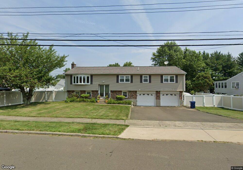
85 Hubbard Rd West Haven, CT 06516
West Shore NeighborhoodEstimated Value: $459,809 - $525,000
4
Beds
3
Baths
1,548
Sq Ft
$322/Sq Ft
Est. Value
About This Home
This home is located at 85 Hubbard Rd, West Haven, CT 06516 and is currently estimated at $498,202, approximately $321 per square foot. 85 Hubbard Rd is a home located in New Haven County with nearby schools including Carrigan 5/6 Intermediate School, Harry M. Bailey Middle School, and West Haven High School.
Ownership History
Date
Name
Owned For
Owner Type
Purchase Details
Closed on
May 14, 2007
Sold by
Tweede Carl
Bought by
Asare Nana A and Tweede Alisha T
Current Estimated Value
Home Financials for this Owner
Home Financials are based on the most recent Mortgage that was taken out on this home.
Original Mortgage
$264,000
Interest Rate
6.21%
Mortgage Type
Purchase Money Mortgage
Purchase Details
Closed on
Sep 26, 2006
Sold by
Saldibar Rose
Bought by
Tweede Carl
Create a Home Valuation Report for This Property
The Home Valuation Report is an in-depth analysis detailing your home's value as well as a comparison with similar homes in the area
Home Values in the Area
Average Home Value in this Area
Purchase History
| Date | Buyer | Sale Price | Title Company |
|---|---|---|---|
| Asare Nana A | $330,000 | -- | |
| Tweede Carl | $320,000 | -- | |
| Asare Nana A | $330,000 | -- | |
| Tweede Carl | $320,000 | -- |
Source: Public Records
Mortgage History
| Date | Status | Borrower | Loan Amount |
|---|---|---|---|
| Open | Tweede Carl | $247,500 | |
| Closed | Tweede Carl | $264,000 | |
| Closed | Tweede Carl | $32,600 |
Source: Public Records
Tax History Compared to Growth
Tax History
| Year | Tax Paid | Tax Assessment Tax Assessment Total Assessment is a certain percentage of the fair market value that is determined by local assessors to be the total taxable value of land and additions on the property. | Land | Improvement |
|---|---|---|---|---|
| 2025 | $8,911 | $271,110 | $93,520 | $177,590 |
| 2024 | $8,653 | $184,660 | $64,750 | $119,910 |
| 2023 | $8,328 | $184,660 | $64,750 | $119,910 |
| 2022 | $8,179 | $184,660 | $64,750 | $119,910 |
| 2021 | $8,179 | $184,660 | $64,750 | $119,910 |
| 2020 | $8,234 | $169,400 | $60,340 | $109,060 |
| 2019 | $7,972 | $169,400 | $60,340 | $109,060 |
| 2018 | $7,858 | $169,400 | $60,340 | $109,060 |
| 2017 | $7,647 | $169,400 | $60,340 | $109,060 |
| 2016 | $7,562 | $169,400 | $60,340 | $109,060 |
| 2015 | $7,978 | $200,060 | $64,400 | $135,660 |
| 2014 | $7,978 | $200,060 | $64,400 | $135,660 |
Source: Public Records
Map
Nearby Homes
- 96 Benham Hill Rd
- 79 Hubbard Rd
- 104 Benham Hill Rd
- 84 Honey Pot Rd
- 82 Honey Pot Rd
- 75 Hubbard Rd
- 112 Benham Hill Rd
- 89 Benham Hill Rd
- 97 Benham Hill Rd
- 86 Honey Pot Rd
- 76 Hubbard Rd
- 83 Benham Hill Rd
- 80 Honey Pot Rd
- 65 Hubbard Rd
- 101 Benham Hill Rd
- 120 Benham Hill Rd
- 12 Peter Ln
- 77 Benham Hill Rd
- 70 Hubbard Rd
- 5 Gertrude Ln