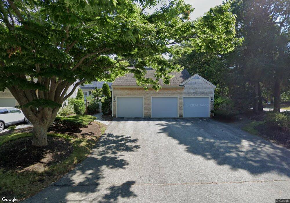
85 Kates Path Unit D Yarmouth Port, MA 02675
Yarmouth Port NeighborhoodEstimated Value: $645,000 - $670,000
2
Beds
3
Baths
1,609
Sq Ft
$408/Sq Ft
Est. Value
About This Home
This home is located at 85 Kates Path Unit D, Yarmouth Port, MA 02675 and is currently estimated at $656,654, approximately $408 per square foot. 85 Kates Path Unit D is a home located in Barnstable County with nearby schools including Dennis-Yarmouth Regional High School.
Ownership History
Date
Name
Owned For
Owner Type
Purchase Details
Closed on
Aug 12, 2020
Sold by
Rawlings Mary L
Bought by
Mlr Rt
Current Estimated Value
Purchase Details
Closed on
Mar 25, 2020
Sold by
Elizabeth J Hemeon T
Bought by
Rawlings Mary L
Home Financials for this Owner
Home Financials are based on the most recent Mortgage that was taken out on this home.
Original Mortgage
$330,000
Interest Rate
3.4%
Mortgage Type
New Conventional
Purchase Details
Closed on
Jul 12, 2013
Sold by
Hemeon Elizabeth J
Bought by
Elizabeth J Hemeon T
Purchase Details
Closed on
Mar 10, 2010
Sold by
Bellmar Robert D and Bellmar Sandra J
Bought by
Hemeon Elizabeth J
Purchase Details
Closed on
Aug 28, 2008
Sold by
Magee Ann T
Bought by
Bellmar Robert D
Home Financials for this Owner
Home Financials are based on the most recent Mortgage that was taken out on this home.
Original Mortgage
$170,000
Interest Rate
6.29%
Mortgage Type
Purchase Money Mortgage
Purchase Details
Closed on
Mar 14, 2007
Sold by
Kelleher Francis G and Kelleher Frank G
Bought by
Magee Ann T
Purchase Details
Closed on
Oct 12, 1990
Sold by
The Green Co Inc
Bought by
Kelleher Frank G
Create a Home Valuation Report for This Property
The Home Valuation Report is an in-depth analysis detailing your home's value as well as a comparison with similar homes in the area
Home Values in the Area
Average Home Value in this Area
Purchase History
| Date | Buyer | Sale Price | Title Company |
|---|---|---|---|
| Mlr Rt | -- | None Available | |
| Rawlings Mary L | $412,500 | None Available | |
| Elizabeth J Hemeon T | -- | -- | |
| Hemeon Elizabeth J | $430,000 | -- | |
| Bellmar Robert D | $305,000 | -- | |
| Magee Ann T | -- | -- | |
| Kelleher Frank G | $190,000 | -- |
Source: Public Records
Mortgage History
| Date | Status | Borrower | Loan Amount |
|---|---|---|---|
| Previous Owner | Rawlings Mary L | $330,000 | |
| Previous Owner | Kelleher Frank G | $170,000 |
Source: Public Records
Tax History Compared to Growth
Tax History
| Year | Tax Paid | Tax Assessment Tax Assessment Total Assessment is a certain percentage of the fair market value that is determined by local assessors to be the total taxable value of land and additions on the property. | Land | Improvement |
|---|---|---|---|---|
| 2025 | $3,842 | $542,700 | $0 | $542,700 |
| 2024 | $4,186 | $567,200 | $0 | $567,200 |
| 2023 | $2,953 | $364,100 | $0 | $364,100 |
| 2022 | $3,309 | $360,500 | $0 | $360,500 |
| 2021 | $3,670 | $383,900 | $0 | $383,900 |
| 2020 | $3,892 | $389,200 | $0 | $389,200 |
| 2019 | $3,648 | $361,200 | $0 | $361,200 |
| 2018 | $3,429 | $333,200 | $0 | $333,200 |
| 2017 | $3,199 | $319,300 | $0 | $319,300 |
| 2016 | $3,047 | $305,300 | $0 | $305,300 |
| 2015 | $3,044 | $303,200 | $0 | $303,200 |
Source: Public Records
Map
Nearby Homes
- 228 Kates Path
- 17 Kates Path Unit A
- 64 Kates Path
- 158 Kates Path
- 19 John Halls Cartpath Village Unit E
- 19 John Hall Cartway Unit E
- 50 John Hall Cartway
- 50 John Hall Cartway Unit 50
- 42 John Hall Cartway Unit 42
- 43 Canterbury Rd
- 28 Oak Glen
- 17 Nottingham Dr
- 44 Stratford Ln
- 25 Oak Glen Village Unit 25
- 25 Oak Glen
- 30 W Woods
- 30 W Woods Cir Unit 30
- 2 Pine Grove
- 800 Route 6a
- 800 Route 6a
- 81 Kates Path
- 85 Kates Path
- 29 Kates Path
- 27 Kates Path
- 25 Kates Path
- 23 Kates Path
- 25 Kates Path Unit A
- 23 Kates Path Unit D
- 27 Kates Path Unit C
- 136 Kates Path Unit C
- 246 Kates Path
- 244 Kates Path
- 234 Kates Path
- 232 Kates Path
- 230 Kates Path
- 224 Kates Path
- 222 Kates Path
- 220 Kates Path
- 218 Kates Path
- 214 Kates Path