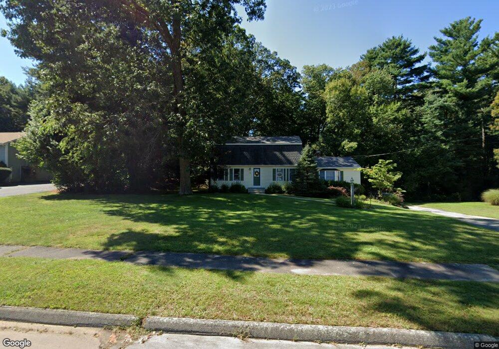
85 King James Way Wrentham, MA 02093
Estimated Value: $664,000 - $716,000
3
Beds
2
Baths
2,011
Sq Ft
$343/Sq Ft
Est. Value
About This Home
This home is located at 85 King James Way, Wrentham, MA 02093 and is currently estimated at $690,316, approximately $343 per square foot. 85 King James Way is a home located in Norfolk County with nearby schools including Delaney Elementary School, Charles E Roderick, and The Sage School.
Ownership History
Date
Name
Owned For
Owner Type
Purchase Details
Closed on
Jul 30, 2007
Sold by
Parkinson Jeffrey M and Parkinson Dania S
Bought by
Levy Alison V and Levy Jerome William
Current Estimated Value
Purchase Details
Closed on
Sep 29, 2000
Sold by
Mcgill Constance M
Bought by
Parkinson Jeffrey M and Parkinson Dania S
Create a Home Valuation Report for This Property
The Home Valuation Report is an in-depth analysis detailing your home's value as well as a comparison with similar homes in the area
Home Values in the Area
Average Home Value in this Area
Purchase History
| Date | Buyer | Sale Price | Title Company |
|---|---|---|---|
| Levy Alison V | $377,000 | -- | |
| Parkinson Jeffrey M | $282,000 | -- |
Source: Public Records
Mortgage History
| Date | Status | Borrower | Loan Amount |
|---|---|---|---|
| Open | Parkinson Jeffrey M | $265,000 | |
| Closed | Parkinson Jeffrey M | $281,000 | |
| Closed | Parkinson Jeffrey M | $284,000 | |
| Closed | Parkinson Jeffrey M | $296,000 |
Source: Public Records
Tax History Compared to Growth
Tax History
| Year | Tax Paid | Tax Assessment Tax Assessment Total Assessment is a certain percentage of the fair market value that is determined by local assessors to be the total taxable value of land and additions on the property. | Land | Improvement |
|---|---|---|---|---|
| 2025 | $6,509 | $561,600 | $289,100 | $272,500 |
| 2024 | $6,262 | $521,800 | $289,100 | $232,700 |
| 2023 | $6,174 | $489,200 | $262,900 | $226,300 |
| 2022 | $5,996 | $438,600 | $245,300 | $193,300 |
| 2021 | $5,686 | $404,100 | $214,100 | $190,000 |
| 2020 | $5,545 | $389,100 | $190,400 | $198,700 |
| 2019 | $5,494 | $389,100 | $190,400 | $198,700 |
| 2018 | $5,334 | $374,600 | $190,600 | $184,000 |
| 2017 | $5,010 | $351,600 | $186,900 | $164,700 |
| 2016 | $4,800 | $336,100 | $181,500 | $154,600 |
| 2015 | $4,675 | $312,100 | $174,500 | $137,600 |
| 2014 | $4,383 | $286,300 | $153,800 | $132,500 |
Source: Public Records
Map
Nearby Homes
- 1 Lorraine Metcalf Dr
- 362 East St
- 270 Dedham St
- 10 Nature View Dr
- 15 Nature View Dr
- 65 Pond St
- 319 Taunton St
- 25 Foxboro Rd
- 120 Hawes St
- 483 Thurston St
- 131 Creek St Unit 7
- 246 Forest Grove Ave
- 11 Earle Stewart Ln
- 10 W Birch Rd
- 0 W Birch Rd
- 3 Oak Rd
- Lot 3 - 14 Earle Stewart Ln
- Lot 1 - Blueberry 2 Car Plan at King Philip Estates
- Lot 8 - Blueberry 2 Car Plan at King Philip Estates
- Lot 6 - Blueberry 3 Car Plan at King Philip Estates
- 95 King James Way
- 75 King James Way
- 191 Janice Cir
- 105 King James Way
- 183 Janice Cir
- 199 Janice Cir
- 80 King James Way
- 70 King James Way
- 201 Janice Cir
- 186 Janice Cir
- 60 King James Way
- 65 King James Way
- 90 King James Way
- 175 Janice Cir
- 198 Janice Cir
- 125 King James Way
- 115 King James Way
- 207 Janice Cir
- 215 Janice Cir
- 50 King James Way