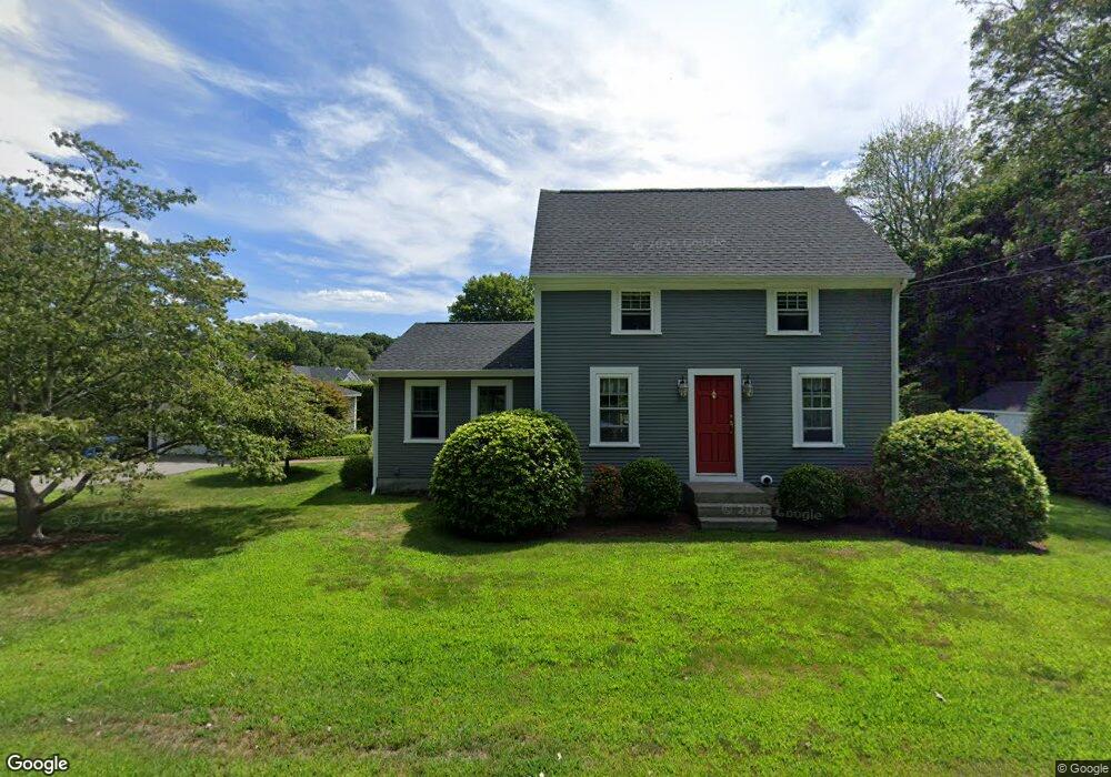
85 Lake St Seekonk, MA 02771
Estimated Value: $444,000 - $490,356
3
Beds
2
Baths
1,337
Sq Ft
$349/Sq Ft
Est. Value
About This Home
This home is located at 85 Lake St, Seekonk, MA 02771 and is currently estimated at $466,589, approximately $348 per square foot. 85 Lake St is a home located in Bristol County with nearby schools including Seekonk High School, St Margaret School, and Providence Country Day School.
Ownership History
Date
Name
Owned For
Owner Type
Purchase Details
Closed on
Mar 16, 2023
Sold by
Saleeba Raymond A and Saleeba Linda A
Bought by
Saleeba Ft
Current Estimated Value
Purchase Details
Closed on
Dec 21, 2006
Sold by
Saleeba Linda A and Saleeba Raymond A
Bought by
R & L Saleeba Ft
Create a Home Valuation Report for This Property
The Home Valuation Report is an in-depth analysis detailing your home's value as well as a comparison with similar homes in the area
Home Values in the Area
Average Home Value in this Area
Purchase History
| Date | Buyer | Sale Price | Title Company |
|---|---|---|---|
| Saleeba Ft | -- | None Available | |
| R & L Saleeba Ft | -- | -- |
Source: Public Records
Tax History Compared to Growth
Tax History
| Year | Tax Paid | Tax Assessment Tax Assessment Total Assessment is a certain percentage of the fair market value that is determined by local assessors to be the total taxable value of land and additions on the property. | Land | Improvement |
|---|---|---|---|---|
| 2025 | $4,649 | $376,400 | $163,900 | $212,500 |
| 2024 | $4,483 | $363,000 | $163,900 | $199,100 |
| 2023 | $4,173 | $318,300 | $149,400 | $168,900 |
| 2022 | $3,620 | $289,700 | $145,100 | $144,600 |
| 2021 | $3,620 | $266,800 | $125,100 | $141,700 |
| 2020 | $3,271 | $248,400 | $124,900 | $123,500 |
| 2019 | $3,185 | $243,900 | $124,900 | $119,000 |
| 2018 | $3,137 | $235,000 | $120,400 | $114,600 |
| 2017 | $3,112 | $231,200 | $120,400 | $110,800 |
| 2016 | $3,068 | $228,800 | $120,400 | $108,400 |
| 2015 | $2,986 | $225,700 | $120,400 | $105,300 |
Source: Public Records
Map
Nearby Homes
- 824 Taunton Ave
- 39 John Alden Rd
- 25 Lincoln St
- 1078 Taunton Ave
- 9 Hidden Hills Dr
- 420 Chestnut St
- 134 Briarbrook Dr
- 0 Patterson St Unit 73348933
- 62 Chestnut St
- 463 Ledge Rd
- 442 Taunton Ave
- 524 County St
- 42 Tee Jay Dr
- 81 Salisbury St
- 268 Pine St Unit 7
- 181 Sherman Ave
- 30 Rosemarie Dr
- 67 Wheeler St
- 349 County St
- 224 Arcade Ave