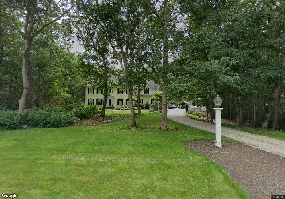
85 Laurel Ridge Trail Killingworth, CT 06419
Estimated Value: $724,000 - $791,000
3
Beds
3
Baths
3,094
Sq Ft
$245/Sq Ft
Est. Value
About This Home
This home is located at 85 Laurel Ridge Trail, Killingworth, CT 06419 and is currently estimated at $758,154, approximately $245 per square foot. 85 Laurel Ridge Trail is a home located in Middlesex County with nearby schools including Haddam-Killingworth High School.
Ownership History
Date
Name
Owned For
Owner Type
Purchase Details
Closed on
Dec 7, 2017
Sold by
Snyder Lawrence B
Bought by
Zandi Kathleen S
Current Estimated Value
Home Financials for this Owner
Home Financials are based on the most recent Mortgage that was taken out on this home.
Original Mortgage
$132,220
Outstanding Balance
$52,446
Interest Rate
3.95%
Mortgage Type
Credit Line Revolving
Estimated Equity
$705,708
Purchase Details
Closed on
Sep 3, 1999
Sold by
J&K Dev
Bought by
Snyder Lawrence B and Zandi Kathleen S
Home Financials for this Owner
Home Financials are based on the most recent Mortgage that was taken out on this home.
Original Mortgage
$264,800
Interest Rate
7.5%
Create a Home Valuation Report for This Property
The Home Valuation Report is an in-depth analysis detailing your home's value as well as a comparison with similar homes in the area
Home Values in the Area
Average Home Value in this Area
Purchase History
| Date | Buyer | Sale Price | Title Company |
|---|---|---|---|
| Zandi Kathleen S | -- | -- | |
| Snyder Lawrence B | $331,000 | -- | |
| J&K Dev | $70,000 | -- |
Source: Public Records
Mortgage History
| Date | Status | Borrower | Loan Amount |
|---|---|---|---|
| Open | J&K Dev | $132,220 | |
| Previous Owner | J&K Dev | $200,000 | |
| Previous Owner | J&K Dev | $234,000 | |
| Previous Owner | J&K Dev | $264,800 |
Source: Public Records
Tax History Compared to Growth
Tax History
| Year | Tax Paid | Tax Assessment Tax Assessment Total Assessment is a certain percentage of the fair market value that is determined by local assessors to be the total taxable value of land and additions on the property. | Land | Improvement |
|---|---|---|---|---|
| 2025 | $9,113 | $347,550 | $102,060 | $245,490 |
| 2024 | $8,418 | $347,550 | $102,060 | $245,490 |
| 2023 | $8,157 | $347,550 | $102,060 | $245,490 |
| 2022 | $8,070 | $347,550 | $102,060 | $245,490 |
| 2021 | $8,156 | $305,250 | $112,540 | $192,710 |
| 2020 | $8,156 | $305,250 | $112,540 | $192,710 |
| 2019 | $8,385 | $305,250 | $112,540 | $192,710 |
| 2018 | $8,385 | $305,250 | $112,540 | $192,710 |
| 2017 | $8,385 | $305,250 | $112,540 | $192,710 |
| 2016 | $8,991 | $347,260 | $174,820 | $172,440 |
| 2015 | $8,761 | $347,260 | $174,820 | $172,440 |
| 2014 | $8,518 | $347,260 | $174,820 | $172,440 |
Source: Public Records
Map
Nearby Homes
- 25 Roast Meat Hill Rd
- 248 Cow Hill Rd
- 11 Silver Birch Ln
- 246 Cow Hill Rd
- 4 Laurel Ln
- 43 Evergreen Park
- 179 Route 81
- 25 Kelseytown Bridge Rd
- 37 Titus Coan Rd
- 0 Kelseytown Bridge Rd
- 15 Egypt Ln
- 131 Cow Hill Rd
- 5 Kings Grant Rd
- 4 Columbia Rd
- 48A Ironworks Rd
- 3 Jamaica Rd
- 262 Connecticut 81
- 19 Ironworks Rd
- 4 Van Dyke Ln
- 14 Blaine Ave
- 87 Laurel Ridge Trail
- 83 Laurel Ridge Trail
- 50 Laurel Ridge Trail
- 47 Laurel Ridge Trail
- 53 Laurel Ridge Trail
- 41 Laurel Ridge Trail
- 56 Laurel Ridge Trail
- 4 Lafata Ln
- 44 Laurel Ridge Trail
- 7 Lafata Ln
- 12 Lafata Ln
- 60 Laurel Ridge Trail
- 96 Laurel Ridge Trail
- 40 Laurel Ridge Trail
- 13 Lafata Ln
- 63 Laurel Ridge Trail
- 16 Lafata Ln
- 12 Linnea Ln
- 28 Laurel Ridge Trail
- 3 Linnea Ln