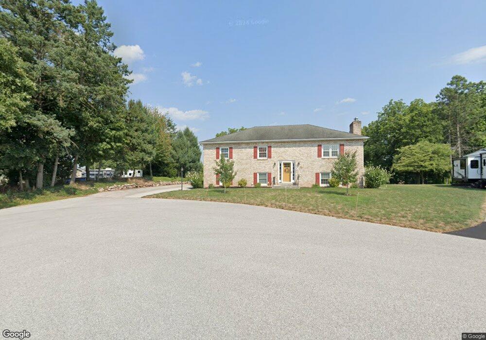
85 Locust Dr Littlestown, PA 17340
Estimated Value: $286,000 - $334,821
3
Beds
2
Baths
1,600
Sq Ft
$196/Sq Ft
Est. Value
About This Home
This home is located at 85 Locust Dr, Littlestown, PA 17340 and is currently estimated at $313,705, approximately $196 per square foot. 85 Locust Dr is a home located in Adams County with nearby schools including Rolling Acres El School, Maple Avenue Middle School, and Littlestown Senior High School.
Ownership History
Date
Name
Owned For
Owner Type
Purchase Details
Closed on
Mar 23, 2021
Sold by
Gearhart Angela R and Berwager Angela R
Bought by
Berwager Fred E and Berwager Angela R
Current Estimated Value
Home Financials for this Owner
Home Financials are based on the most recent Mortgage that was taken out on this home.
Original Mortgage
$196,000
Outstanding Balance
$143,794
Interest Rate
2.19%
Mortgage Type
New Conventional
Estimated Equity
$169,911
Purchase Details
Closed on
Jul 21, 2017
Sold by
Sell Ii Donald P and Sell Donald P
Bought by
Gearhart Angela R
Home Financials for this Owner
Home Financials are based on the most recent Mortgage that was taken out on this home.
Original Mortgage
$136,000
Interest Rate
3.9%
Mortgage Type
New Conventional
Purchase Details
Closed on
Jun 13, 2011
Sold by
Sell Donald P and Sell Nancy C
Bought by
Sell Donald P
Create a Home Valuation Report for This Property
The Home Valuation Report is an in-depth analysis detailing your home's value as well as a comparison with similar homes in the area
Home Values in the Area
Average Home Value in this Area
Purchase History
| Date | Buyer | Sale Price | Title Company |
|---|---|---|---|
| Berwager Fred E | -- | None Available | |
| Gearhart Angela R | $170,000 | None Available | |
| Sell Donald P | -- | -- |
Source: Public Records
Mortgage History
| Date | Status | Borrower | Loan Amount |
|---|---|---|---|
| Open | Berwager Fred E | $196,000 | |
| Closed | Gearhart Angela R | $136,000 |
Source: Public Records
Tax History Compared to Growth
Tax History
| Year | Tax Paid | Tax Assessment Tax Assessment Total Assessment is a certain percentage of the fair market value that is determined by local assessors to be the total taxable value of land and additions on the property. | Land | Improvement |
|---|---|---|---|---|
| 2025 | $4,480 | $236,700 | $49,400 | $187,300 |
| 2024 | $4,307 | $236,700 | $49,400 | $187,300 |
| 2023 | $4,198 | $236,700 | $49,400 | $187,300 |
| 2022 | $4,167 | $236,700 | $49,400 | $187,300 |
| 2021 | $4,019 | $236,700 | $49,400 | $187,300 |
| 2020 | $3,961 | $236,700 | $49,400 | $187,300 |
| 2019 | $3,876 | $236,700 | $49,400 | $187,300 |
| 2018 | $3,761 | $236,700 | $49,400 | $187,300 |
| 2017 | $4,006 | $260,300 | $49,400 | $210,900 |
| 2016 | -- | $260,300 | $49,400 | $210,900 |
| 2015 | -- | $260,300 | $49,400 | $210,900 |
| 2014 | -- | $260,300 | $49,400 | $210,900 |
Source: Public Records
Map
Nearby Homes
- 0 Locust Dr Unit PAAD2015910
- 20c Locust Dr
- 20 Locust Dr
- 58 Windsor Ct
- 48 Windsor Ct
- 440 N Queen St
- 162 Newark St
- 58 N Gala Unit 397
- 135 Apple Grove Ln Unit 438
- 140 Apple Grove Ln Unit 425
- 161 Stoners Cir
- 52 Stayman Way Unit 81
- 41 Smith Cir
- 349 Basehoar School Rd Unit 5
- 22 Rita Marie Ave
- 61 E King St
- 129 W King St
- 211 E King St
- 115 Charles St
- 449 Glenwyn Dr
- 75 Locust Dr
- 2131 White Hall Rd
- 2065 White Hall Rd
- 80 Locust Dr
- 63 Locust Dr
- 72 Locust Dr
- 2145 White Hall Rd
- 64 Locust Dr
- 64 Locust Dr
- 45 Locust Dr
- 2134 White Hall Rd
- 56 Locust Dr
- 2142 White Hall Rd
- 2091 White Hall Rd
- 2161 White Hall Rd
- 48 Locust Dr
- 2160 White Hall Rd Unit 3
- 36 Locust Dr
- 2171 White Hall Rd
- 44 Locust Dr Unit 14