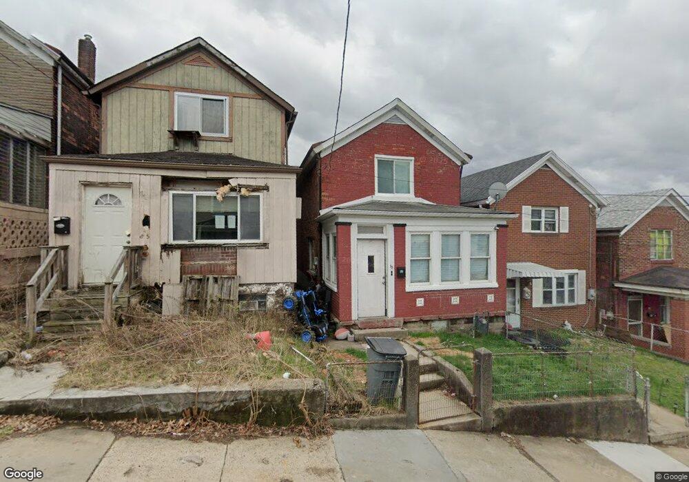
85 McKinnie Ave Mc Kees Rocks, PA 15136
Stowe Township NeighborhoodEstimated Value: $74,321 - $116,000
4
Beds
2
Baths
1,536
Sq Ft
$59/Sq Ft
Est. Value
About This Home
This home is located at 85 McKinnie Ave, Mc Kees Rocks, PA 15136 and is currently estimated at $90,580, approximately $58 per square foot. 85 McKinnie Ave is a home located in Allegheny County with nearby schools including Sto-Rox Upper Elementary School, Sto-Rox Primary Center, and Sto-Rox Junior/Senior High School.
Ownership History
Date
Name
Owned For
Owner Type
Purchase Details
Closed on
May 16, 2019
Sold by
Cozza Bartel & Uselton Llc
Bought by
Westburgh Holdings Llc
Current Estimated Value
Purchase Details
Closed on
Apr 8, 2002
Sold by
Federal Home Loan Mortgage Corporation
Bought by
Richards John R
Purchase Details
Closed on
Jan 17, 2002
Sold by
Hamilton David S and Hamilton Amy L
Bought by
Federal Home Loan Mortgage Corporation
Purchase Details
Closed on
Dec 28, 1995
Sold by
Woodward Rex H and Woodward Mary Kay
Bought by
Hamilton David S and Hamilton Amy L
Create a Home Valuation Report for This Property
The Home Valuation Report is an in-depth analysis detailing your home's value as well as a comparison with similar homes in the area
Home Values in the Area
Average Home Value in this Area
Purchase History
| Date | Buyer | Sale Price | Title Company |
|---|---|---|---|
| Westburgh Holdings Llc | $9,000 | Pv Settlement Llc | |
| Richards John R | $16,000 | -- | |
| Federal Home Loan Mortgage Corporation | $971 | -- | |
| Hamilton David S | $33,000 | -- |
Source: Public Records
Tax History Compared to Growth
Tax History
| Year | Tax Paid | Tax Assessment Tax Assessment Total Assessment is a certain percentage of the fair market value that is determined by local assessors to be the total taxable value of land and additions on the property. | Land | Improvement |
|---|---|---|---|---|
| 2025 | $341 | $7,900 | $3,000 | $4,900 |
| 2024 | $341 | $7,900 | $3,000 | $4,900 |
| 2023 | $328 | $7,900 | $3,000 | $4,900 |
| 2022 | $318 | $7,900 | $3,000 | $4,900 |
| 2021 | $2,032 | $7,900 | $3,000 | $4,900 |
| 2020 | $2,032 | $51,700 | $8,200 | $43,500 |
| 2019 | $2,032 | $51,700 | $8,200 | $43,500 |
| 2018 | $245 | $51,700 | $8,200 | $43,500 |
| 2017 | $1,985 | $51,700 | $8,200 | $43,500 |
| 2016 | $245 | $51,700 | $8,200 | $43,500 |
| 2015 | $245 | $51,700 | $8,200 | $43,500 |
| 2014 | $1,985 | $51,700 | $8,200 | $43,500 |
Source: Public Records
Map
Nearby Homes
- 125 Frazier Ave
- 82 Harlem Ave
- 45 Harlem Ave
- 27 Highland Ave
- 22 Harlem Ave
- 533 Woodward Ave
- 38 May Ave
- 620 Broadway Ave
- 19 Shaw Ave
- 634 Broadway Ave
- 755 Frederick St
- 705 Broadway Ave
- 420 Broadway Ave
- 705 Russellwood Ave
- 810 Woodward Ave
- 813 8th St
- 713 Russellwood Ave
- 711 Fruit Way
- 709 Fruit Way
- 416 Grove St
- 83 McKinnie Ave
- 87 McKinnie Ave
- 81 McKinnie Ave
- 89 McKinnie Ave
- 91 McKinnie Ave
- 79 McKinnie Ave
- 93 McKinnie Ave
- 95 McKinnie Ave
- 94 Highland Ave
- 90 Highland Ave
- 96 Highland Ave
- 75 McKinnie Ave
- 98 Highland Ave
- 88 Highland Ave
- 97 McKinnie Ave
- 86 McKinnie Ave
- 86 Highland Ave
- 84 McKinnie Ave
- 88 McKinnie Ave
- 82 McKinnie Ave