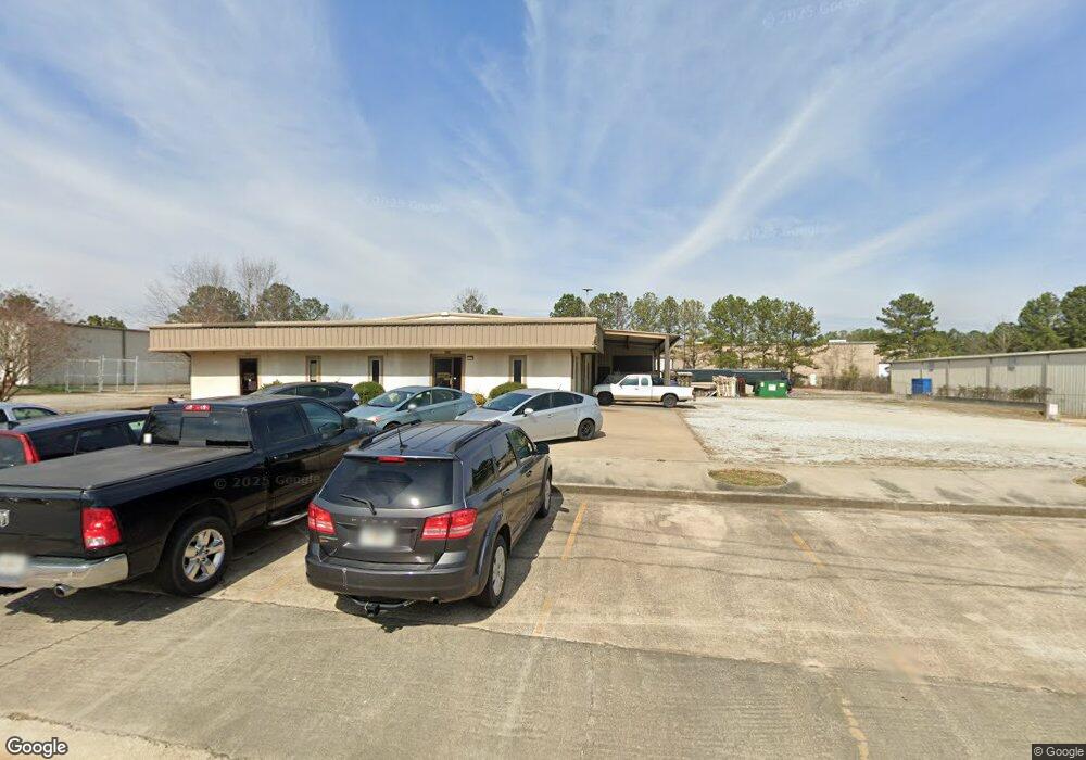
85 N Industrial Palmetto, GA 30268
Estimated Value: $980,593
--
Bed
--
Bath
10,000
Sq Ft
$98/Sq Ft
Est. Value
About This Home
This home is located at 85 N Industrial, Palmetto, GA 30268 and is currently estimated at $980,593, approximately $98 per square foot. 85 N Industrial is a home located in Coweta County with nearby schools including Arbor Springs Elementary School, Madras Middle School, and Northgate High School.
Ownership History
Date
Name
Owned For
Owner Type
Purchase Details
Closed on
Mar 10, 2017
Bought by
Cannon Load Banks Inc
Current Estimated Value
Home Financials for this Owner
Home Financials are based on the most recent Mortgage that was taken out on this home.
Original Mortgage
$449,650
Interest Rate
4.17%
Mortgage Type
Commercial
Purchase Details
Closed on
Sep 17, 2008
Sold by
Pcovernight Com Inc
Bought by
Pcovernight Llc
Purchase Details
Closed on
Jul 11, 2006
Sold by
Emerald Coast Auto Crafters In
Bought by
Pcovernite Com Inc
Purchase Details
Closed on
Aug 22, 1990
Bought by
Emerald Coast Auto C
Purchase Details
Closed on
Nov 30, 1987
Bought by
Lewis Development Co
Create a Home Valuation Report for This Property
The Home Valuation Report is an in-depth analysis detailing your home's value as well as a comparison with similar homes in the area
Home Values in the Area
Average Home Value in this Area
Purchase History
| Date | Buyer | Sale Price | Title Company |
|---|---|---|---|
| Cannon Load Banks Inc | $529,000 | -- | |
| Pcovernight Llc | -- | -- | |
| Pcovernite Com Inc | $510,000 | -- | |
| Emerald Coast Auto C | $123,500 | -- | |
| Lewis Development Co | -- | -- |
Source: Public Records
Mortgage History
| Date | Status | Borrower | Loan Amount |
|---|---|---|---|
| Closed | Cannon Load Banks Inc | $449,650 |
Source: Public Records
Tax History Compared to Growth
Tax History
| Year | Tax Paid | Tax Assessment Tax Assessment Total Assessment is a certain percentage of the fair market value that is determined by local assessors to be the total taxable value of land and additions on the property. | Land | Improvement |
|---|---|---|---|---|
| 2025 | $4,111 | $174,022 | $16,940 | $157,082 |
| 2024 | $3,608 | $155,436 | $16,940 | $138,496 |
| 2023 | $3,608 | $152,239 | $16,940 | $135,299 |
| 2022 | $3,727 | $151,294 | $16,940 | $134,354 |
| 2021 | $3,983 | $151,294 | $16,940 | $134,354 |
| 2020 | $4,010 | $151,294 | $16,940 | $134,354 |
| 2019 | $4,569 | $156,114 | $16,940 | $139,174 |
| 2018 | $4,293 | $146,434 | $7,260 | $139,174 |
| 2017 | $4,292 | $146,434 | $7,260 | $139,174 |
| 2016 | $2,683 | $92,629 | $7,260 | $85,369 |
| 2015 | $2,637 | $92,629 | $7,260 | $85,369 |
| 2014 | $3,147 | $92,629 | $7,260 | $85,369 |
Source: Public Records
Map
Nearby Homes
- 2460 N Highway 29 Unit 2
- 502 Bavarian Dr
- 27 Dorian Ct
- 518 Main St
- 40 Springdale Dr
- 0 Springdale Dr Unit 10647918
- 205 Cobb St
- 5588 Highway 29 N
- 518 Palmetto Tyrone Rd
- 211 Cobb St
- 56 Hudgen Rd
- 594 Collinsworth Rd
- 50 Big Oaks Ct
- 291 Cannongate Rd
- 234 Fayetteville Rd
- 518 Toombs St
- 0 Fischer Spur Rd Unit 10495301
- 30 Joe Lee Dr
- 40 Joe Lee Dr
- 205 Hidden Brook Trail
- 105 N Industrial
- 90 N Industrial
- 87 Johnston Cir
- 85 Johnston Cir
- N N Industrial
- 200 Johnston Cir
- 6080 Highway 29 N
- 101 Weldon Rd
- 123 Weldon Rd
- 137 Weldon Rd
- 0 Ridley Rd Unit 8333194
- 0 Ridley Rd Unit 5971398
- 0 Ridley Rd Unit TR 6 2848111
- 0 Ridley Rd Unit TR 5 2848107
- 0 Ridley Rd Unit TR 4 2848104
- 0 Ridley Rd Unit TR 3 2848094
- 0 Ridley Rd Unit TR 2 2848091
- 0 Ridley Rd Unit TR 1 2848087
- 0 Ridley Rd Unit 2847931
- 0 Ridley Rd Unit TR 5 3259398