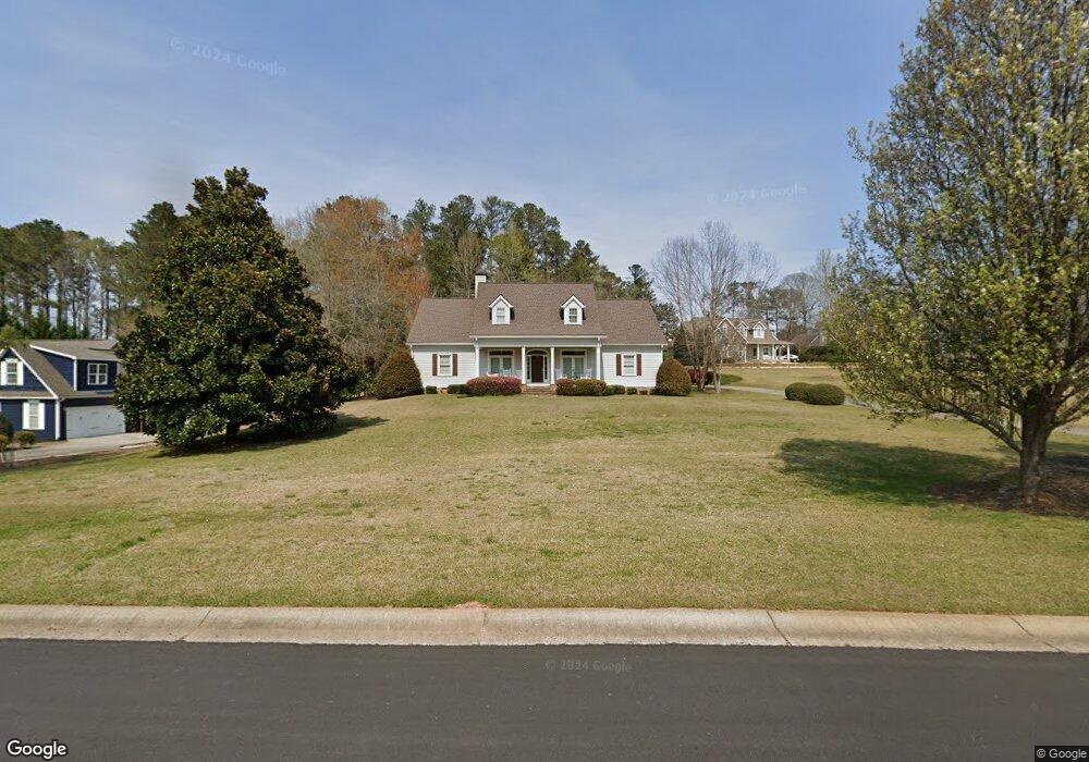
85 O Dell Ridge Newnan, GA 30263
Estimated Value: $462,000 - $548,000
4
Beds
3
Baths
2,377
Sq Ft
$215/Sq Ft
Est. Value
About This Home
This home is located at 85 O Dell Ridge, Newnan, GA 30263 and is currently estimated at $512,216, approximately $215 per square foot. 85 O Dell Ridge is a home located in Coweta County with nearby schools including Ruth Hill Elementary School, Smokey Road Middle School, and Newnan High School.
Ownership History
Date
Name
Owned For
Owner Type
Purchase Details
Closed on
Apr 2, 2018
Sold by
Baker Charlotte E
Bought by
Hartel Walter K and Woods Susan M
Current Estimated Value
Purchase Details
Closed on
Dec 20, 2011
Sold by
Baker Gary L
Bought by
Baker Charlotte E
Purchase Details
Closed on
May 2, 2001
Sold by
O'Dell William R
Bought by
Baker Gary L and Baker Charlotte
Home Financials for this Owner
Home Financials are based on the most recent Mortgage that was taken out on this home.
Original Mortgage
$24,750
Interest Rate
6.95%
Mortgage Type
New Conventional
Purchase Details
Closed on
Nov 30, 1972
Bought by
Dell William Ross O
Create a Home Valuation Report for This Property
The Home Valuation Report is an in-depth analysis detailing your home's value as well as a comparison with similar homes in the area
Home Values in the Area
Average Home Value in this Area
Purchase History
| Date | Buyer | Sale Price | Title Company |
|---|---|---|---|
| Hartel Walter K | $297,625 | -- | |
| Baker Charlotte E | -- | -- | |
| Baker Gary L | $31,500 | -- | |
| Dell William Ross O | $40,000 | -- |
Source: Public Records
Mortgage History
| Date | Status | Borrower | Loan Amount |
|---|---|---|---|
| Previous Owner | Baker Gary L | $24,750 |
Source: Public Records
Tax History Compared to Growth
Tax History
| Year | Tax Paid | Tax Assessment Tax Assessment Total Assessment is a certain percentage of the fair market value that is determined by local assessors to be the total taxable value of land and additions on the property. | Land | Improvement |
|---|---|---|---|---|
| 2024 | $2,966 | $207,362 | $32,000 | $175,362 |
| 2023 | $2,966 | $178,514 | $28,000 | $150,514 |
| 2022 | $1,674 | $146,049 | $28,000 | $118,049 |
| 2021 | $1,069 | $118,854 | $14,000 | $104,854 |
| 2020 | $1,070 | $118,854 | $14,000 | $104,854 |
| 2019 | $2,173 | $115,865 | $18,000 | $97,865 |
| 2018 | $2,913 | $104,115 | $18,000 | $86,115 |
| 2017 | $2,912 | $104,115 | $18,000 | $86,115 |
| 2016 | $2,879 | $104,115 | $18,000 | $86,115 |
| 2015 | $2,833 | $104,115 | $18,000 | $86,115 |
| 2014 | $2,507 | $104,115 | $18,000 | $86,115 |
Source: Public Records
Map
Nearby Homes
- 15 Forest Place
- 56 Fox Hollow Run
- 1845 Smokey Rd
- 68 Timberland Trail
- 50 Hearthstone Dr
- 0 George Arnold Rd Unit 7657652
- 0 George Arnold Rd Unit 10617612
- 150 Wild Boar Way
- 0 Walt Sanders Rd Unit 10607560
- 713 Smokey Rd
- 20 Beaver Ct
- 130 Mallard Dr
- 130 Wallace Gray Cir
- 124 Wallace Gray Cir
- 623 Belk Rd
- 48 Wallace Gray Ct
- 0 Wallace Gray Cir Unit 10590659
- 75 Davis McLendon Way
- 16 Fayme Ct
- Zoey II Plan at Chapel Hill
- 95 O Dell Ridge
- 0 Dads Walk Unit LOT B-19
- 75 O Dell Ridge
- 105 O'Dell Ridge
- 100 O'Dell Ridge
- 10 Dads Walk
- 100 O Dell Ridge Unit B16
- 100 O Dell Ridge
- 65 O Dell Ridge
- 65 O'Dell Ridge
- 70 O Dell Ridge
- 70 O'Dell Ridge
- 30 Dads Walk
- 19 Dads Walk
- 45 O Dell Ridge
- 60 O Dell Ridge
- 110 O Dell Ridge
- 115 O Dell Ridge
- 20 Dads Walk
- 0 O'Dell Ridge Unit 8498835