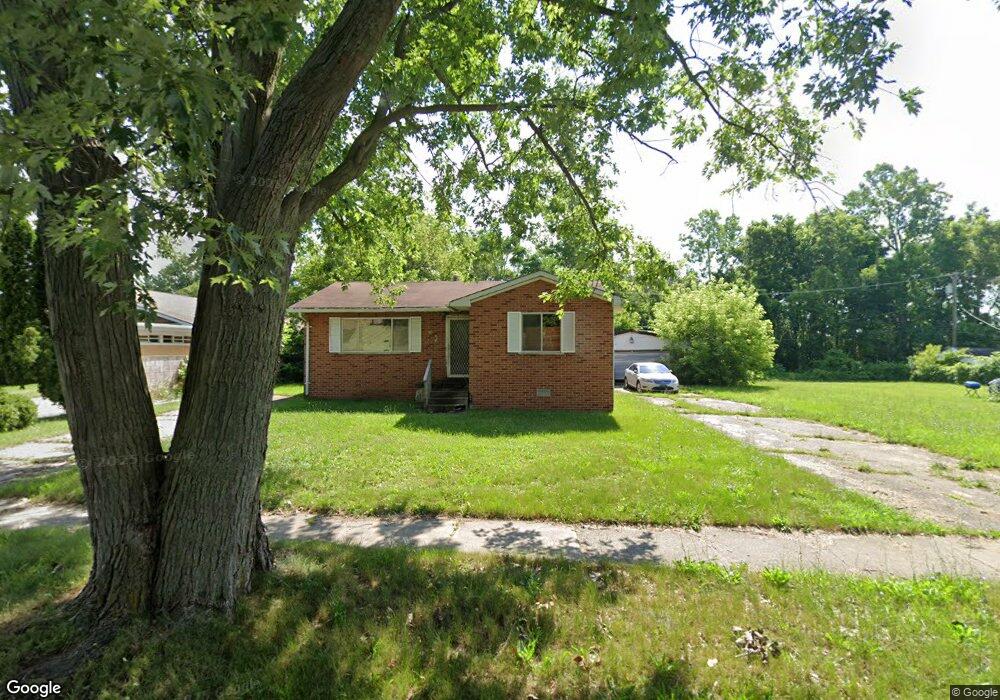
85 S Astor St Pontiac, MI 48342
Estimated Value: $142,000 - $220,000
3
Beds
2
Baths
1,341
Sq Ft
$131/Sq Ft
Est. Value
About This Home
This home is located at 85 S Astor St, Pontiac, MI 48342 and is currently estimated at $175,543, approximately $130 per square foot. 85 S Astor St is a home located in Oakland County with nearby schools including Herrington Elementary School, Pontiac Middle School, and Pontiac High School.
Ownership History
Date
Name
Owned For
Owner Type
Purchase Details
Closed on
Sep 27, 2017
Sold by
Bullock Johnnie A
Bought by
Nicholson Nancy Mae
Current Estimated Value
Purchase Details
Closed on
May 2, 2017
Sold by
Bullock Johnnie A and Bullock Rochelle Y
Bought by
Bullock Johnnie A
Purchase Details
Closed on
Apr 27, 2017
Sold by
Bullock Johnnie A and Bullock Rochelle Y
Bought by
Bullock Johnnie A
Purchase Details
Closed on
Apr 15, 2015
Sold by
Bullock Johnnie and Bullock Rochelle
Bought by
Hurt Henry and Hurt Mary
Purchase Details
Closed on
Jun 12, 1997
Sold by
Bullock Johnnie A
Bought by
Bullock Johnnie A
Home Financials for this Owner
Home Financials are based on the most recent Mortgage that was taken out on this home.
Original Mortgage
$51,000
Interest Rate
8.01%
Create a Home Valuation Report for This Property
The Home Valuation Report is an in-depth analysis detailing your home's value as well as a comparison with similar homes in the area
Home Values in the Area
Average Home Value in this Area
Purchase History
| Date | Buyer | Sale Price | Title Company |
|---|---|---|---|
| Nicholson Nancy Mae | $5,000 | None Available | |
| Bullock Johnnie A | -- | None Available | |
| Bullock Johnnie A | -- | None Available | |
| Hurt Henry | -- | None Available | |
| Bullock Johnnie A | -- | -- |
Source: Public Records
Mortgage History
| Date | Status | Borrower | Loan Amount |
|---|---|---|---|
| Previous Owner | Bullock Johnnie A | $51,000 |
Source: Public Records
Tax History Compared to Growth
Tax History
| Year | Tax Paid | Tax Assessment Tax Assessment Total Assessment is a certain percentage of the fair market value that is determined by local assessors to be the total taxable value of land and additions on the property. | Land | Improvement |
|---|---|---|---|---|
| 2024 | $1,758 | $58,390 | $0 | $0 |
| 2023 | $1,675 | $50,980 | $0 | $0 |
| 2022 | $2,205 | $44,510 | $0 | $0 |
| 2021 | $2,699 | $42,580 | $0 | $0 |
| 2020 | $1,523 | $34,380 | $0 | $0 |
| 2019 | $2,296 | $30,340 | $0 | $0 |
| 2018 | $1,535 | $26,590 | $0 | $0 |
| 2017 | $1,837 | $25,620 | $0 | $0 |
| 2016 | $982 | $24,780 | $0 | $0 |
| 2015 | -- | $22,760 | $0 | $0 |
| 2014 | -- | $19,680 | $0 | $0 |
| 2011 | -- | $26,490 | $0 | $0 |
Source: Public Records
Map
Nearby Homes
- 717 E Pike St
- 28 S Marshall St
- 53 N Midland Dr
- 88 N Astor St
- 46 N Anderson Ave
- 505 Auburn Ave
- 511 E Pike St
- 176 S Francis Ave
- 291 Michigan Ave
- 33 S Tasmania St
- 389 Osmun St
- 18 S Shirley St
- 328 Whittemore St
- 187 Wall St
- 440 Martin Luther King Junior Blvd S
- 53 N Roselawn St
- 55 N Roselawn St
- 306 Whittemore St
- 70 N Roselawn St
- 57 N Roselawn St
- 93 S Astor St
- 101 S Astor St
- 84 S Astor St
- 84 S Astor St
- 61 S Astor St
- 96 S Astor St
- 51 S Astor St
- 662 Homestead Dr
- 100 S Astor St
- 658 Homestead Dr
- 104 S Astor St
- 00 Clifford St
- 0 Clifford Unit 217102154
- 678 Rosewood Place
- 50 S Astor St
- 654 Homestead Dr
- 661 Homestead Dr
- 674 Rosewood Place
- 657 Homestead Dr
- 650 Homestead Dr